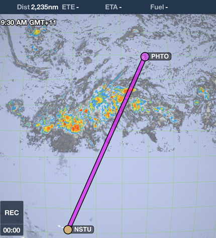
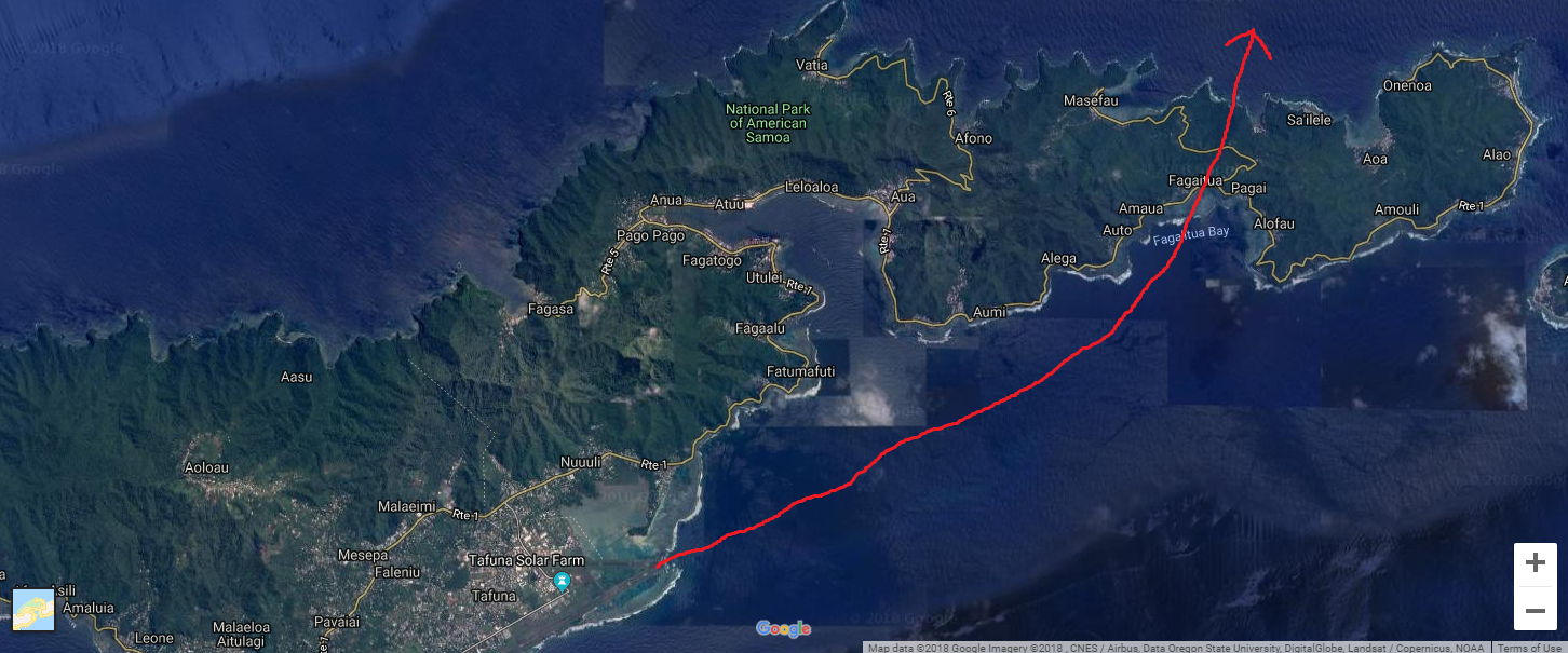
 Expedition Day 55 - "How many souls on board?" I departed Pago Pago at the crack of dawn. My destination was Hilo, Hawaii, 2235 nautical miles away across the Intertropical Convergence Zone. I was carrying a massive amount of fuel and expected very low climb performance on take-off. "May" lifted off at 75 knots. I leveled her at ten feet over the runway to build speed, and climbed slowly over the cobalt blue water along the coastline, and passed by the scenic Pago Pago harbor. Eventually, I climbed high enough to clear the terrain over the island and headed north towards Hawaii. En-route to Hilo, the headwinds were much stronger than predicted. My calculations showed that I would arrive in Hilo short of fuel, so I decided to divert to Christmas Island. 500 nm south-west of Christmas Island My challenge was to now contact Christmas Island tower/operations to open the airport for an after hours landing. They have a reputation being extremely difficult to contact, either by phone, e-mail, or text. On top of this, my Garmin Inreach beacon was intermittently sending position reports. I received a flurry of worried texts from my handler and family when the Inreach beacon failed to transmit to the Iridium satellite. All means of communication were used: my incredibly determined handlers from G.A.S.E. (Eddie and Ahmed), San Francisco radio (transoceanic communications), e-mails to all known airport staff at Christmas Island, and commercial aircraft overhead on the guard frequency. For 5 hours, all attempts to contact Christmas Island failed. The situation looked dire: approach the island three hours after dark, with no open airport, no runway lights, and land in IFR conditions. Why is Christmas Island operations not responsive? I thought they were a diversion airport! Stay calm and work the problem. My plan "B" was to orbit the island at 1500 ft to wake up the airport staff to turn on the lights for an instrument landing. I could circle the island for some time at a reduced power setting. I was now within a few degrees of the equator and my HF radio link failed again from spotty propagation. I was unable to contact SF radio on any HF frequency and switched to the VHF guard frequency. Was anyone listening over the Pacific ocean? A vigilant Hawaiian Airlines flight, within 300 miles of my present position and overhead at 35,000 ft, heard my radio calls and relayed my position reports to SF Radio/ATC. 300 nm south-west of Christmas Island. 850 nm east of Howland Island. Before fading away, the last transmission from the Hawaiian airline crew to me on the guard frequency was: Hawaiian airlines: "San Francisco radio is unable to reach Christmas Island to turn on the landing lights. (pause)... How many souls on board?" Me: "One" Hawaiian airlines: "Good luck to you Sir." If my navigation was off by a few degrees and miss the island, I might run out of fuel and be forced to land at night in the trackless Pacific ocean. I fully comprehend how Amelia Earhart and Fred Noonan felt while trying to find the tiny speck of land called Howland island. 100 nm south-west of Christmas Island: Though dogged persistence, G.A.S.E. was able to reach Christmas Island by phone at the last moment. 100 miles offshore, I heard a faint and repeating radio transmission, "N944JK, ... Christmas Island" from the small radio shack on the Kiribati atoll. Someone was at the airport, ready to turn on the runway lights! Knowing the airport was open, I gradually descended from 9000 ft through the bands of rain towards the CXI RNAV initial approach fix. As I flew over the island's lagoon, the airport staff fired up the generator which lit up the edges of the single runway. I cross checked instruments and my navigation until I landed on the smooth, recently resurfaced runway on Christmas Island. The 11 hour ordeal was over. I was safe on the ground and slowly taxied towards the single story tin-roofed terminal building. Waiting for me were the airport manager, customs official, and a few sleepy ground staff. After shutting down the engine, I immediately thanked the entire airport staff for opening the airport after hours. I was exhausted and my body had been running on adrenalin for many hours. The airport manager suggested that AVGAS might be available, but could not promise anything. It was late, so I headed to the Captain Cook hotel for some rest and would deal with the fuel situation in the morning.
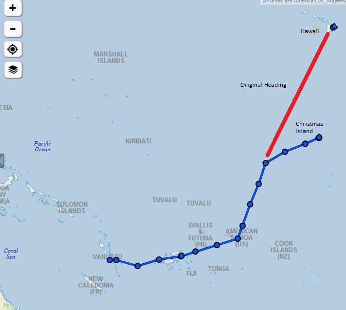
My original route was to fly directly from Pago Pago to Hilo. My fuel diversion to Christmas Island is shown in the map on the upper right. 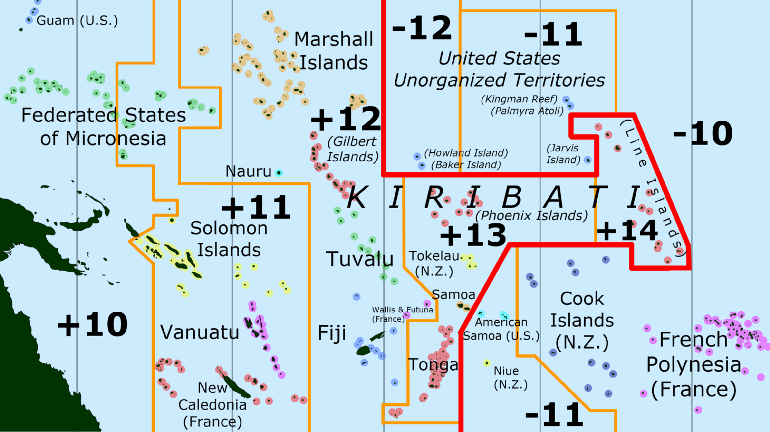 Special Time Zones Keeping track of the day and time while traversing the South Pacific can be challenging. Kiribati uses special time zones with +13, +14 UTC along with modifying the shape of the international date line. 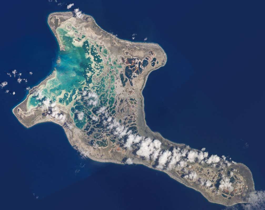 Christmas Island. A beautiful island with a violent past. The world's largest coral atoll is very remote, situated at the midpoint between Australia and the United States and just 2 degrees north latitude. It is one of 27 diversion airports, spread across the Pacific and capable of handling ETOPS rated aircraft. Photo credit: The Living Moon 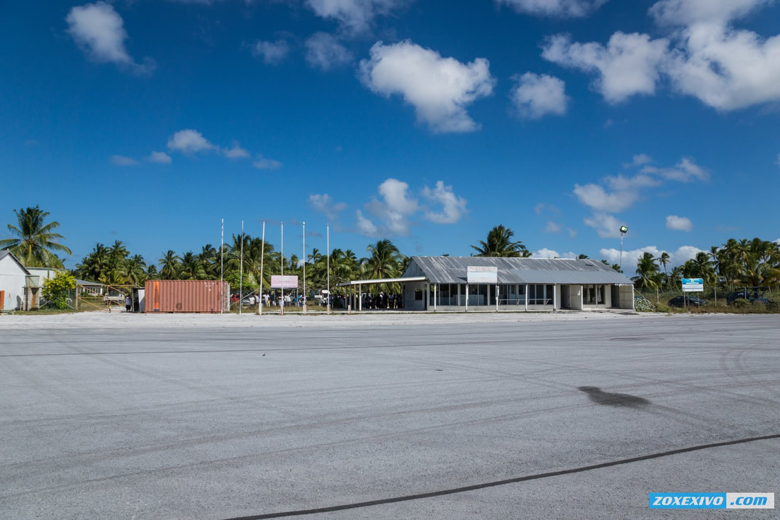 A new Christmas Island (Cassidy) International terminal building was under construction during my visit in July 2018. I am pleased to report the runway was recently repaved. This is a vast improvement over the chunky, cracking runway surface that pilots reported before my visit. Photo Credit: ZOXEXIVO.com 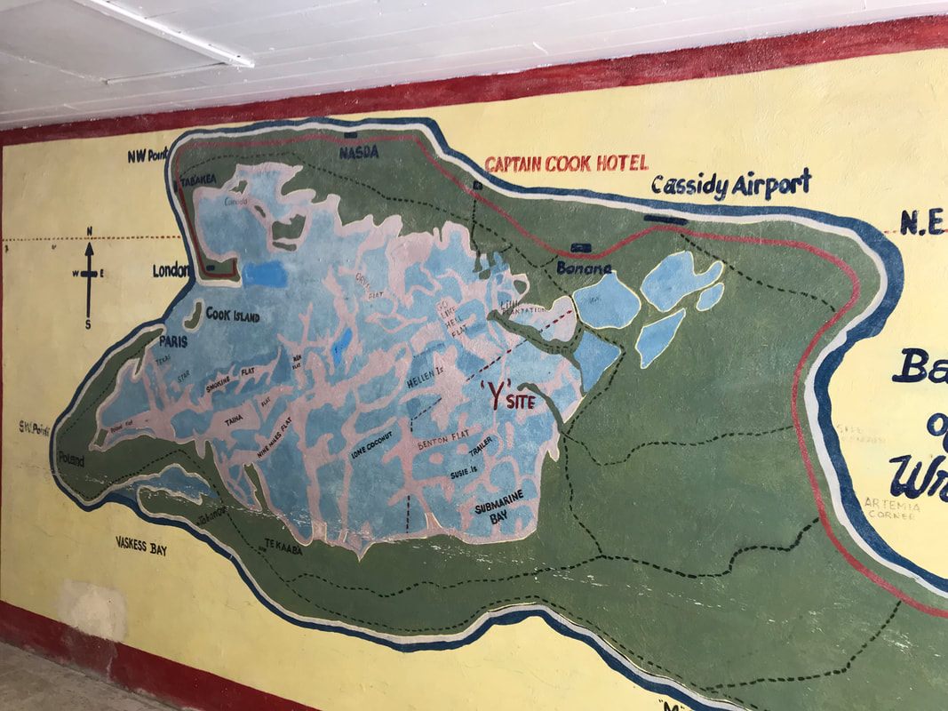 The place is the bomb. Hand painted map in the lobby of the Captain Cook hotel. 'Y" marks the spot of ground zero. In the 1950's, the British detonated multiple nuclear bombs above the island which produced high amounts of radioactive fallout. Many additional nuclear tests were carried out in the surrounding waters. Not to be outdone, the United States detonated an additional 22 bombs in proximity to the island after the British completed their tests. Grapple X was detonated over Christmas Island, at around one kilometer above ground. The two-staged design brought about a hydrogen reaction yielding 1.8 megatons. The weapons engineers had underestimated the yield by 80%. The damage caused by the explosion’s shock wave was consequently greater than expected, resulting in demolished buildings, equipment and infrastructure. The next explosion, Grapple Y, yielded a massive 3 megatons – the largest nuclear test ever conducted by the UK. In comparison, the bomb dropped at Hiroshima had a 16 kiloton yield.
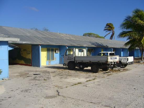
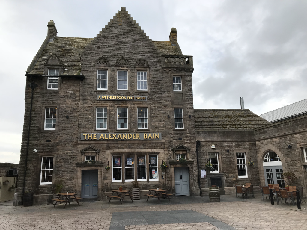
The rustic Captain Cook hotel, built on the grounds of a British military camp used during bomb testing. An encouraging report about Christmas Island. 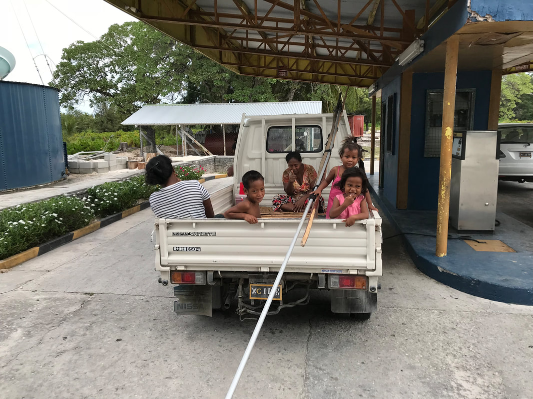  The hunt for AVGAS and the elusive "fuel boss" of Christmas Island I woke the next morning at the rustic Captain Cook hotel feeling optimistic. After breakfast, the airport manager drove me to the KOIL (Kiribati OIL) facility, where to my great relief, lay a new pallet containing a 1000 liter stash of recently delivered AVGAS. Stacked along the far perimeter fence was another 6000 liters of expired AVGAS in rusting, red barrels. The issue now was KOIL would not sell me AVGAS without authorization from the elusive "fuel boss". We jumped back in the airport ops car and drove through the villages of "Banana", "Tabwakea, and "London" before arriving at the home of the boss. His wife gave us the news that he was out fishing. There will be no fuel purchase today. In the mean time, in anticipation of fuel and airport fee payments, I located the only functioning ATM on the island and withdrew Australia dollars. The ATM cash limit forced me to obtain more cash from the local bank and from a "third party" with a better exchange rate. The next day, I made arrangements for 400 liters of "fresh" avgas to be delivered to the airport in the evening. To put it bluntly, the fuel situation here is irregular, and in the past, RTW pilots have been stuck in Kiribati for months waiting for the next AVGAS shipment from Australia. The landing/parking fees were still undetermined until 11 pm the night before departure. The bill needed to be processed in Tarawa (capital of Kiribati), 3,288 km away from Christmas Island. Kiribati (spoken as Kiribass) is spread over an incredible 1.4 million square miles (3.5M sq. km) of the central Pacific ocean and includes three island groups. I am grateful the airport staff did eventually open a closed airport, turn on the airport lights, and provide me with fuel so that I could continue my trip around the world. Communications with the outside world - 2018 Cell/Internet communications on the island is still in it's infancy, with spotty, slow links. Sending video was out of the question, but text and small photos could be shared back home. The Garmin Inreach struggled sending and receiving texts with Christmas Island positioned only a few degrees above the equator. FIshing
Christmas Island is famous for it's torpedo-fast bonefish and wily giant trevally (GT). The video below captures the excitement of fly fishing for 100 lb GT. Both sport fish are off limits for eating to preserve the stock. Catch and release only - fly fishing is taken very seriously here! Comments are closed.
|
Archives
September 2018
Categories |