|
I wish to thank the following companies for sponsorship and assistance during my flight around the world: MCW Associates, Aircraft Spruce, Ameriprise Financial, Classic Aero Designs, Odyssey Batteries, MFJ, Dynon Avionics, and Garmin for funding, equipment, and technical support.
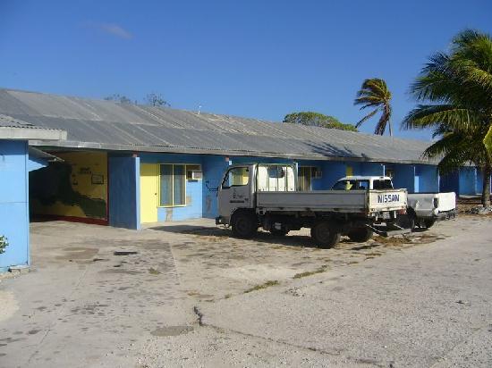
General Aviation Support Egypt for their expertise to obtain permits, arrange handling, and provide 24h flight watch. Their network of agents around the planet is an invaluable resource for RTW pilots. Thank you, Eddie and Ahmed! The professional airline crews who helped relay messages on my behalf, when HF communications failed over the Pacific and Indian oceans. The pilot community from Vans Airforce, who quickly arranged a hanger at Maui airport (PHOG) while a Category 4 hurricane rapidly approached Hawaii. The heroes of Experimental Aircraft Association Chapter 1581, who helped me repair my plane in Trento, Italy. The many RTW enthusiasts who provided me with encouragement and tracked my aircraft over the vast Atlantic, Indian, and Pacific oceans. You were my wingmen. 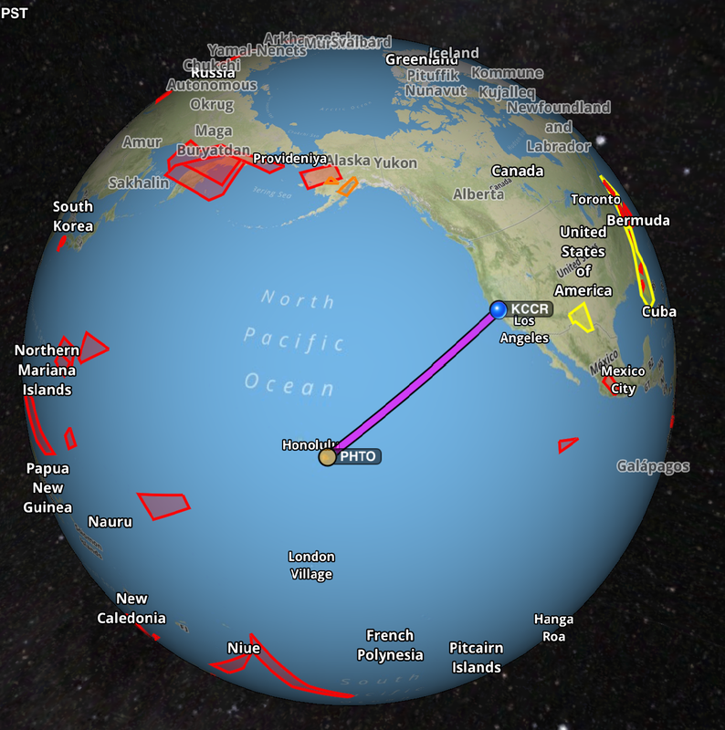 A 2050 nautical mile, 16.5 hour flight between Hilo, Hawaii and the San Francisco bay area. Expedition Day 91 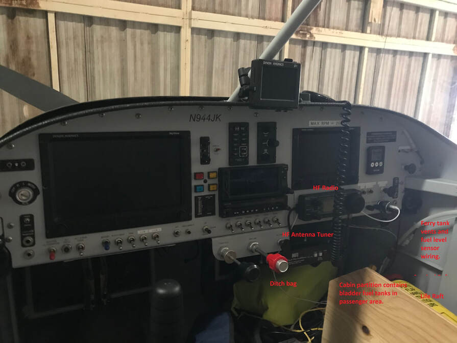 Kahului airport, Maui, Hawaii. The plane was lightened 50 lbs to carry extra fuel for the final leg of the RTW flight. Excess equipment (polar and desert survival gear, etc. ), spare parts, and souvenirs were boxed up and shipped back to my home in California.  Night flight 1000 miles off the coast of California in an experimental aircraft. The longest over-water route in the world is the stretch between Hawaii and the U.S. mainland. If you run into trouble, there are no alternate landing locations along this route. The flight planning, weather conditions, the readiness of the aircraft and pilot are all critical. According to the Air Services Hawaii (ASH) FBO, it is common for ferry pilots to wait up to a month before attempting this passage. August 31, 2018 - The morning of departure At 5:30am, a USDA official inspected my aircraft, looking for fresh fruit/vegetables that might introduce invasive pests to California. The ag. inspection lasted 2 minutes as there was nothing to declare. Air Services Hawaii then helped me to pump 127 gallons (762 lbs) or 3.5x the normal load of fuel into the 5 tanks onboard the aircraft. Of that, 91 gallons of high octane aviation fuel was now stored in tanks surrounding me inside the small cockpit. Visibility outside the aircraft was blocked to my right as the bulging Turtle-pac bladder tanks touched the top of the canopy. The aircraft center of gravity was now at the aft limit. I would need to be vigilant to not stall the aircraft on take-off, letting it fly when there was sufficient lift on the wings. I wedged myself into the pilot's seat, with little room to move inside the cockpit. As a precaution against DVT (Deep Vein Thrombosis) during the expected 17 hour flight, I planned to perform leg/arm exercises every 30 minutes, and take Aspirin as a blood thinner. After obtaining an IFR clearance, I taxied out to the run-up area and performed one final engine and systems configuration check. Did I forget anything? No, the checklists were completed. I still had butterflies in my stomach. The tower cleared me to depart Hilo on the longest runway, heading 80 degrees in the general direction of the west coast of the United States. As I pushed in the engine throttle, the plane felt very heavy and accelerated incredibly slowly, using over 2/3rds of the 9800 ft runway before lift-off. With such an enormous load, my stall speed was significantly higher than the standard 48 knots (clean) of a stock Van's RV-9A. I increased speed to 100 knots, paralleling the runway, before attempting to climb. The coastline of the Big Island quickly disappeared behind me as I headed east, chasing the morning sun. This would be a brutally long solo flight. After reaching a cruising altitude of 10,000 ft, I switched to my aft fuel tank (22g, 4 hours), then the bladder tanks #1 (22g ( 4 hours) and #2 (50g (7 hours)), and main tanks (5 hours). The next challenge was to establish communications with San Francisco radio (controller of the eastern Pacific) on the high frequency radio. If I can't reach SF radio, Hawaiian ATC would not let me leave their airspace and I would be forced to return to Hawaii. Since my aircraft does not have the ability to dump fuel in flight, I would need to burn off 15 hours of fuel in a giant hold around the Hawaiian islands. Even with a perfect technique, the gear simply could not handle a landing while the plane was hundreds of pounds over gross weight. 200 nm off the east coast of Hawaii, I finally reached SF Radio as line-of-sight VHF communications began to fade. The HF radio link was tenuous, with the signal bouncing off the ionosphere before returning to earth. The controller's faint, ghost like voice was surrounded with static crashes and fading. If you have ever listened to a shortwave radio, you know what this sounds like. At what seemed like the last moment, Hawaiian ATC released me from their airspace and I was on my way to California! For the first 1000 nm, I encountered 10 knot headwinds and later, the outer bands of Hurricane Miriam. At "bingo fuel", the winds aloft suddenly shifted (as forecasted) and pushed me towards the California coast. . I flew on for the next 6.5 hours until landing at 3:30 am in Concord, California. The 17 hour journey from Hilo to Oakland/Concord was extremely exhausting and was compounded by insomnia from the previous night. I had reached my physical limit. Over the course of a few days, I quickly recovered from the lack of sleep, but it would take many months to "process" the flight around the world. 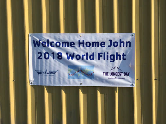 Thanks for the welcome home banner Pete W! "May" is safely back home at Buchanan field surrounded by her experimental aircraft cohort: a GlassAir II and III , RV8, Volksplane, and a P-40 replica.
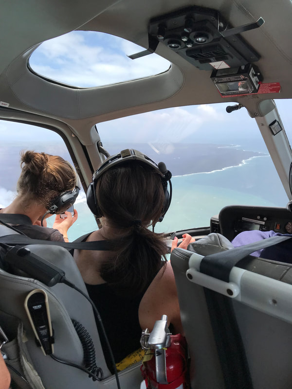
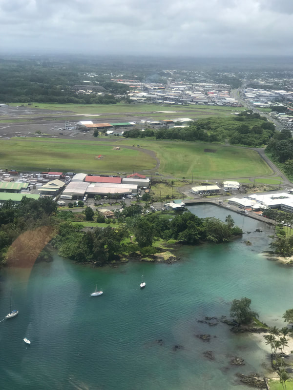
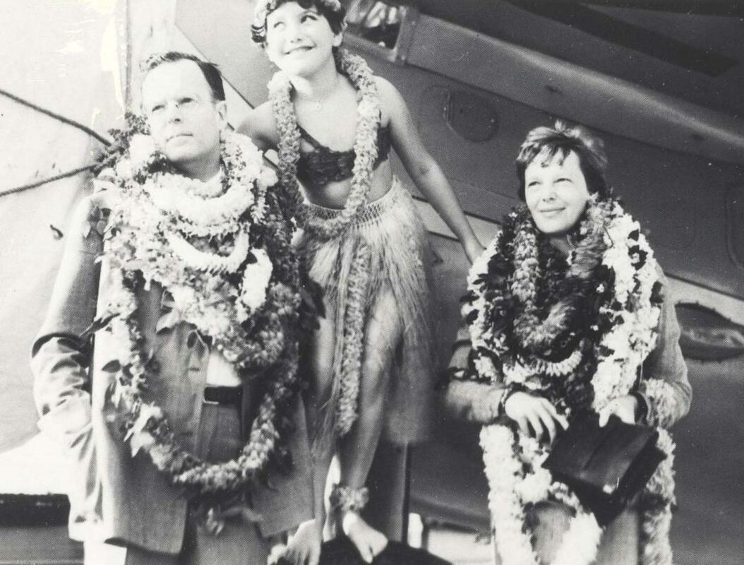
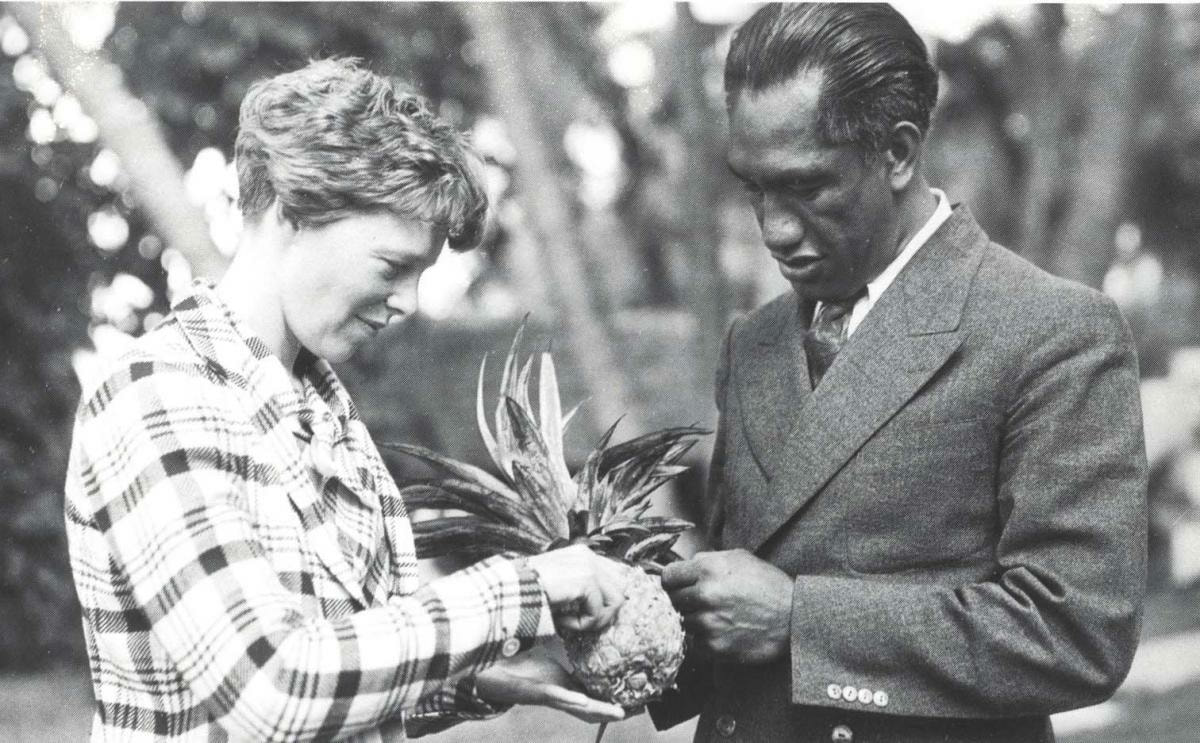
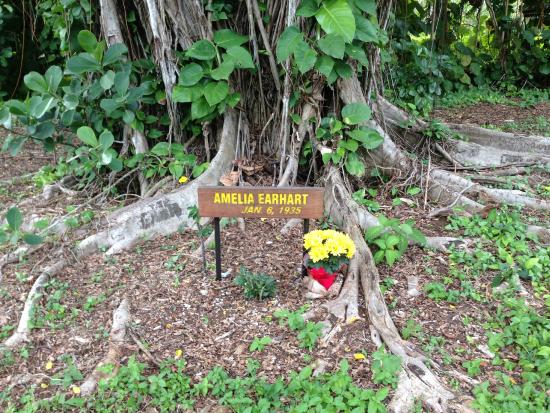
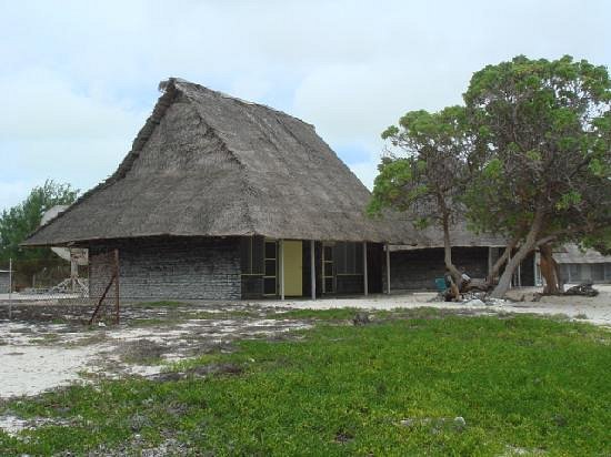
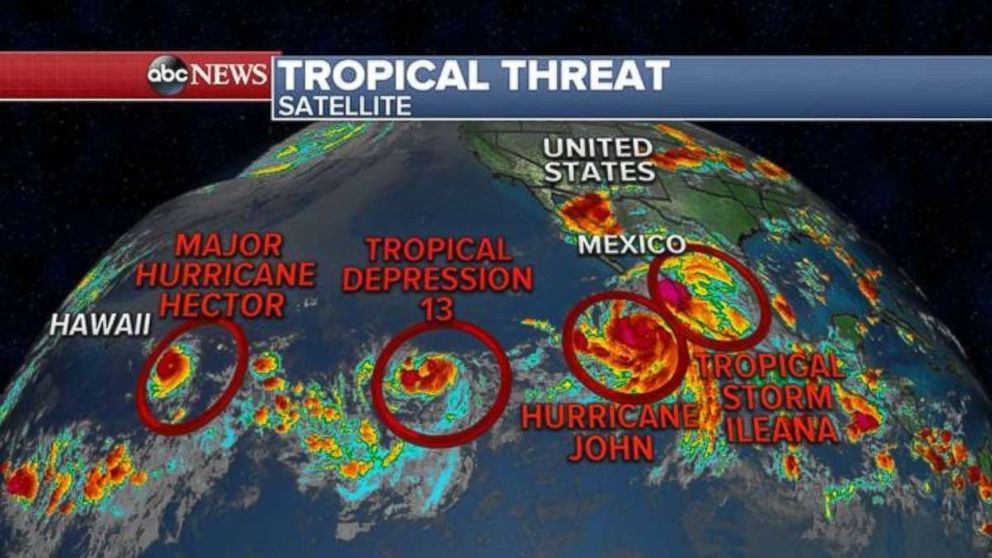 Credit: abc.com Expedition Day 58 The eastern Pacific was churning from 4 tropical depressions heading directly for the Hawaiian islands. The winds aloft forecast models for the Hawaii/California passage did not look favorable for the next three weeks. 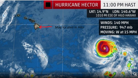 Credit: abc.com "May" was parked at the vulnerable Hilo International Airport as Hurricane Hector approached the eastern shore of the Big Island of Hawaii. Everyone was scrambling to protect their property and many tourists cut short their vacation and flew back home. I was really worried that my plane would be clobbered by hurricanes Hector and Lane approaching Hilo. No hangers were available on the Big Island, so I decided to relocate "May" to another island. Ed Neffinger put the word out about my dire situation on the Vans Airforce community web site. After chasing a few leads, I was able to secure a hanger at Kahului Airport (PHOG) for three weeks at no charge. The following Kahului pilots helped me find a hanger: Scott (local pilot), Eric, (owner of Maui Plane Rides), and Brad (local bar owner and a RTW enthusiast who offered me his hanger while his plane was being serviced in Oahu). Eric even let me crash on his sofa before my flights to/from California. I was grateful for all of the help I received in Hawaii from the local pilot community. Now that my plane was safe in a hanger, I decided to fly home commercially, rest (by this time in my trip, I was both mentally and physically exhausted) , and prepare for Hawaii to California flight. I did not want to make mistakes due to exhaustion or be in a rush to complete the trip. Returning to Hawaii After A Three Week Break On August 28, I flew commercially back to Maui on Hawaiian Airlines. I picked a window seat to carefully observe the weather between California to Hawaii. In a few days, I would attempt to fly in the opposite direction in my tiny experimental RV airplane. Before re-positioning my aircraft back to Hilo, I added an additional 22 gallon bladder fuel tank and plumbing for extra range. The plane could now fly 2750 nm, sufficient to fly from Hawaii to California with ample reserves. I heard of a recent ferry flight that went down 13 nm short of the islands due to a fuel shortage. They almost made it. I was determined to not make the same mistake. To refresh my instrument skills, I filed IFR for the flight back to Hilo. On final approach to Hilo International, ATC was landing traffic in opposite directions. I faced a Boeing 737 on short final, which felt like an "airplane" version of chicken. The "Do Not Delay" instructions to clear the runway were heeded immediately as I quickly exited the active runway. Who was I to argue? "May" weighs 1% of a loaded 737. Hurricane Hector clobbered Hilo. With extreme winds and 52 inches (132 cm) of rain, creeks overflowed their banks and debris littered the harbor and roads. A summary of the 2018 Hawaii hurricane season 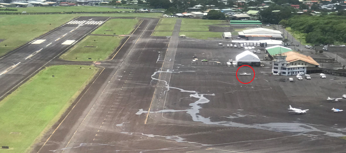 "May" parked next to the historic "old" Hilo tower and waiting for a weather window to California. My friendly and helpful ground handler in Hilo, Aircraft Services Hawaii (ASH), is located in the historic "old" airport tower building. ASH provided fuel, prompt handling, taxi service, plentiful snacks, and even assisted me to package and mail home 50 lbs of gear/parts not needed for the Hawaii - California flight. They definitely went out of their way to provide excellent service. 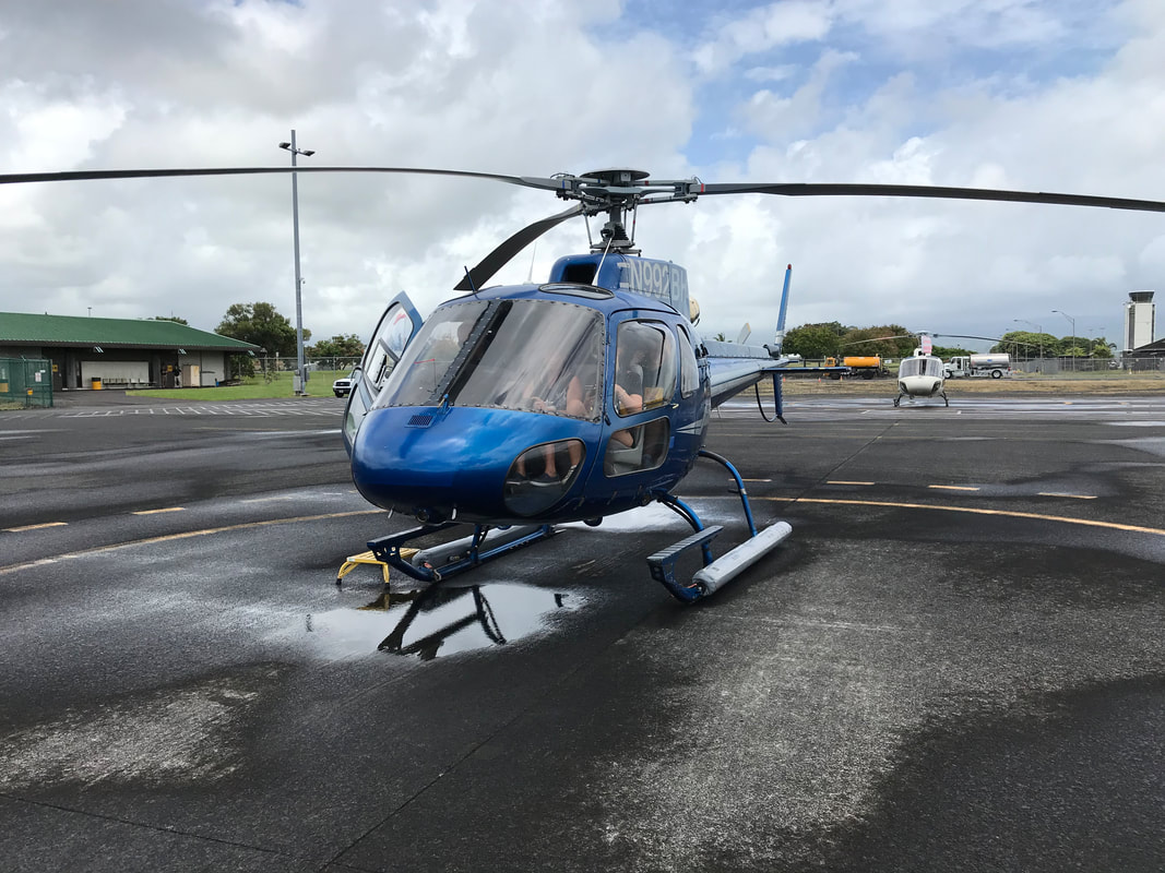 "Blue Hawaiian" helicopters offers a new volcano tour over the Big Island. The helicopter ride was a joyful distraction from my mounting concerns about the upcoming flight to California. 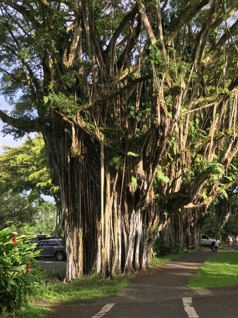 Banyan Drive, known as the "Hilo Walk of Fame", is lined with trees planted by celebrities and adventurers, including pilot Amelia Earhart. Historic photos of aviation in Hawaii. Credit: Hawaii Aviation - Hawaii.gov, TripAdvisor 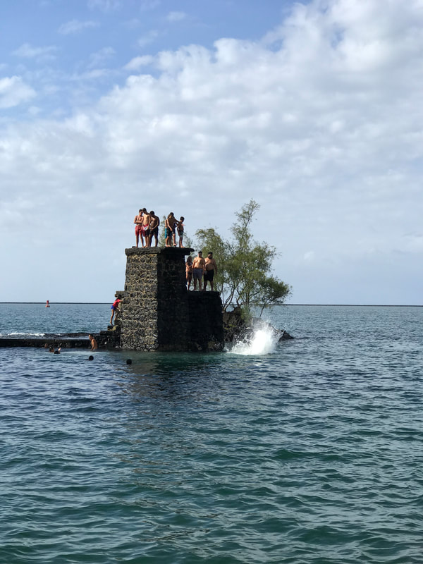 A lazy Sunday afternoon with friends. Diving tower on Mokuola island, Hilo 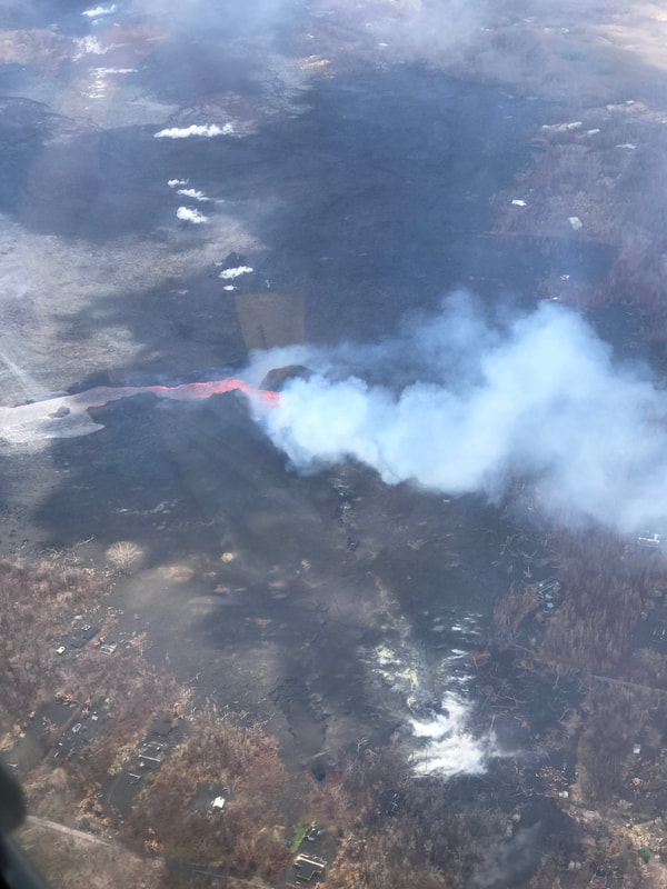 A river of magma flowing through someone's backyard. Vacationland, Hawaii. 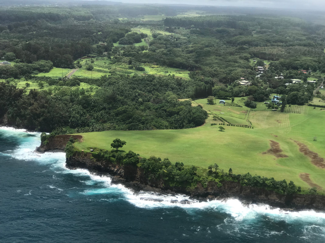 A dramatic low-level flight along the Hilo coastline with "Blue Hawaiian" helicopters. This is the closest I will get to an "Island Hopper" experience, although not in a doors off Hughes 500D. 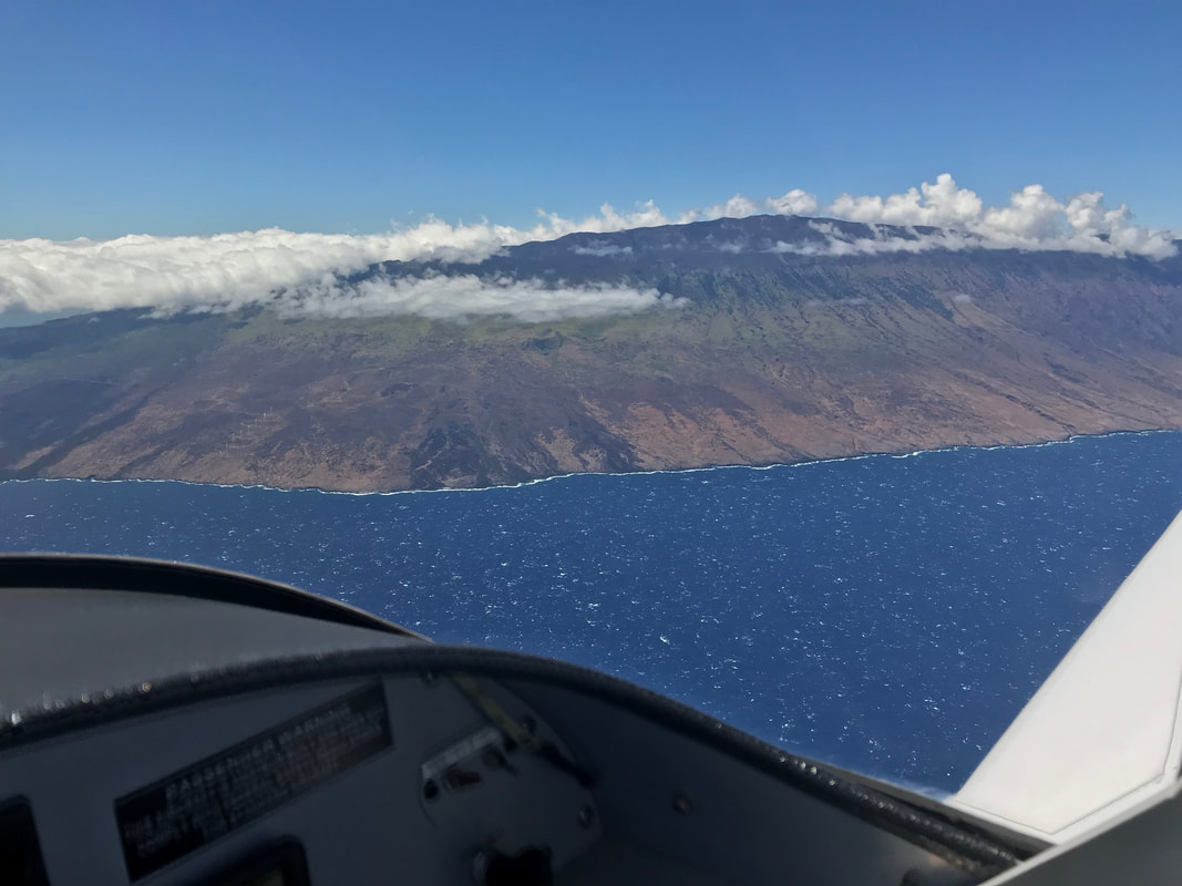 Crossing the turbulent strait between the Big Island and Maui. From 7,000 ft AGL, the water looks rough below.
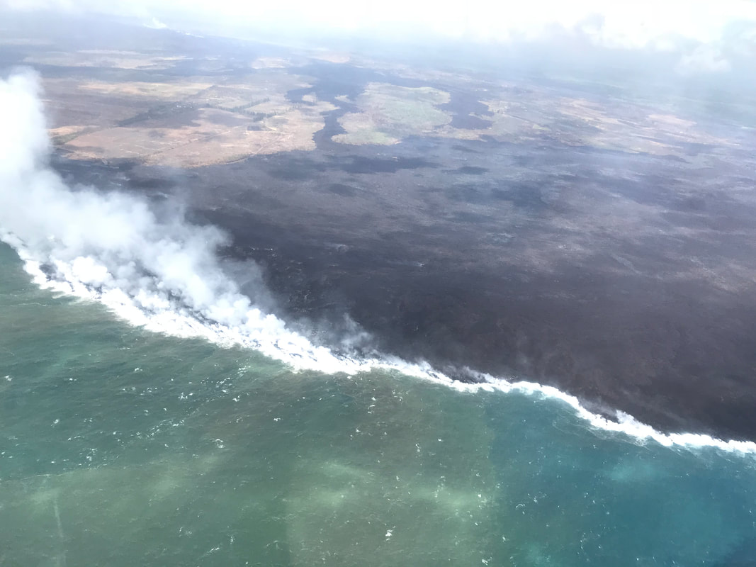
On my return flight from Maui to Hilo, I rocked my wings as I flew past Kipahulu, the final resting place of Charles Lindbergh. Perhaps "Lucky Lindy" would approve of my flight around the world. 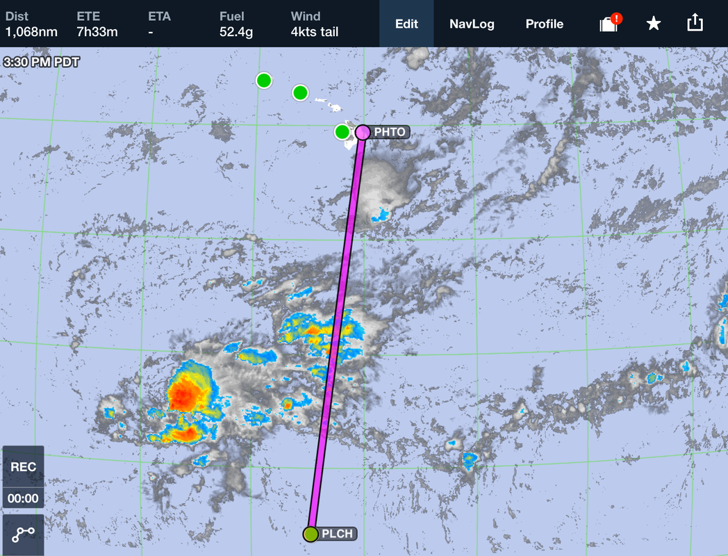 Kiribati to Hawaii through the thunderstorm infested ITCZ. Expedition Day 57 The Intertropical Convergence Zone, or ITCZ, is a belt of low pressure which circles the Earth generally near the equator where the trade winds of the Northern and Southern Hemispheres come together. The area receives the highest amount of heat energy from the sun, which causes moisture to condense quickly in to clouds. The rising air in the ITCZ cause frequent thunderstorms and heavy rainfall. Circular typhoons often form along with the highest recorded winds on the planet. For months I had been dreading the flight through the ITCZ. Like mariners facing an unpredictable passage around Cape Horn, pilots face the ITCZ with trepidation as the weather is nearly always stormy. Unlike a jet, which can fly above the weather, "May" would fly from 8,000 to 12,000 ft down in the clouds and unforgiving turbulence. Squall lines and embedded thunderstorms are common and should be expected. To maximize my chance of success, I decided to fly through the ITCZ only during the daylight hours, so that I could see and avoid the worst of the weather. Reviewing the satellite weather charts from Christmas Island the night before the flight, suggested that flying just to the west of the 1100 nautical mile direct line path to Hawaii would avoid most of the weather. On the morning of departure, I double checked the weather and filed an IFR flight plan at the "radio shack" at Christmas Island. The controllers had a relaxed, positive attitude, and ensured me that the flight plan would go through. That said, we needed to take up a collection of phone credits to call in the flight plan. I knew that the aircraft was prepared for the flight with plenty of fuel, but just how bad would be the passage be through the ITCZ? 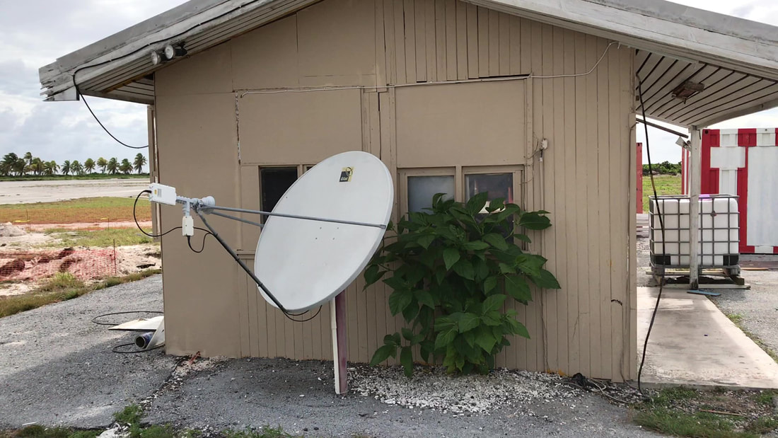 This modest building at Christmas Island houses automated weather and air traffic control services. 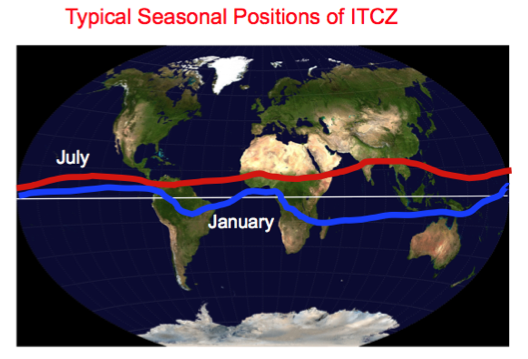 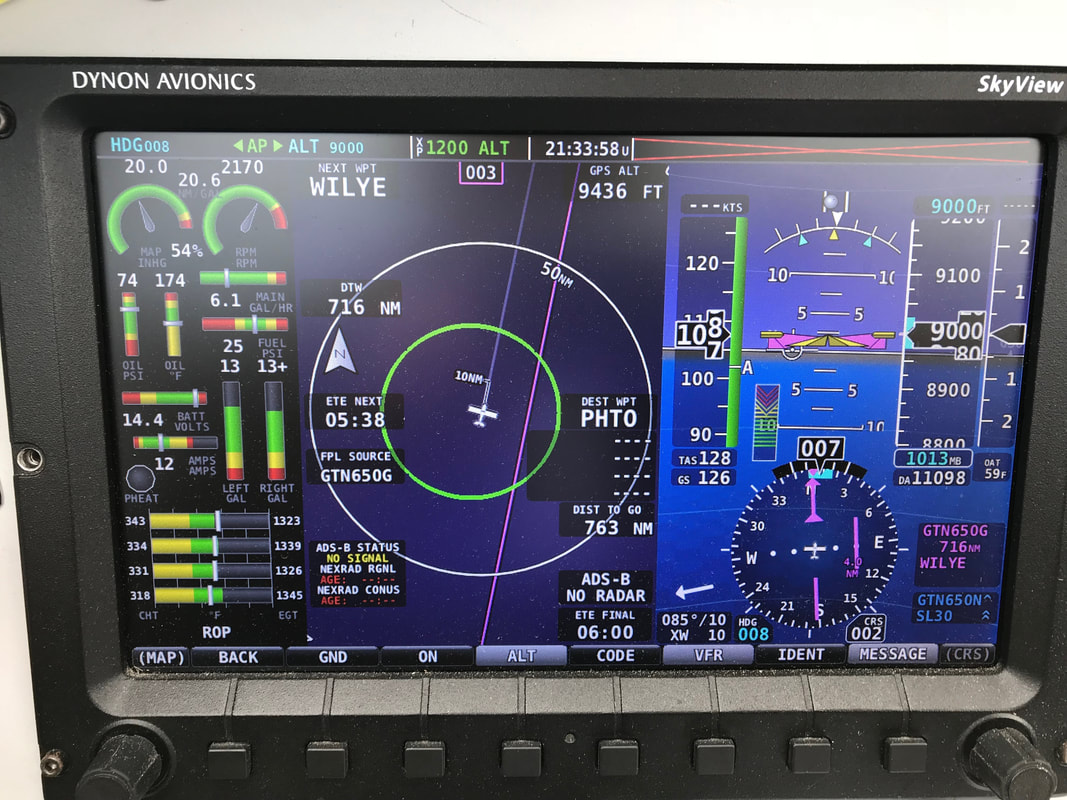 Without radar or a storm scope, I relied on the old-school method of flying through the lighter parts of the clouds. This technique was effective, but required vigilance. I had no idea what weather lay further along my path and was prepared to back-track or go-around the largest cloud build-ups. 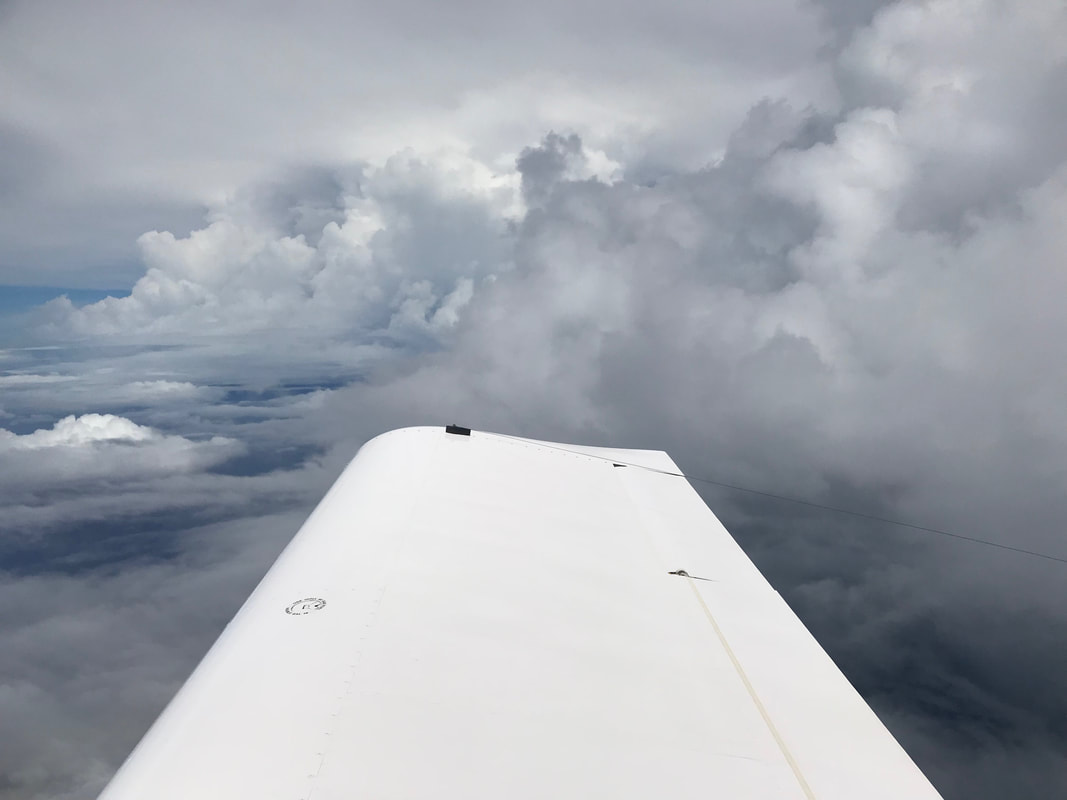 The experimental high frequency (HF) wire antenna could reach ARINC stations 5000+ miles away. I purchased a used Icom 706Mk2 mobile ham radio on Craigslist and modified it to transmit on aircraft frequencies. 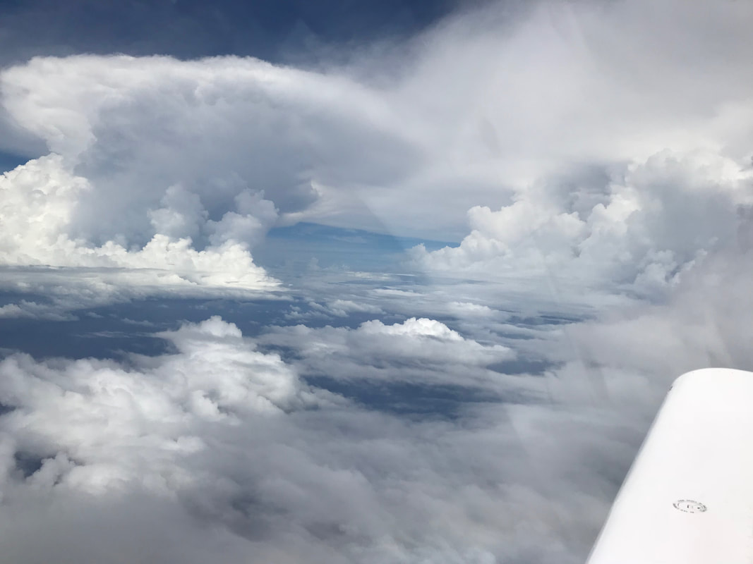 Slalom course around towering CB's in the ITCZ. Half way between Christmas Island and Hawaii. For 7 1/2 hours I flew on, covering a little over 2 nautical miles per minute. I felt very exposed flying over this isolated section of the Pacific; keenly aware a water rescue would take a long time if the engine quit. 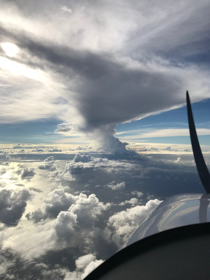 Volcanic navigation. The tallest mountain on earth (Mauna Kea - at 32,696 feet) is hidden from view. 200 miles off the coast of the Big Island of Hawaii, in-cockpit traffic and weather data suddenly appeared on the EFIS (glass panel). These enhanced services were not available to me outside the US, so they were a welcome surprise when I approached Hawaii. For most of the RTW flight, with the exception of terminal areas around airports, I practically had the airspace from 0-18,000 ft AGL to myself. The sky now felt very busy with all the jet traffic and helicopter tourist flights around the Big Island. From my vantage point 100 miles out, the entire Big Island was obscured from view. The steam generated from magma pouring in to the ocean, rose 25,000 feet in to the atmosphere. The highest peak in the entire Pacific Ocean, and the tallest mountain on Earth as measured from base to summit, was hidden in the cloud over the Big island. I passed through the ITCZ unscathed but landed at Hilo 72 hours prior to the arrival of Cat 4 hurricane Hector. There was not much time to recover and come up with a new game plan. 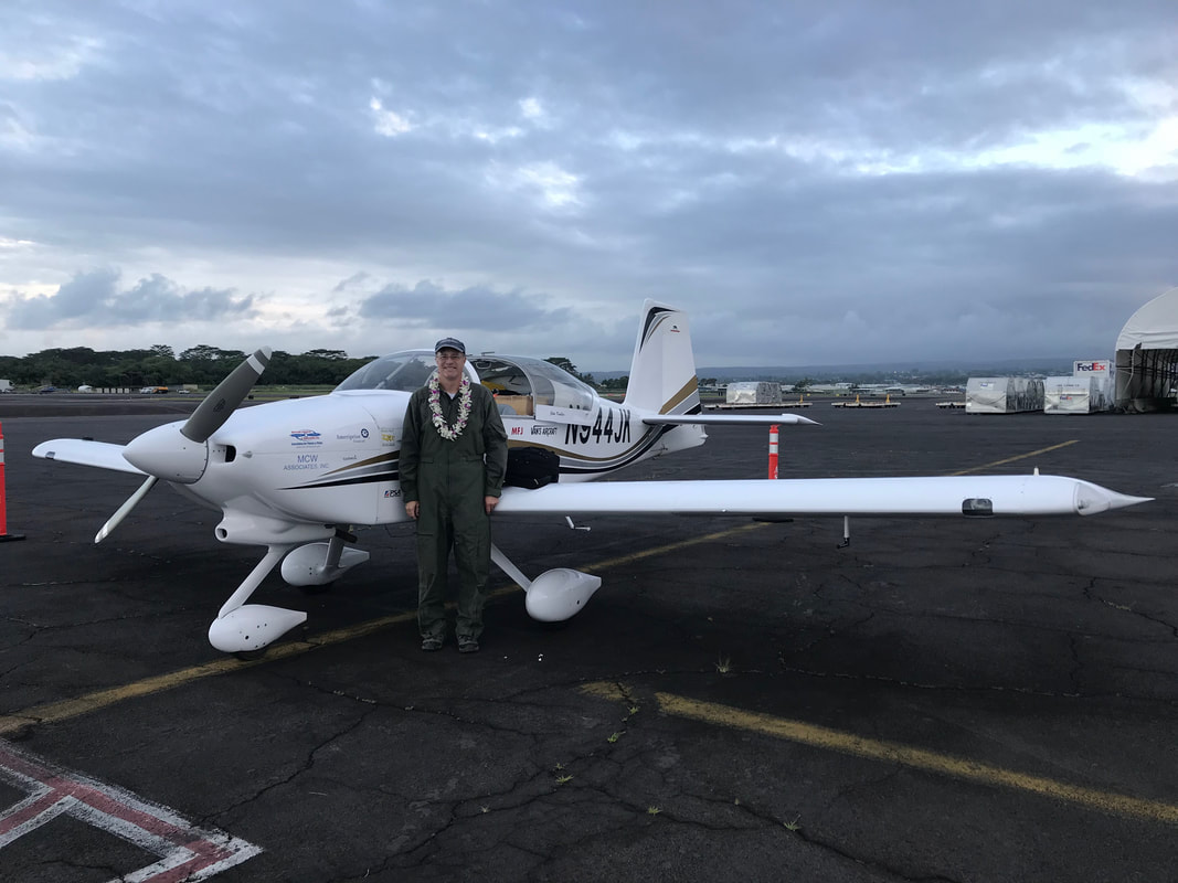 Moments after my arrival at Hilo, Big Island, Hawaii, the welcoming staff of Air Services Hawaii hung a lei around my neck and handed me an ice-cold Kona Longboard beer. Mahalo.
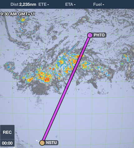
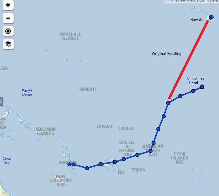
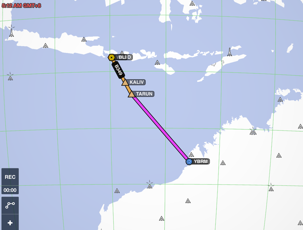
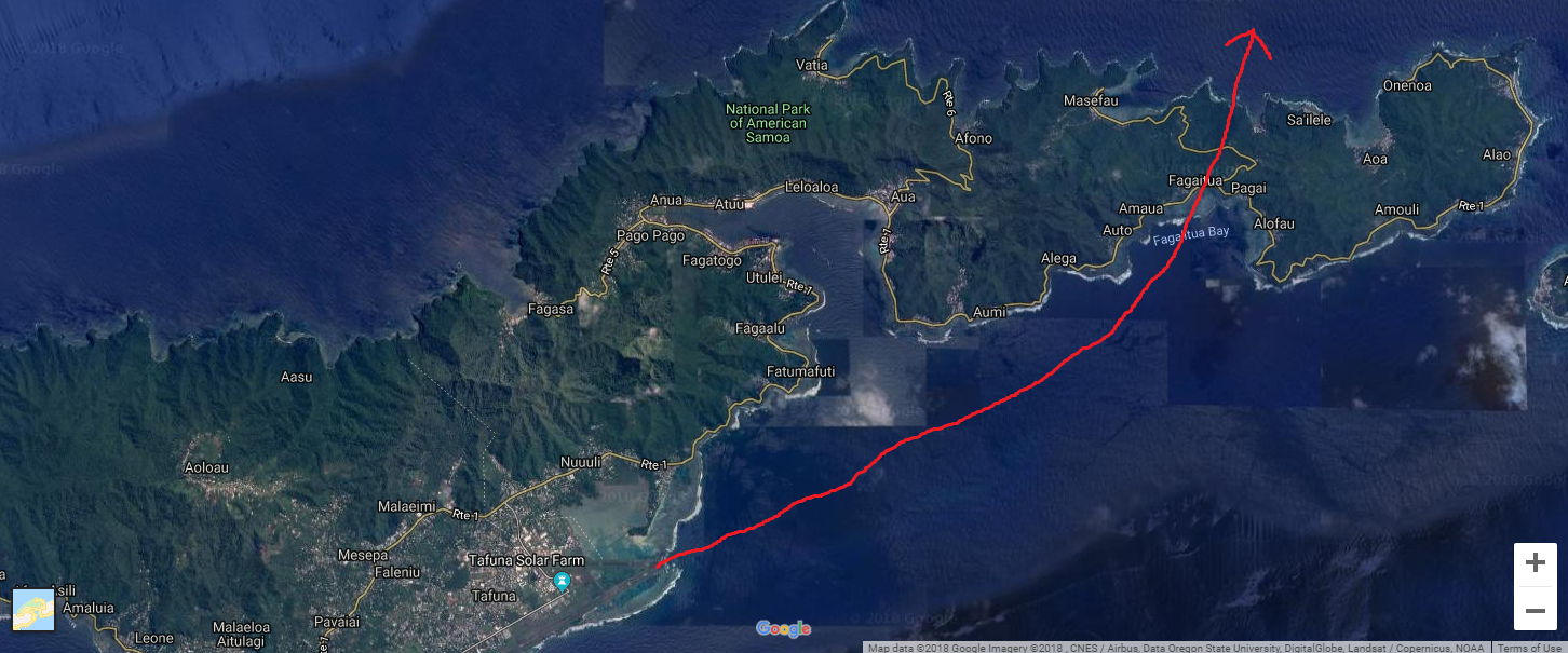 Expedition Day 55 - "How many souls on board?" I departed Pago Pago at the crack of dawn. My destination was Hilo, Hawaii, 2235 nautical miles away across the Intertropical Convergence Zone. I was carrying a massive amount of fuel and expected very low climb performance on take-off. "May" lifted off at 75 knots. I leveled her at ten feet over the runway to build speed, and climbed slowly over the cobalt blue water along the coastline, and passed by the scenic Pago Pago harbor. Eventually, I climbed high enough to clear the terrain over the island and headed north towards Hawaii. En-route to Hilo, the headwinds were much stronger than predicted. My calculations showed that I would arrive in Hilo short of fuel, so I decided to divert to Christmas Island. 500 nm south-west of Christmas Island My challenge was to now contact Christmas Island tower/operations to open the airport for an after hours landing. They have a reputation being extremely difficult to contact, either by phone, e-mail, or text. On top of this, my Garmin Inreach beacon was intermittently sending position reports. I received a flurry of worried texts from my handler and family when the Inreach beacon failed to transmit to the Iridium satellite. All means of communication were used: my incredibly determined handlers from G.A.S.E. (Eddie and Ahmed), San Francisco radio (transoceanic communications), e-mails to all known airport staff at Christmas Island, and commercial aircraft overhead on the guard frequency. For 5 hours, all attempts to contact Christmas Island failed. The situation looked dire: approach the island three hours after dark, with no open airport, no runway lights, and land in IFR conditions. Why is Christmas Island operations not responsive? I thought they were a diversion airport! Stay calm and work the problem. My plan "B" was to orbit the island at 1500 ft to wake up the airport staff to turn on the lights for an instrument landing. I could circle the island for some time at a reduced power setting. I was now within a few degrees of the equator and my HF radio link failed again from spotty propagation. I was unable to contact SF radio on any HF frequency and switched to the VHF guard frequency. Was anyone listening over the Pacific ocean? A vigilant Hawaiian Airlines flight, within 300 miles of my present position and overhead at 35,000 ft, heard my radio calls and relayed my position reports to SF Radio/ATC. 300 nm south-west of Christmas Island. 850 nm east of Howland Island. Before fading away, the last transmission from the Hawaiian airline crew to me on the guard frequency was: Hawaiian airlines: "San Francisco radio is unable to reach Christmas Island to turn on the landing lights. (pause)... How many souls on board?" Me: "One" Hawaiian airlines: "Good luck to you Sir." If my navigation was off by a few degrees and miss the island, I might run out of fuel and be forced to land at night in the trackless Pacific ocean. I fully comprehend how Amelia Earhart and Fred Noonan felt while trying to find the tiny speck of land called Howland island. 100 nm south-west of Christmas Island: Though dogged persistence, G.A.S.E. was able to reach Christmas Island by phone at the last moment. 100 miles offshore, I heard a faint and repeating radio transmission, "N944JK, ... Christmas Island" from the small radio shack on the Kiribati atoll. Someone was at the airport, ready to turn on the runway lights! Knowing the airport was open, I gradually descended from 9000 ft through the bands of rain towards the CXI RNAV initial approach fix. As I flew over the island's lagoon, the airport staff fired up the generator which lit up the edges of the single runway. I cross checked instruments and my navigation until I landed on the smooth, recently resurfaced runway on Christmas Island. The 11 hour ordeal was over. I was safe on the ground and slowly taxied towards the single story tin-roofed terminal building. Waiting for me were the airport manager, customs official, and a few sleepy ground staff. After shutting down the engine, I immediately thanked the entire airport staff for opening the airport after hours. I was exhausted and my body had been running on adrenalin for many hours. The airport manager suggested that AVGAS might be available, but could not promise anything. It was late, so I headed to the Captain Cook hotel for some rest and would deal with the fuel situation in the morning.
My original route was to fly directly from Pago Pago to Hilo. My fuel diversion to Christmas Island is shown in the map on the upper right. 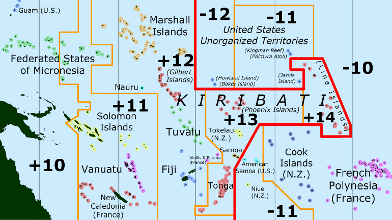 Special Time Zones Keeping track of the day and time while traversing the South Pacific can be challenging. Kiribati uses special time zones with +13, +14 UTC along with modifying the shape of the international date line. 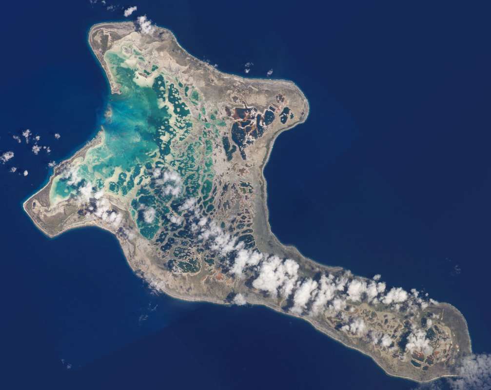 Christmas Island. A beautiful island with a violent past. The world's largest coral atoll is very remote, situated at the midpoint between Australia and the United States and just 2 degrees north latitude. It is one of 27 diversion airports, spread across the Pacific and capable of handling ETOPS rated aircraft. Photo credit: The Living Moon 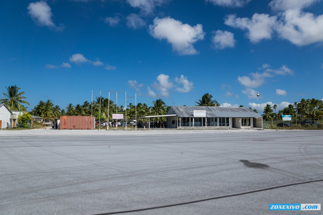 A new Christmas Island (Cassidy) International terminal building was under construction during my visit in July 2018. I am pleased to report the runway was recently repaved. This is a vast improvement over the chunky, cracking runway surface that pilots reported before my visit. Photo Credit: ZOXEXIVO.com 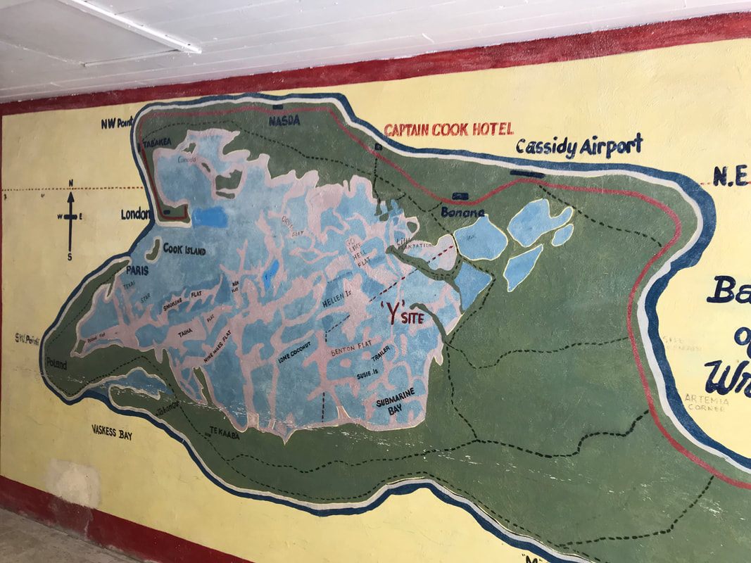 The place is the bomb. Hand painted map in the lobby of the Captain Cook hotel. 'Y" marks the spot of ground zero. In the 1950's, the British detonated multiple nuclear bombs above the island which produced high amounts of radioactive fallout. Many additional nuclear tests were carried out in the surrounding waters. Not to be outdone, the United States detonated an additional 22 bombs in proximity to the island after the British completed their tests. Grapple X was detonated over Christmas Island, at around one kilometer above ground. The two-staged design brought about a hydrogen reaction yielding 1.8 megatons. The weapons engineers had underestimated the yield by 80%. The damage caused by the explosion’s shock wave was consequently greater than expected, resulting in demolished buildings, equipment and infrastructure. The next explosion, Grapple Y, yielded a massive 3 megatons – the largest nuclear test ever conducted by the UK. In comparison, the bomb dropped at Hiroshima had a 16 kiloton yield.
The rustic Captain Cook hotel, built on the grounds of a British military camp used during bomb testing. An encouraging report about Christmas Island.   The hunt for AVGAS and the elusive "fuel boss" of Christmas Island I woke the next morning at the rustic Captain Cook hotel feeling optimistic. After breakfast, the airport manager drove me to the KOIL (Kiribati OIL) facility, where to my great relief, lay a new pallet containing a 1000 liter stash of recently delivered AVGAS. Stacked along the far perimeter fence was another 6000 liters of expired AVGAS in rusting, red barrels. The issue now was KOIL would not sell me AVGAS without authorization from the elusive "fuel boss". We jumped back in the airport ops car and drove through the villages of "Banana", "Tabwakea, and "London" before arriving at the home of the boss. His wife gave us the news that he was out fishing. There will be no fuel purchase today. In the mean time, in anticipation of fuel and airport fee payments, I located the only functioning ATM on the island and withdrew Australia dollars. The ATM cash limit forced me to obtain more cash from the local bank and from a "third party" with a better exchange rate. The next day, I made arrangements for 400 liters of "fresh" avgas to be delivered to the airport in the evening. To put it bluntly, the fuel situation here is irregular, and in the past, RTW pilots have been stuck in Kiribati for months waiting for the next AVGAS shipment from Australia. The landing/parking fees were still undetermined until 11 pm the night before departure. The bill needed to be processed in Tarawa (capital of Kiribati), 3,288 km away from Christmas Island. Kiribati (spoken as Kiribass) is spread over an incredible 1.4 million square miles (3.5M sq. km) of the central Pacific ocean and includes three island groups. I am grateful the airport staff did eventually open a closed airport, turn on the airport lights, and provide me with fuel so that I could continue my trip around the world. Communications with the outside world - 2018 Cell/Internet communications on the island is still in it's infancy, with spotty, slow links. Sending video was out of the question, but text and small photos could be shared back home. The Garmin Inreach struggled sending and receiving texts with Christmas Island positioned only a few degrees above the equator. FIshing
Christmas Island is famous for it's torpedo-fast bonefish and wily giant trevally (GT). The video below captures the excitement of fly fishing for 100 lb GT. Both sport fish are off limits for eating to preserve the stock. Catch and release only - fly fishing is taken very seriously here! 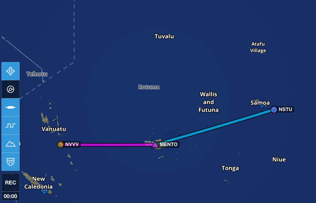 Expedition Day 54 After two restful days in Port Vila, I head to Bauerfield International Airport for an early morning flight. The operations chief greets me at the terminal entrance and then speeds me through customs, fee payment, and fueling before the commercial flights begin. Within a very short period of time, the terminal building fills with passengers and the ramp is a hive of aviation activity. The Vanuatu pilots and ground crew shake their heads and laugh nervously as I start up the engine and obtain my clearance. They can not believe that "May", a mere toy in their eyes, has the range to make it all the way to American Samoa. I smile, give a thumbs up, and taxi between the tightly spaced aircraft to the run-up area. I back-taxi and zoom climb away from the airport at 90 knots. Once reaching 9000 ft and 50 miles off the coast of Vanuatu, I divert south in a giant arc to avoid another volcanic plume (2 of 3 in this trip) which had drifted south-east from Vanuatu. While planning for this leg, I was warned of the $3000 landing/parking fees at Nadi, Fiji, so I bypass Viti Levu and and continue east towards American Samoa. Little did I know at the time, I would get royally fleeced for fuel in Pago Pago, American Samoa. The solid overcast over Fiji prevented me from seeing the many beautiful tropical islands below me. I overfly Bligh Water, made famous when cannibalistic local tribes chased Captain Bligh through this passage in 1789. 50 nm to the north lay the Yasawa Group, a chain of mountainous islands and the infamous "Blue Lagoon". 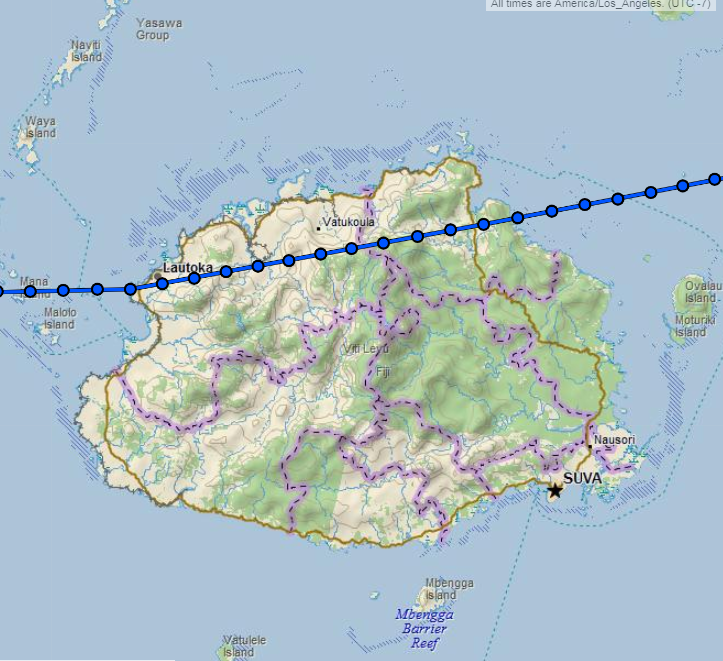 Viti Levu is the largest of the islands comprising the South Pacific nation of Fiji.  The engine is running lean-of-peak (LOP) at 5 gallons per hour. Photo taken at 9000 ft MSL over Viti Levu, Fiji. 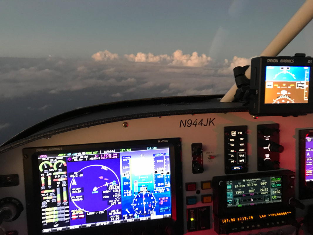 Golden hour lasted for only a few minutes. The rapid transition of day to night near the equator happens in a flash. Approaching the island of Tutuila (American Samoa). One third of the way across the Pacific ocean, with another 4300 nm of island hopping to California. 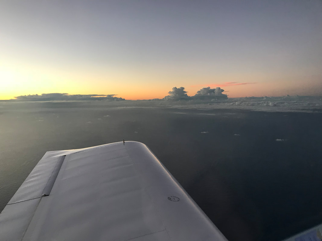 The moon was below the horizon as I approached Pago Pago airport. My eyes were fully adjusted to the darkness of the remote South Pacific, but useless to pick out high terrain features around the airport. It's not an issue as I am flying on instruments. The air traffic controller, who seemed to be running a little behind schedule for some unexplained reason ( I was the only aircraft for 100 miles), delayed switching on the runway lighting. I made a second request for the lights to be turned on. I was past the final approach fix and preparing to declare a missed approach. At ILS minimums, the airport lights were switched on to maximum brightness nearly blinding me. Within a few hundred feet of the ground, the plane's landing lights revealed the runway was crawling with hundreds of chunky cane toads. Do I declare a missed approach with an army of amphibians on the runway? I continued with the flare and landing, with toads clearing a path. The Samoan controller then directed me to taxi over a water causeway and proceed to any spot near the terminal building. After 10 hours of flying over the warm waters of the South Pacific, I switched off the engine to silence and slid open the Plexiglas canopy. I popped my ears to normalize pressure and immediately heard the roar of the pounding surf against the reef and seawall. My handler warmly welcomed me to Pago Pago but then said, "Do you want to hear the good news first or the bad news?" 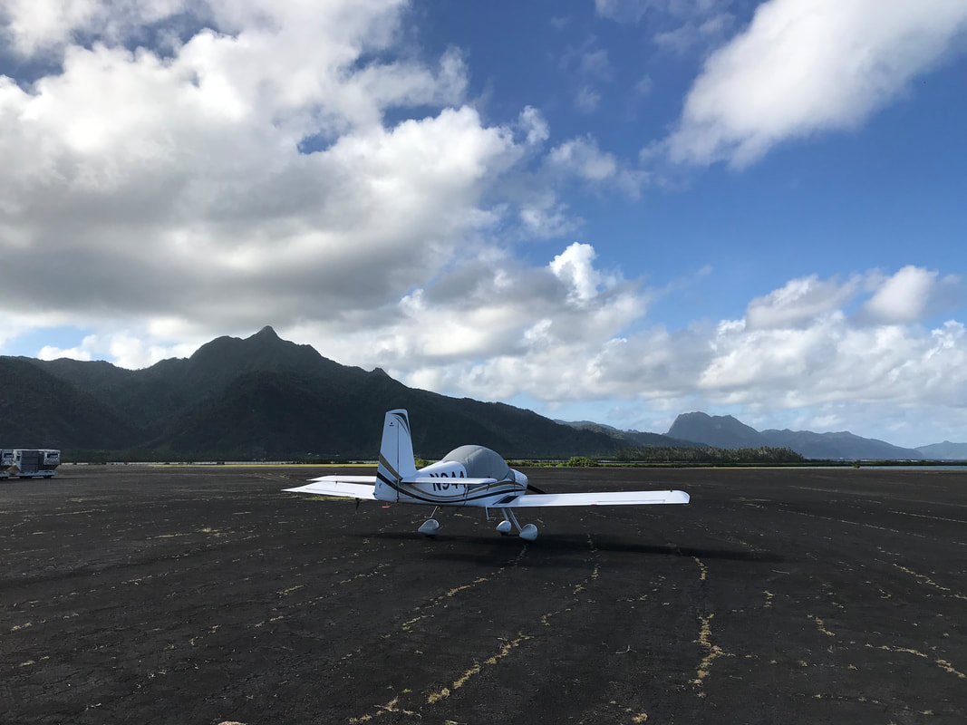 Historical Note: Pago Pago and NASA American Samoa and Pago Pago International Airport had historic significance with the Apollo Program. The astronaut crews of Apollo 10, 12, 13, 14, and 17 were retrieved a few hundred miles from Pago Pago and transported by helicopter to the airport prior to being flown to Honolulu on C-141 Starlifter military aircraft. "Apollo Splashdowns Near American Samoa". Tavita Herdrich and News Bulletin. Retrieved July 7, 2010. "Apollo 17 Lunar Surface Journal – Kevin Steen". Eric M. Jones. Retrieved February 23, 2011. 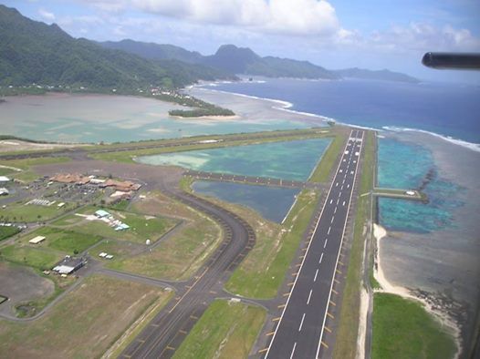 The 10,000 ft sea level runway at NSTU, Pago Pago, American Samoa. The risk of flying around the world in a small plane On 23 July 2014, Babar Suleman and son Haris departed from this runway on a rainy, moonless night. Within moments of take-off, they crashed their heavily loaded Beechcraft Bonanza in to the ocean off Pago Pago. My handler was on duty that night and witnessed the crash. He was still understandably, very upset by the experience and he implored me to not take off at night. I listened to his advice and departed early the following morning. Suleman accident report: https://www.usatoday.com/story/news/nation/2014/08/13/ind-teen-pilot-crash/14015495/ Photo credit: Pinterest 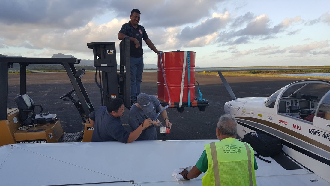 The $3000 fuel bill. Improvised aircraft fueling at Pago Pago.
After landing at Pago Pago, my handler bluntly said that my reserved aviation fuel (AVGAS) at the airport was no longer available. This was devastating news. Unless I could "MacGyver" high octane aviation fuel from coconuts, I would need to scramble to find an alternative fuel source. A new shipment of AVGAS would take months as it is shipped from the US. I was leery to use lower octane auto fuel as it had not been tested with my engine and fuel delivery system, and might subject my engine to detonation. The use of an untested fuel might lead to disaster on take-off. The only other avgas on the island was stored in a 500 gallon container at the port of Pago Pago, which was originally intended for tuna boat helicopters. The new helicopters use jet fuel, so this precious, highly refined fuel, was available for $31/gallon, or over six times the cost of fuel on the continental US. There was no negotiation. Buy it now or get stuck for a very long time in American Samoa. The fuel was delivered promptly that afternoon in two 55 gallon drums along with a disclaimer absolving them of any responsibly about the fuel quality. Once back at the airport, the uncooperative fueler would not let me borrow their transfer pump, which was readily available. My handler, Prichard Airport Services, instead offered to help me siphon 110 gallons of AVGAS to my fuel tanks using a fork lift, Baja fuel filter, and 1" vinyl tube bought that afternoon at Ace Hardware. Thank you Richard (and good natured crew) for your assistance during a difficult situation. The job took three long hours, with a few minor spills, dozens of re-primes without the use of a manual pump. We completed the fueling after dark using flashlights. In the photo shown above, the fellow in the yellow safety jersey spit out a mouth of AVGAS while re-priming the siphon. Photo credit: Prichard Airport Services 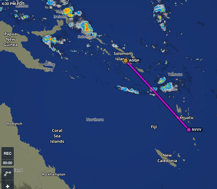 Expedition Day 53 Solomon Islands to Port Vila, Vanuatu. Hard IFR departure, rain, and overcast skies for the entire flight. A strong tail wind for the last half of the flight pushed fuel economy over 40 mpg. 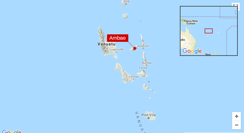 My flight off the west coast of Vanuatu required diverting around the giant Ambae volcanic plume. The grey-brown colored plume was clearly visible at my altitude and extended well off the coast line. I did not take chances with ash clogging the air filter and engine. 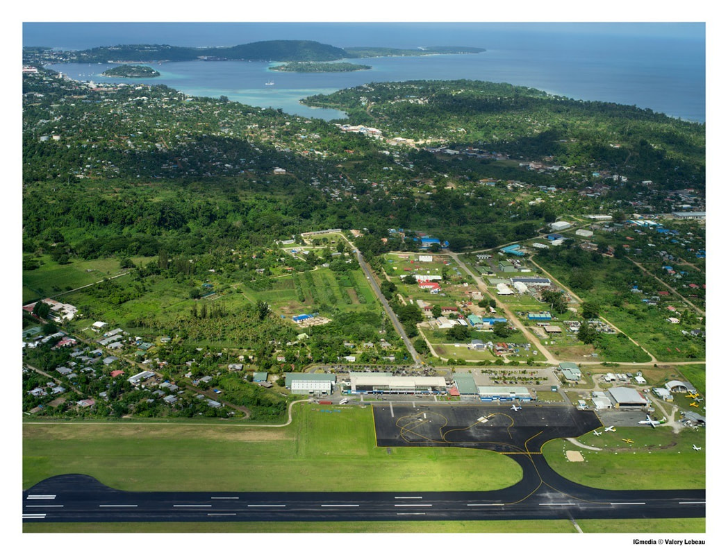 Port Vila, Vanuatu - Highly recommended. My destination, Port Vila airport (NVVV), has a single runway and a very compact terminal area. Because of the limited parking area, flight schedules are tightly controlled and ground staff constantly choreograph aircraft movement. Many operators based at Port Vila fly to Tanna Island for overnight volcano tours. At the end of each day, the terminal area is packed with planes both on the pavement and grass overflow areas. May was tucked way in a corner, adjacent to the operations office and out of harm's way. The ground staff and pilots at Port Vila were the most enthusiastic I experienced on my trip. May received considerable attention and photos, and I was asked many questions regarding the trip and modifications to the RV-9A for long-range flying. The last known experimental aircraft to land in Vanuatu (Luganville, Espiritu Santo) was B-KOO, Hank Cheng's RV-8, on his around the world trip in 2016. Photo credit: Red – Vanuatu 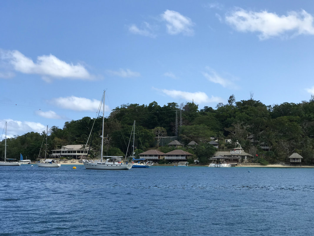 A scheduled lay-over day in beautiful Port Vila harbor, Vanuatu. 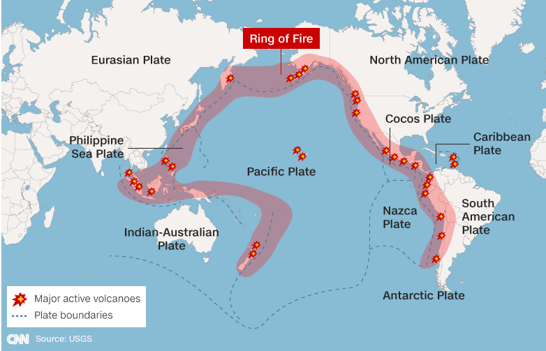 Vanuatu is located along the "Ring of Fire". During both the approach and departure from this island nation, I avoided multiple volcanic plumes, which can pose a significant flight safety hazard. The ash contaminates fuel and water systems, can jam gears, and quickly make aircraft engines fail. Lava bombs and lighting on Mt. Yasur.
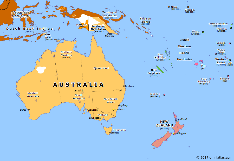 Expedition Day 48 After crossing the bone-dry outback of Australia, N944JK headed north-east across the Coral sea to Henderson Field on the island of Guadalcanal (Solomon Islands). The long way around the Pacific Most RTW pilots on the classic easterly, central pacific route, island hop from Australia to the western USA via New Caledonia or Norfok Island, Nadi (Fiji), Pago Pago (American Samoa ), Christmas Island( Kiribati), Hilo (Hawaii), Santa Barbara or Monterey ( California). Flying around the Pacific via Japan, eastern Russia, to Alaska is actually a shortcut to the west coast of the United States. Graphic credit: omniatlas.com 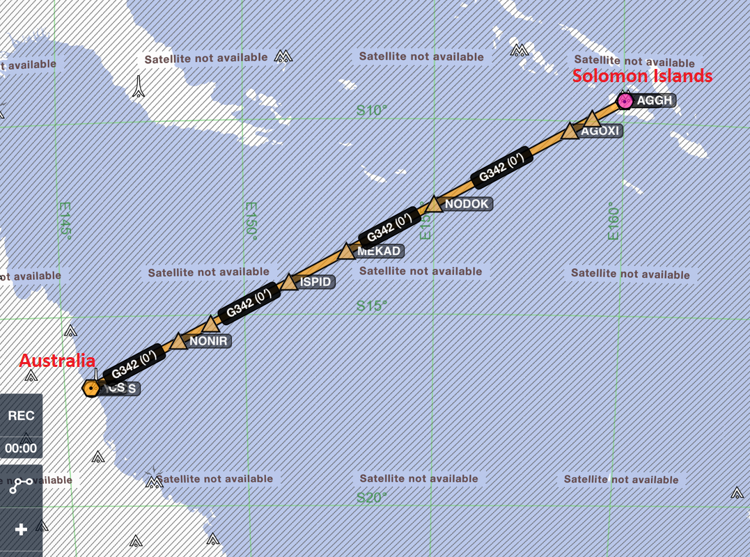 After a brief visit to Cairns, Australia, I head across the Coral Sea to Guadalcanal. 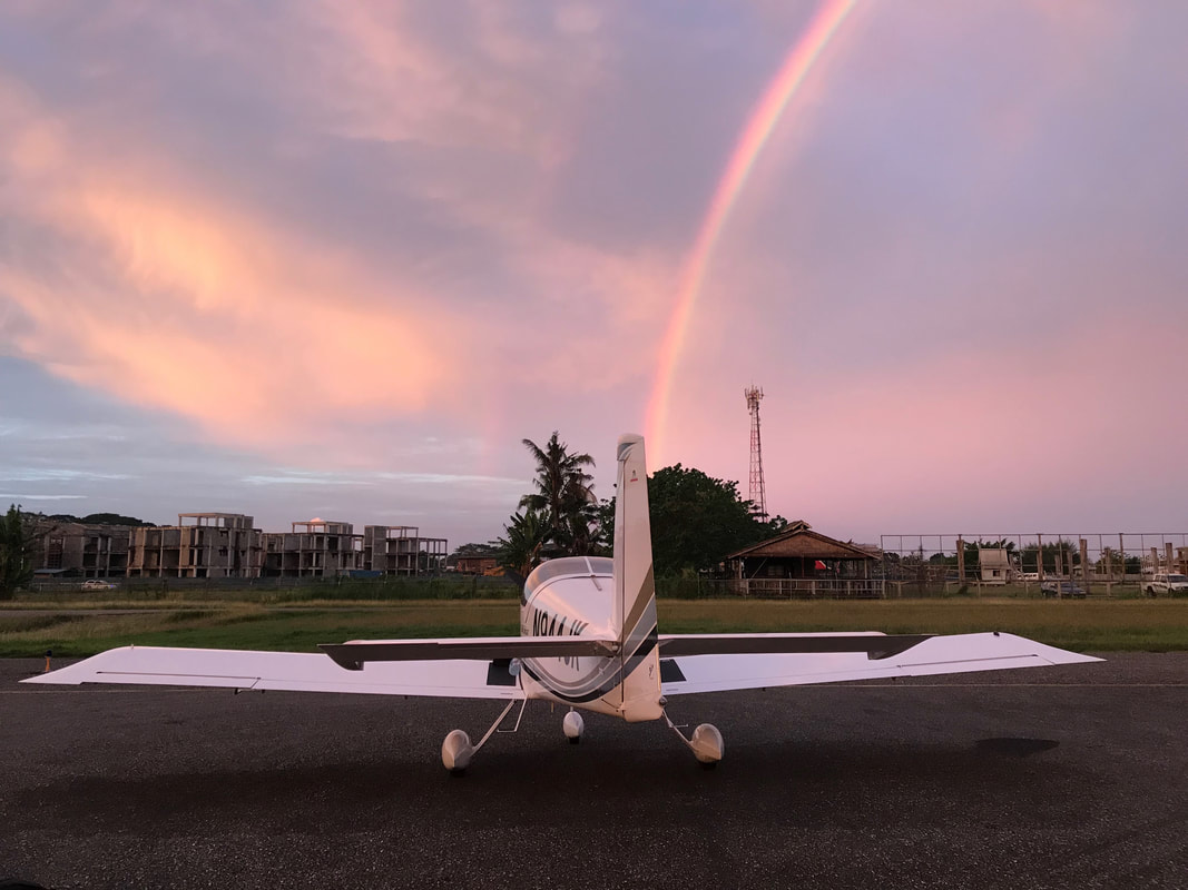 Intense humidity, malaria mosquitoes, and a rainbow at Henderson Field, Guadalcanal. 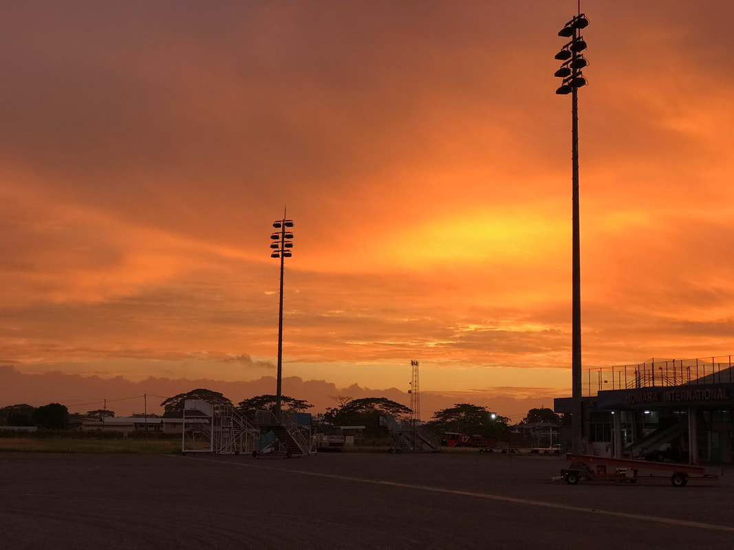 A beautiful sunset at historic Henderson field. I came here to experience flying over the area hotly contested between the Japanese and American airmen during the early part of WWII, and possibly see a few war artifacts remaining on the ground.   On my day off, I wandered around Honiara and visited the somber Guadalcanal American Memorial, perched on a hilltop overlooking the town. An occasional American or Japanese tourist visits the memorial, but the locals seem to have long forgotten about the war. 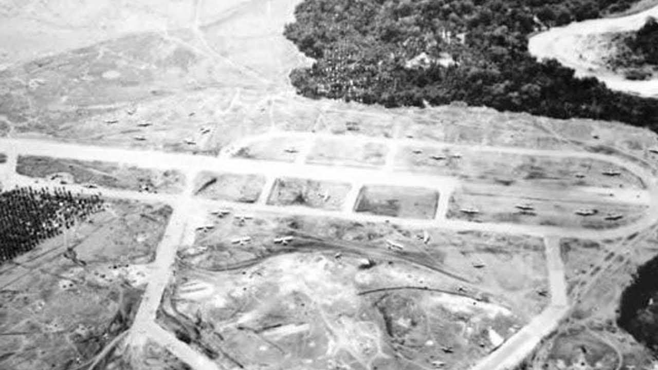 Henderson field was carved out of the jungle by the Japanese military and later completed by the Americans after the capture of Guadalcanal. Life on Guadalcanal during WWII www.nationalww2museum.org/war/articles/life-guadalcanal
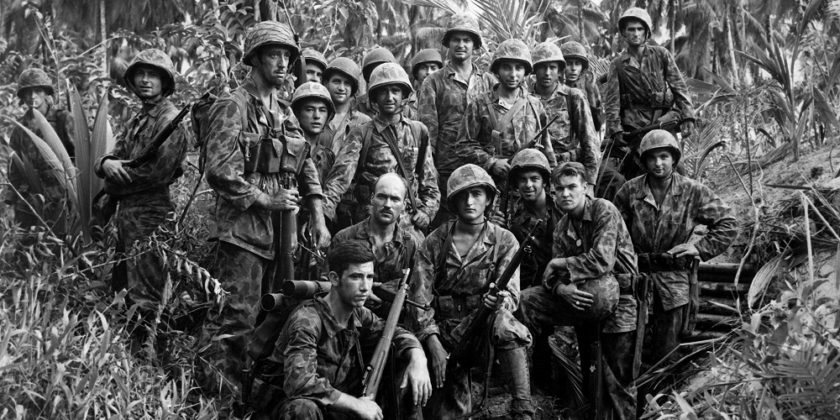 I can't imagine the hardship the marines encountered while fighting the Japanese on Guadalcanal in 1942/43. The American supply line failed, forcing soldiers to eat abandoned Japanese rations. It was not uncommon for men to lose as much as 40 pounds due to malnutrition and tropical diseases. The Japanese suffered equally and called this place "Death Island".
The constant threat of Malaria Credit: National Museum of Health and Medicine During WWII, the US military produced a series of posters and comics as part of a propaganda campaign against Malaria. ----- On the morning of departure, thunderstorms were quickly approaching the Solomon Islands from the north. Humidity was increasing to intolerable levels as were the mosquitoes. Vanuatu to the south-east promised better weather, and I was motivated to leave quickly. There were major complications with payment for the fuel and airport fees, but I departed just before the tropical rains hit. Normally highly orchestrated, my IFR departure was completely at pilot discretion. The tower was manned and operational, but guidance that day was practically "do what you want". I followed the published SID, but tagged on "Black Sheep" to my radio calls (in homage to VMF 214) as I departed historic Henderson Field. 20 miles northwest of Henderson Field, a lone Solomon Airlines Twin Otter reported bouncing around in heavy rain. I announced my intentions on the tower frequency and climbed quickly over Alligator Creek in to ever thickening clouds over Iron Bottom sound, in the direction of Tulagi. At 1200 feet, I provided another position report, turned left back towards the Honiara, and climbed rapidly to 9000 feet for terrain avoidance. A relatively short distance away, the numerous jungle-clad peaks of western Guadalcanal were hidden in the clouds. I relaxed somewhat after heading over open water towards Vanuatu. Off my left wing, Vanuatu reported an active volcanic plume, but this could be avoided visually.  "Black Sheep" with a B-17 bomber in the background.
The decal is a tribute to VMF 214 and Pappy Boyington. 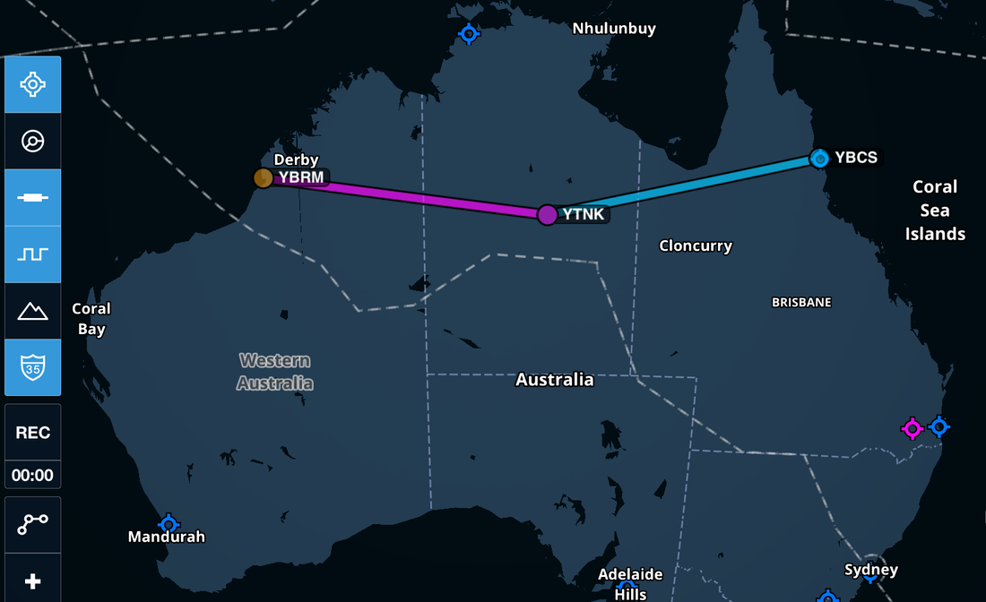 Crossing the Australian continent with an overnight stop in Tennant Creek, Northern Territory. Expedition Day 47 From Broome to Cairns, I flew past multi-million square acre cattle stations spread out across the vast and desolate outback. Due to the distances involved, Australian air traffic control requires pilots to blindly broadcast position reports on shared multi-frequency repeaters located near the cattle stations. The desolation is astonishing. You can fly for a hundred miles without seeing any sign of human impact on the ground. I signed up for adventure on this trip and Australia delivered in spades. Dusty landing strips with uniquely Australian names like Margaret River Station, Halls Creek, Browns Range, Herbertvale Cattleyards, and Century Mine popped up on the GPS. The Nevil Shute books I read in my youth came to life, while crossing the outback and Gulf country.  A dream flight over unforgiving terrain below. CAVU (ceiling and visibility unlimited) weather, 40 knot tail wind in smooth air, and moderate winter temperatures while flying over the entire Australian continent. 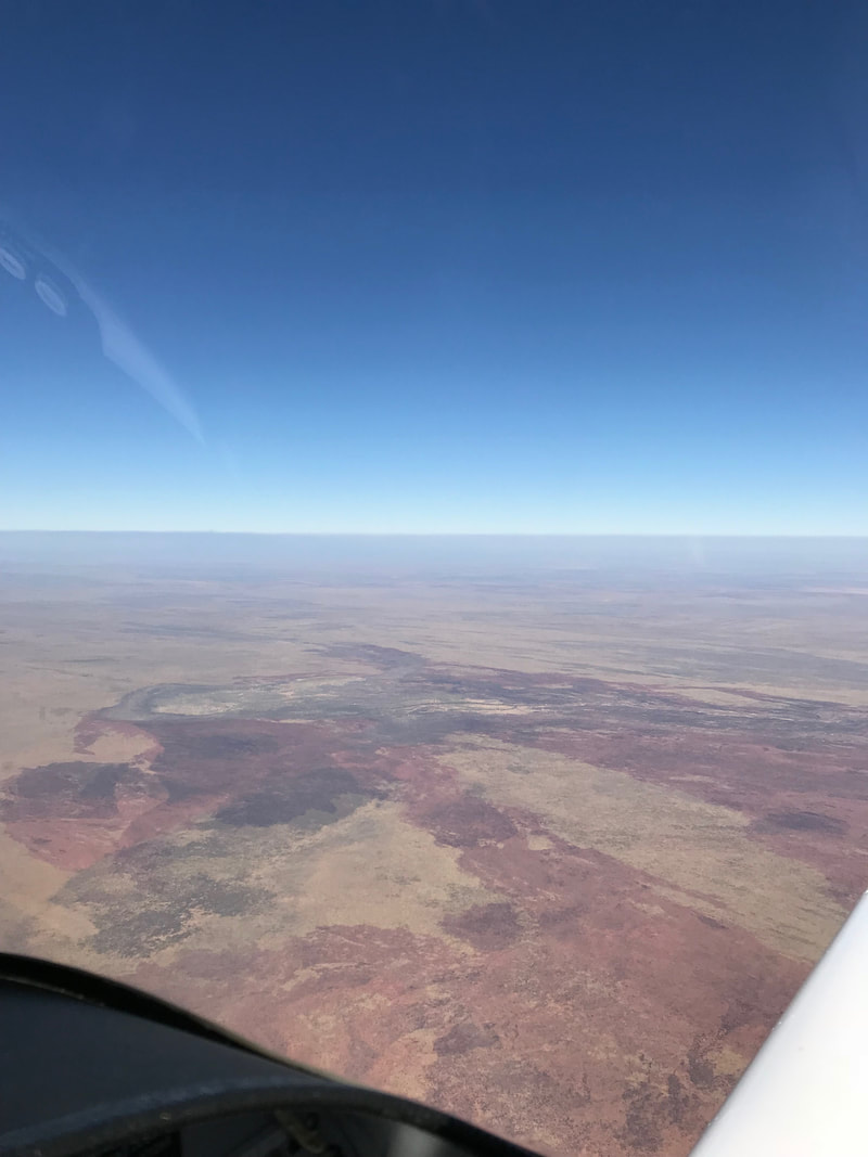 Jon Johanson, (a famous Australian aviator and a mentor) who flew around the world three times in his experimental RV4 (east, west, polar) reminded me to not underestimate the outback. If you are forced down, you may never be found if your ELT and PLB are destroyed in the crash. He equated the risk to that of the north Atlantic crossing. My plane carried extra water and survival equipment for polar, desert, and marine environments. The engine runs smoothly and all systems are nominal. 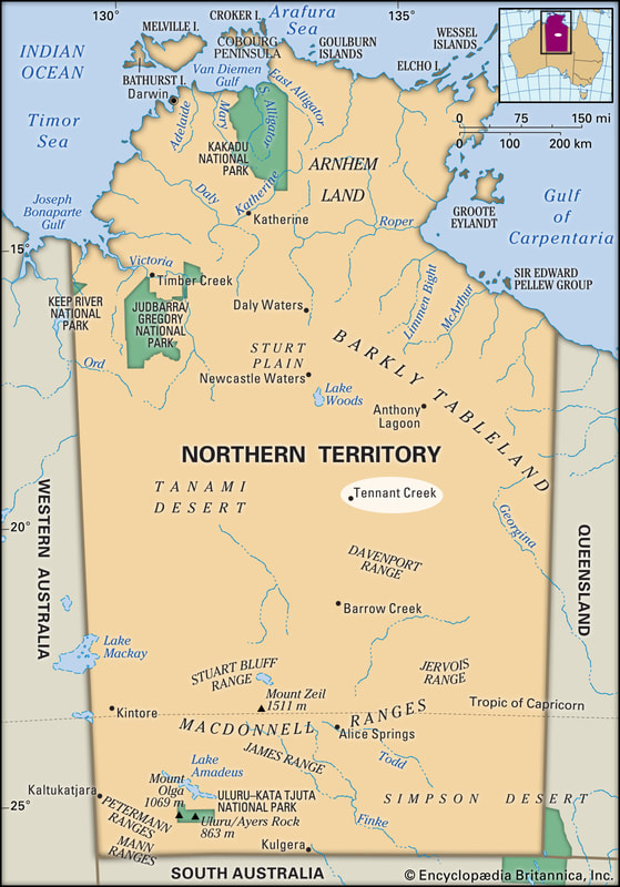 Credit: Britannica  I flew for 5 hours over the exceedingly barren Western Australia and Tanami deserts, before landing at Tennant Creek airport. Tenant Creek is positioned at junction of two great highways, the Barkly and the Stuart, also known as the Overlander and Explorer's Ways. I marveled at the change from humid coastal, western Australia to the dry, blast furnace of the outback. The airport supports the mining companies and Aboriginal communities in the surrounding areas. When I arrived, the place was extremely quiet compared with the international airports I had recently visited. A few dogs barked in the distance, so I knew the town was not that far away. I eventually found the manager/caretaker busy working in his maintenance shed. We chatted for a bit, and later drove into town at the end of his shift. As mentioned in the "About" section of this web site, the around the world flight is dedicated to my mother who brought me to my first flying lesson. Throughout her lifetime, May admired Australia through books and film. Actor Brian Brown in "A town like Alice" and the film "The Man from Snowy River" were some of her favorites. May never made it to Australia in her lifetime, but she finally made it to the land "Down Under" in spirit.
 Expedition Day 46 With 23 million annual visitors arriving by air, Bali air traffic control really "pushes tin" at Ngurah Rai International Airport (WADD). As I taxied towards the active runway, the sound of the huge jets taking off with full power, vibrated my plane and body like a tuning fork. It was unbelievably loud, even when wearing active noise cancelling headphones. The tower directed me to hold short on the active runway into a cloud of jet fumes. I grinned and tightened my shoulder harnesses in anticipation of another epic flight. Behind N944JK, I counted seven jets queued on the main taxiway. Once released, I climbed at 90 knots to 3,000 ft through the low-level clouds before given an immediate southerly vector towards Australia. The clouds eventually dissipated to reveal the most incredibly green-blue water over the Timor sea. See below.  The approach to Broome International airport was visually stunning as brilliant sand beaches and turquoise waters welcome you to Australia. 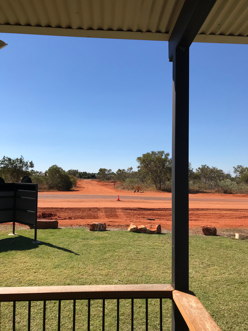 The strikingly red outback soil and clear skies of Western Australia After flying over pink sand beaches, I landed at Broome International airport in the northwestern corner of Australia. I was directed to taxi to the foreign aircraft quarantine area, next to a plain, single story immigration building. The youthful immigration/agriculture officer on duty ran up to my plane and handed me a small spray can of floral scent insecticide. After shutting down the motor, I activated the insecticide can, which stuck in the on position and filled the cockpit with a choking fog in about 1 second. I suspect the can had the fogging volume for a cabin class aircraft and overkill. The can was tossed tossed outside, still ejecting insecticide at full throttle and spinning in a circle on the red earth. I was warned to remain inside the cockpit for the next 5 minutes (required to kill insect stowaways). Temperatures in the bubble canopy during the mid-day sun reached (130f/55c?). Given a thumbs up from the officer, I quickly opened the bubble canopy for fresh air. I was drenched in sweat, so the officer pointed me to the quarantine hut for shade and to hydrate (I was handed a cold bottle of water) before we resumed the paperwork. A month after the completion of the RTW trip, Australia billed me $200 for the small can of insecticide spray. 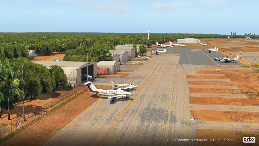 Necessary aircraft maintenance at Broom airport.
My last oil change was in Italy, 8000nm ago. Since then, I had flown through a light dust/sand storm over Saudi Arabia and near volcanic plumes in Indonesia. It was absolutely necessary to perform another oil change and firewall forward inspection in one of the maintenance hangers at the Broome International Airport. I was told to "just pump the oil from the 200 liter drums out back , mate". A few aircraft waited to be serviced outside, so I was given about two hours to complete my work. The mechanics were constantly doing fleet maintenance and did 3 oil changes for my one. I was grateful for access to a covered space out of the blistering sun, few tools to work on my plane, but it was accelerated work. After the oil change, I moved the plane outside for thorough inspection of the firewall forward before re-installing the engine cowl. I felt pretty weak after the maintenance work and headed back to the hotel. For the past three weeks, I had been battling with rather severe digestive issues ever since Pakistan. Tech notes: Oil used on the RTW flight "May's" 400 hr experimental Lycoming YIO-320 engine consumed about 1-2 quarts per 65 hours of operation. I started the trip using Phillips 66 20W-50 in the USA, then switched to Aeroshell 100W in Italy, and Aeroshell 20W-50 in Australia. I filled an extra 4 quart bottles for the last 8000 nm back to California. Since I built the RV-9A, I had high confidence in the airworthiness of the aircraft. Photo Credit: Orbx |
Archives
September 2018
Categories |