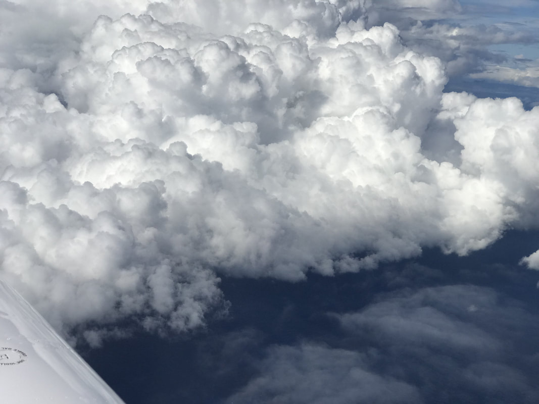
 Expedition Day 42 Almost immediately after departure from Subang International, Air Traffic Control directed me in to towering (CB) cumulonimbus clouds. I requested an immediate modification of the SID (standard instrument departure) but was denied course changes due to the surrounding jet traffic. Preparing for the worst, I slowed down to 90 knots - VA (maneuvering airspeed) to minimize stress on the aircraft. The plane was carrying 2.5x the normal amount of fuel, with a slight aft center of gravity, as I punched through the wall of cloud. Inside the maelstrom, I was slammed with rain and a moderate up/down drafts until passing through the far side of the cloud. Throughout the flight I had to avoid many formidable CB's over the Strait of Malacca and extending south-east all the way to Bali (1100nm away). 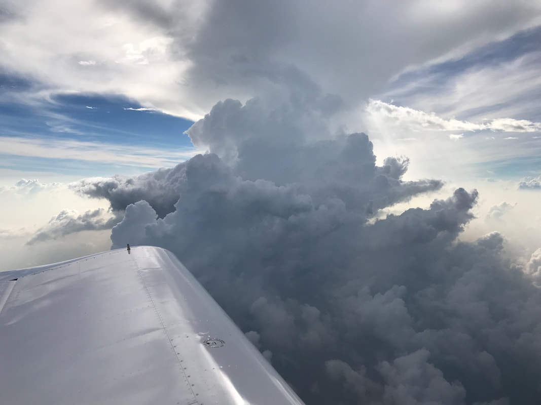 Dodging weather over the Straight of Malacca. 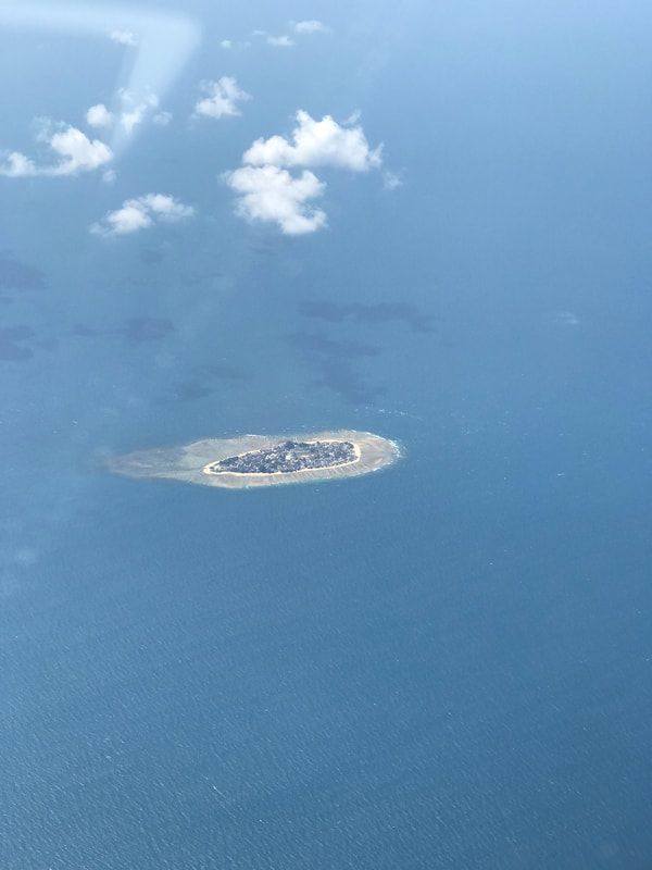 Further south of Singapore, I spot numerous, densely populated islands between Malaysia and Indonesia. 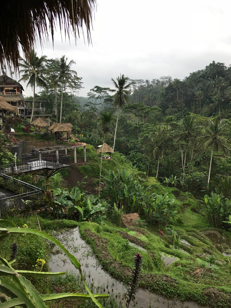 Lush, tropical rice terraces are located in the the highlands of Bali.  Photo credit: Paula Bronstein/Getty Images Civit cat snacking on coffee cherries. The first step of the Kopi Luwak coffee "process". Near the photogenic rice terraces, my driver stops at one of the roadside coffee plantations. We sample a dozen types of coffee, including Bali's infamous and pricey Kopi Luwak (civet cat) coffee. 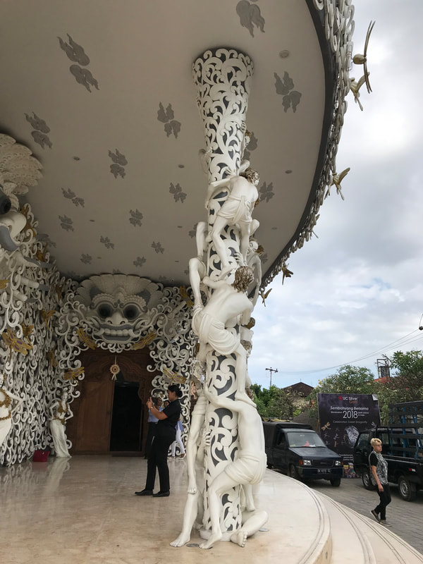 Exquisite Balinese artistry on display at the UC Silver factory and museum in Denpasar. 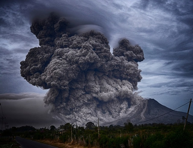 Photo Credit: Novinite
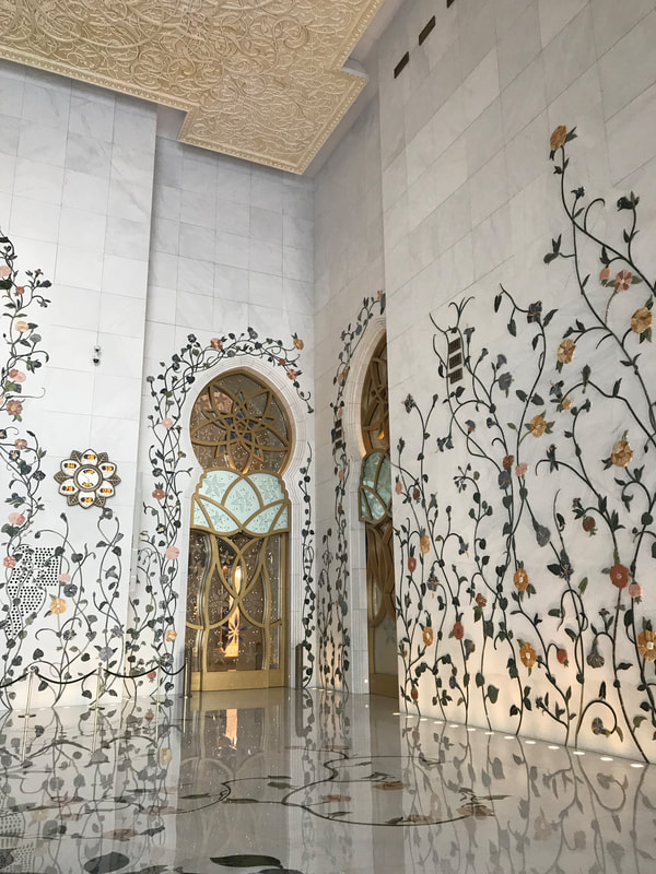
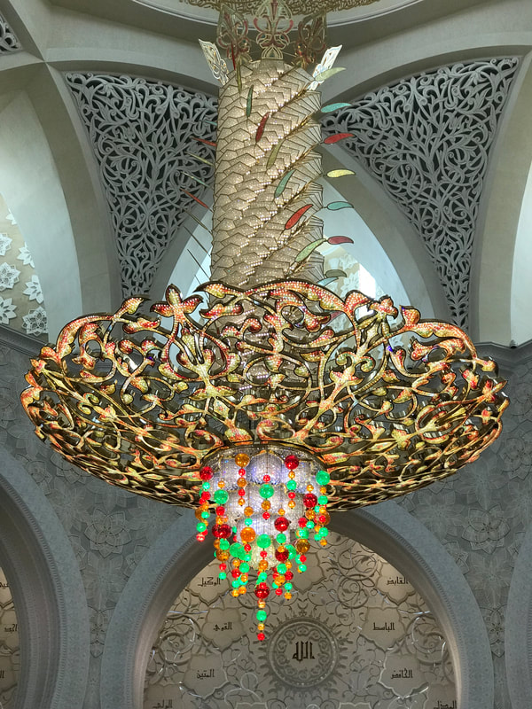
Mt. Agung shuts down air traffic again at Bali Airport. I carefully time my arrival and departure from Bali to avoid damaging volcanic plumes from recently active Mount Agung and Batur. Hours after my departure from Bali, Mount Agung blew out another plume which disrupted air traffic over Indonesia. This is the first of three volcanoes that will impact my flight around the world. 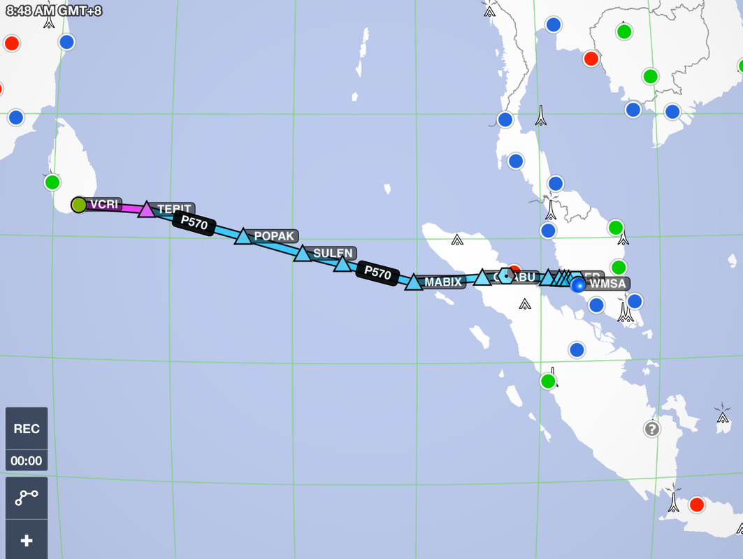 Expedition Day 41 My 1240 nm short cut across the Bay of Bengal. I contemplate the fate of Malaysian Airlines flight MH370, that disappeared while flying over these waters. How could a large, certified aircraft carrying hundreds of passengers vanish from radar and never be found? Would I ever be found if my engine were to fail over this remote area? "May's" Lycoming experimental engine does not care that I am flying over the ocean and continues to run smoothly. 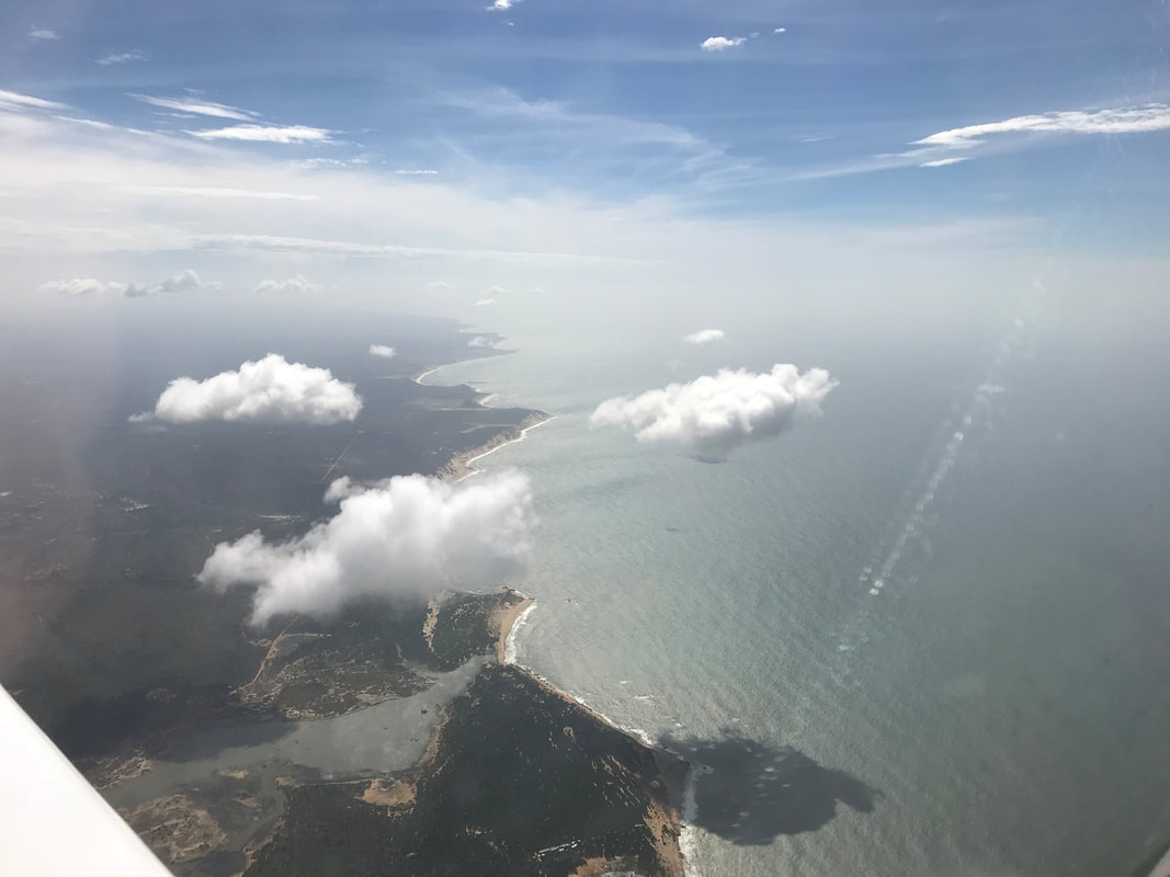 Once leaving Mattala, Sri Lanka, I climb to 9000 ft and set the autopilot on a easterly heading. The monsoon weather is finally behind me as "May" cruises over the Bay of Bengal at 150 knots.  11,000 ft over the rugged, black spine of the Bukit Barisan mountain range. Island of Sumatra, Indonesia ATC initially provided me with a cruise altitude which would put me with a collision course with the mountain range. I requested and was given a higher altitude for terrain clearance. I flew north of the Toba super volcano which produced the largest known volcanic eruption on earth during the past 2 million years. On the next flight (Kuala Lumpur to Bali), I flew past the remnants of the Krakatoa caldera. After crossing the Malacca strait, I joined heavy jet traffic in the clouds while on approach to Sultan Abdul Aziz Shah Airport in Malaysia. It felt incredibly satisfying as a low-time IFR pilot, to keep ahead of the aircraft and land safely at a busy international airport. My 75 knot approach speed to the runway became problematic for the much faster jets, which were quickly closing the gap to my aircraft. 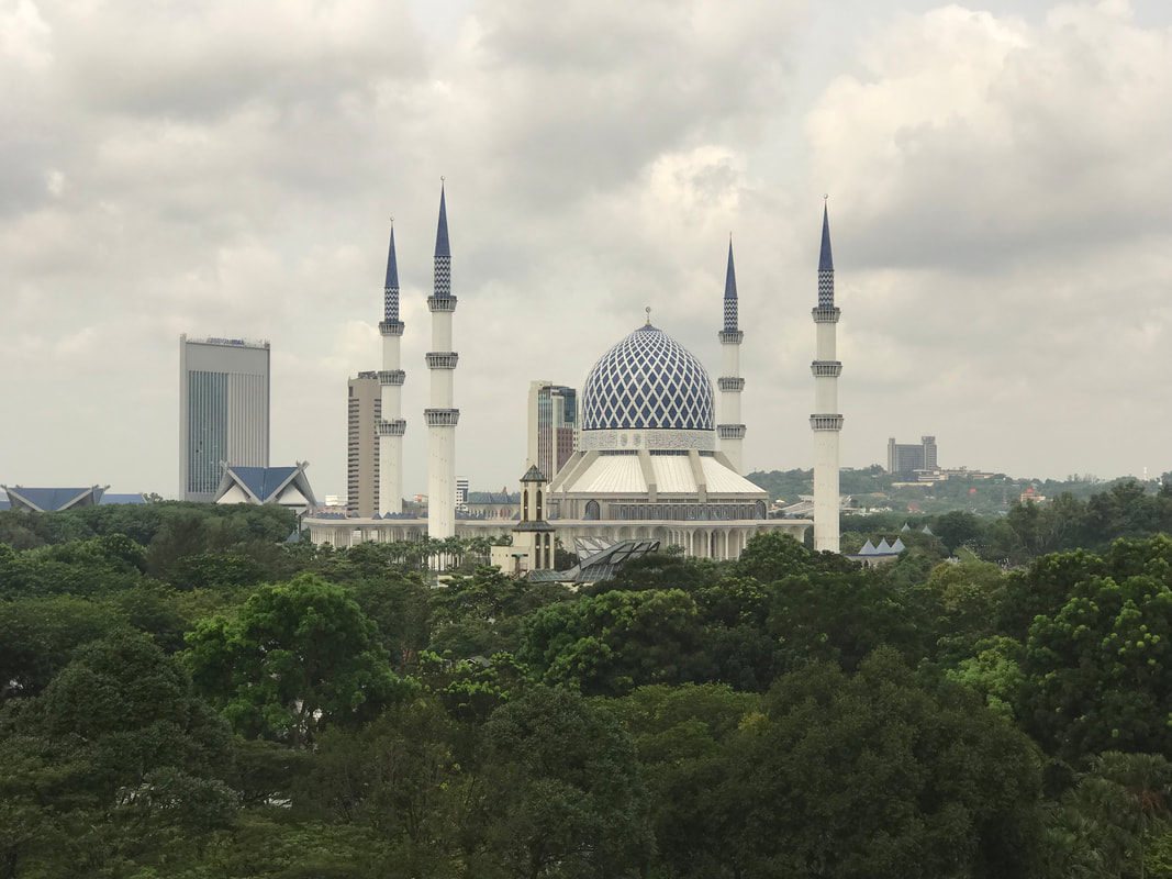 Sultan Salahuddin Abdul Aziz Mosque This impressive mosque can handle 24,000 worshipers under one roof. 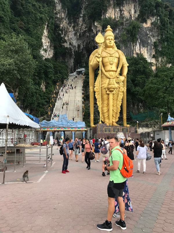 The 140 ft (43m) golden Lord Murugan statue guards the entrance to the Badu caves. The stairs leading up to the cave are quite steep and treacherous. 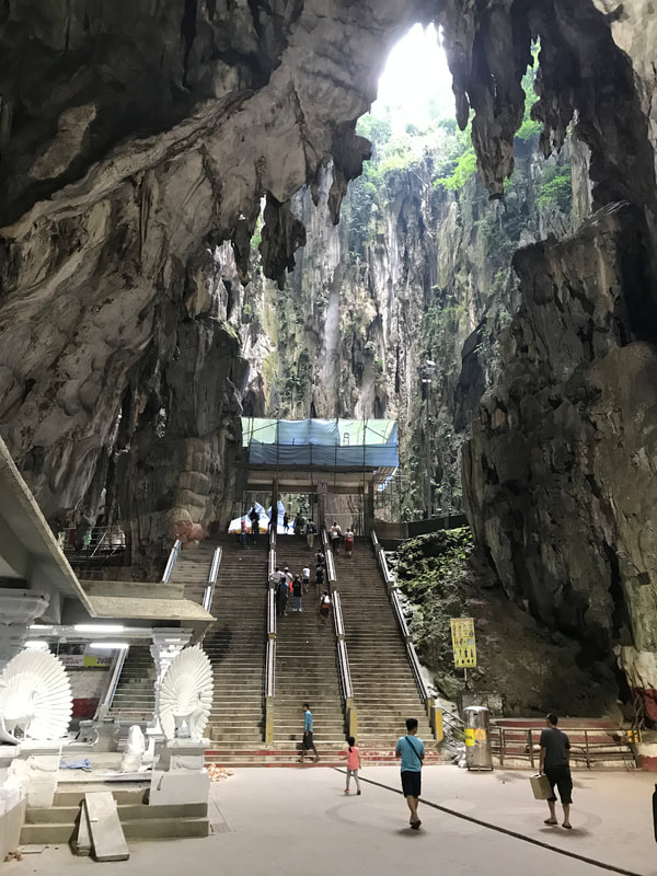 The capacious interior of the Badu caves.
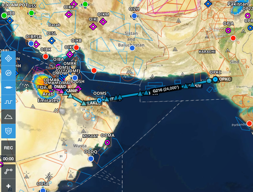
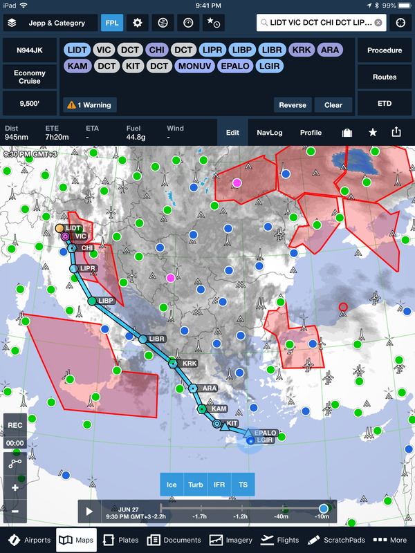
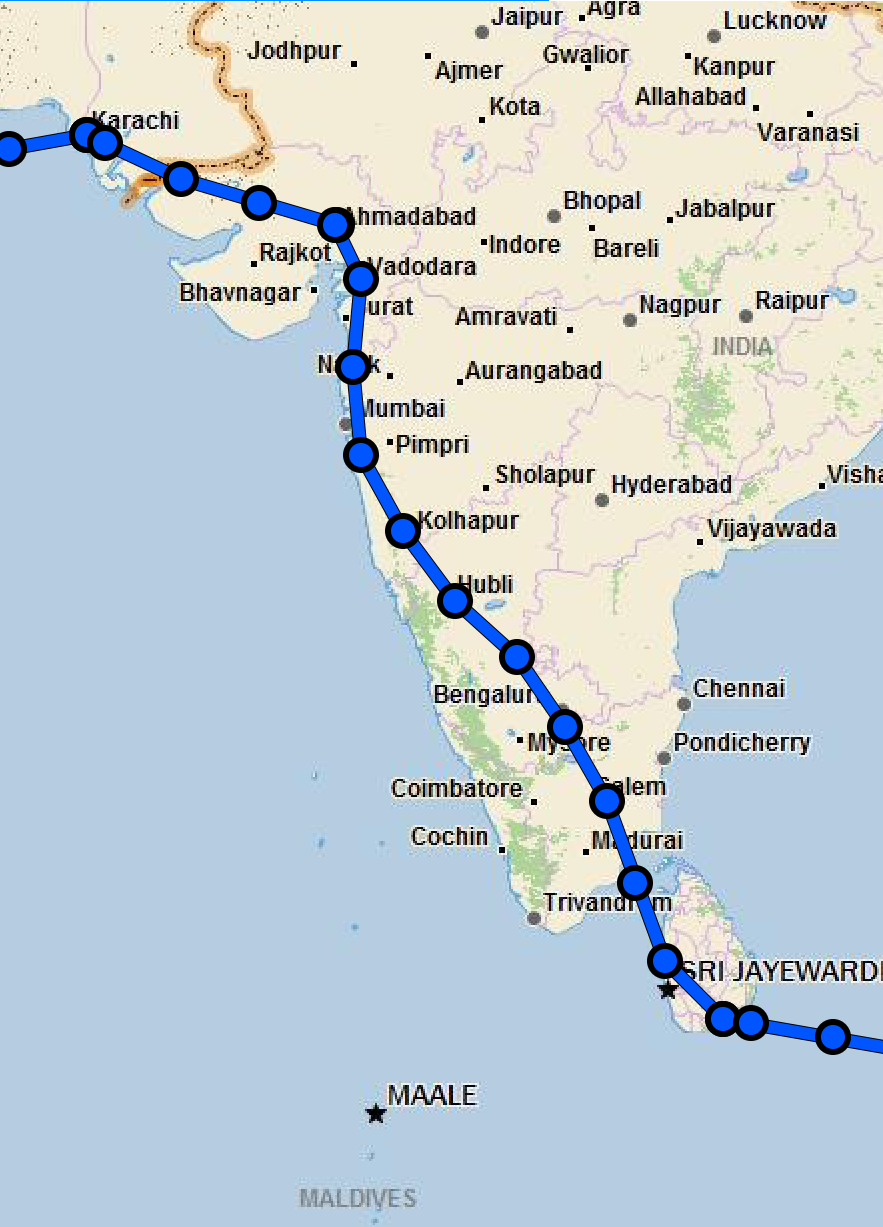 Expedition Day 39 My route over India as recorded by Garmin Inreach. Report: Ahmedabad, India I woke up in my hotel room in Ahmedabad contemplating - the aircraft that I had built in my garage had transported me halfway around the world to exotic India. Incredible. Thank you Van's aircraft for helping me to fulfill my dream. The day before departure from India, Dr. Pravin Dave visited my hotel room and provided me with a "fit to fly" document required by customs prior to departure. This was the first time in my life that a doctor paid me a visit at a location convenient to me for a health checkup. I was very grateful for the excellent medical care I received while in India. Upon reaching the airport, my transit through customs and immigration took only 45 minutes before my handlers dropped me off at the plane for pre-flight inspection. I was quickly given a clearance and taxied to the run-up area past Airbus and Boeing giants. Again, "May" was the smallest aircraft on the entire airport. Taking off under instruments from Ahmedabad international, I climbed up through the clouds and proceeded south to a way-point directly over Mumbai, a city of nearly 19 million people. My passage over India would take approximately 9 hours flying through monsoon weather. Indian air traffic control provided no weather avoidance services nor was ADS-B (weather or traffic) available. I pressed on, following the assigned IFR route with slight deviations away from the "darker" parts of the sky. Once underway, I had no advanced warning of embedded thunderstorms along my route within the clouds. While crossing over the expansive Indian subcontinent, it was hard to imagine that the land below supported 1 billion people. Towards the mountainous southern part of India, large areas appeared to be undeveloped. As I crossed over the southern tip of India, I noted that I had plenty of fuel remaining. I increase my speed to 150 knots over the strait between India and Sri Lanka. It felt satisfying to fly fast again after sluggish performance earlier in the flight to preserve fuel and minimize stress on the heavily loaded aircraft. Colombo ATC directed me to climb to 11,000 as twilight descended over this beautiful Island. The approach in to Mattela (VCRI) required flying past a 9,000 ft mountain, followed by an instrument descent to a DME ARC and ILS intercept in the darkness. To avoid spatial disorientation, I did not dare to look out the window until the final crossing fix, with the approach lighting guiding me to the long runway. Once again, like at Aqaba, Jordan (OJAQ), they opened an entire international airport for my sole aircraft. It started to rain lightly as I was directed to my parking space. The airport staff was out in force, with 20 handlers and a ground transportation bus that could have held 75 passengers. There were even a few very beautiful women from Sri Lankan airways waiting to greet me as I entered the airport arrivals lobby at this late hour. Inside the spacious arrival area, a giant Buddha instilled peace and I relaxed immediately. Furthermore, customs took 5 minutes to process my paperwork, a remarkable and welcome difference than that of India. During the late night 30 minute taxi ride to the resort, I spotted a few wild elephants walking slowly along the side of the nearly empty road. The resort was situated on the south-eastern side of the Sri Lanka, with rough sea conditions, not suitable for swimming during my stay. There were only two guests staying at the beach resort - the benefits of low season travel. I rested one day at the nearly empty resort before tackling a shortcut across the Bay of Bengal to Subang Jaya, Malaysia. I was fortunate my flight over the bay was largely VFR, as this passage is notorious for especially severe Monsoon conditions. 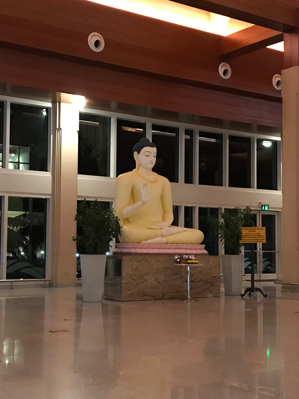 Main lobby of the Mattala International Airport. It has been called "the world's emptiest international airport" due to its low number of flights despite the large size of the airport. 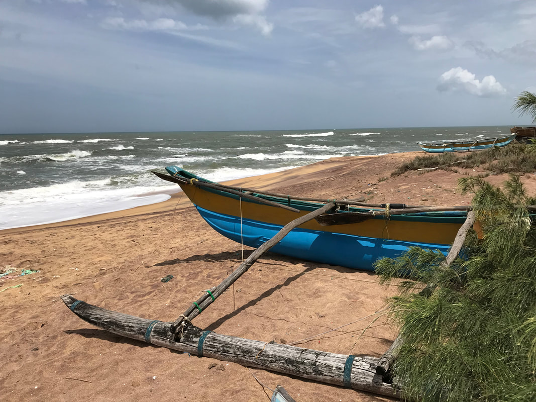 2004 Tsunami
This beach on the south-eastern coast of Sri Lanka was struck by a wall of water 10 m (30 ft) high during the 2004 Indian Ocean tsunami. The 500 mph tsunami traveled 850 nautical miles across the Bay of Bengal in 1h 45m. My hotel room was about 300 m from the beach. Expedition Day 35 I woke up at 3:30 am, packed quickly and called for a taxi to the airport. After three days at my fortress like hotel, I was ready to continue flying southeast towards my next stop, Mattala, Sri Lanka. My handler met me at the airport entrance and rushed me through customs and security, which was surprisingly easy since I was designated as the "Captain/Aircraft crew”. I purchased drinks and snacks before leaving the departure area of the airport and was shuttled to the plane in the pre-dawn light. I flicked on my headlamp for an inspection of the aircraft and discovered the entire plane was covered with a light brown layer of dust/oil. Since I had only a few clean microfiber cloths left, I decided to clean only the windshield and proceeded with the inspection. Later this residue would be washed clean by the rains over India. Soon the fueling crew arrived with two barrels of Avgas strapped to the back of a trailer. Halfway through fueling the plane from 200 liter barrels, their noisy and dilapidated manual fuel transfer pump broke down. I waited for another 45 minutes while they disassembled and repaired what appeared to be their only AVGAS pump while my departure time slipped. Once again, I was sandwiched between jumbo jets weighing upwards of 500,000 pounds during taxi to the active runway. I could have easily taxied “May” under the 777 aircraft but kept my distance. I was wary of the powerful General Electric GE90’s, which could have flipped my plane if they gunned the engines. The smell of jet exhaust started to fill the cockpit. The take-off from Karachi was sluggish since the aircraft was over gross with fuel for the 10 hour flight to Sri Lanka. Squawk 7700 Two hours after crossing the Pakistan/India border, I started to feel very ill from food eaten the previous night at the hotel in Karachi. I was flying solo at 9000 ft in the monsoon rain clouds and recognized that I could not continue flying for another 8 hours in this condition. With much deliberation and considering all options, I declared a "Mayday" over the VHF radio. I explained my situation and requested a vector to Ahmedabad airport, which has both a published precision approach and AVGAS. The radio traffic immediately fell silent after I declared a mayday. Without hesitation, Indian ATC provided me with priority routing to Ahmedabad airport. Inside the monsoon, intense bands of rain pummeled the canopy and over powered the sound of the engine. Turbulence bounced me around while I was throwing up in to a sick sack and cross checking my instruments. This was the most difficult approach I have ever flown and showcases the risk of single-pilot instrument flying. Upon landing at Ahmedabad, I was directed to park in front of the main terminal of the airport, in full view of hundreds of observers. Crash fire tenders, an ambulance, soldiers and airport police, a doctor, handlers, and numerous ground crew surrounded my aircraft. After answering a few questions from airport operations and a quick consultation with the doctor, I was asked to re-position the aircraft to the general aviation area of the airport. I felt embarrassed, but at least I was alive and safe on the ground.  The general aviation parking at Ahmedabad airport. The ground staff patiently waited two hours for me to secure the aircraft. I was extremely weak and further affected by the midday heat and humidity. This was the low point of my trip. After aircraft tie-down, I spent 4 hours waiting to clear customs, probably due to my unorthodox arrival. My customs paperwork contained at least twenty forms, all needing to be signed and stamped with multiple copies distributed to various departments. The Indians love their paperwork and their bureaucracy is formidable. I spent the next 4 days recovering in my hotel room, but managed to take a few walks near the hotel. Strong odors, noise from honking tuk tuks, the crush of humanity, and ever rising levels of humidity as the monsoon intensifies - visiting urban India can be overwhelming. I was lucky up to this point with my health. Whether it was the air, the exotic food, or just the anxiety of being in such an unusual place, I would not feel entirely well for another 3 weeks until passing through Australia. Dare to cross a road in India? I hope that you have a life insurance policy. 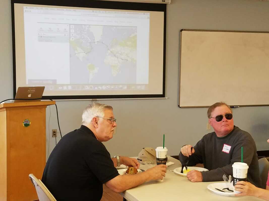 Local pilots from the Concord, CA EAA branch (chapter 393) tracking my flight progress over breakfast. Ed Neffinger and Maurice Gunderson provided updates to the group.
 From Abu Dhabi, I was cleared to climb up to 13,000 ft over the mountains of Oman. The air quality remained very poor due to dust until I was hundreds of miles out over the Indian Ocean. To the north of my flight path lay Iran and Afghanistan, two countries that would not welcome a visiting pilot from the United States.
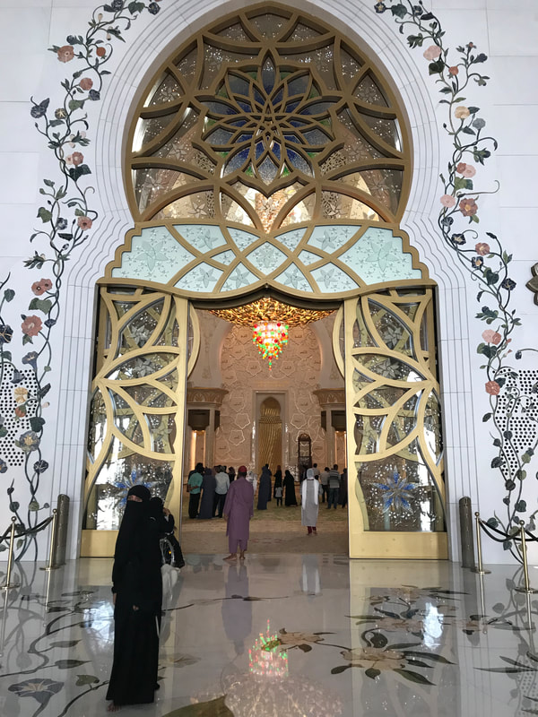
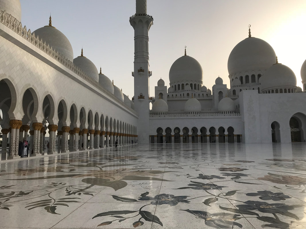
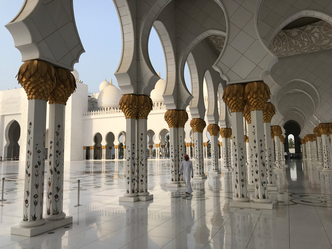
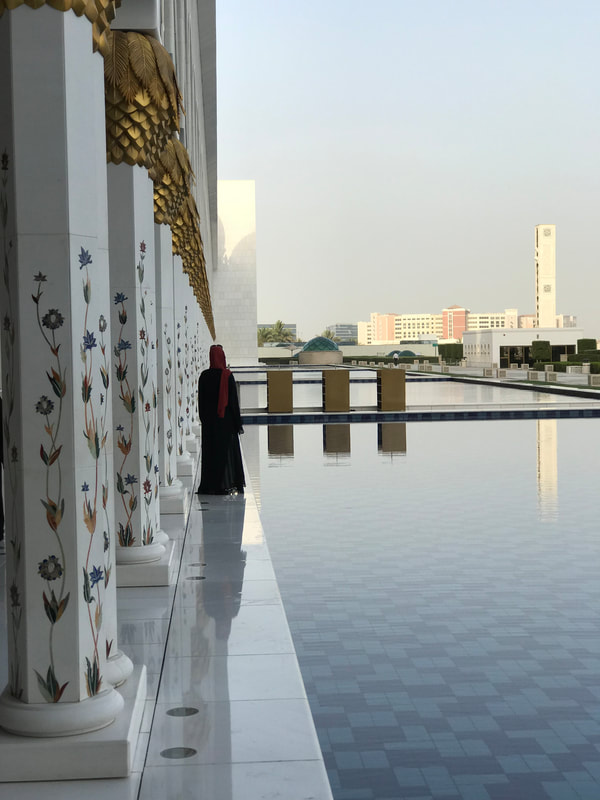
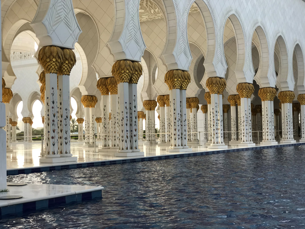
Two hundred miles from Karachi, Pakistan, I reviewed all the approach plates and confirmed what procedures to expect with air traffic control. Every instrument approach is different and requires vigilance and attention to detail. By now, the desert crossings were just a memory, as the dry climate had turned to sweltering monsoon. I descended through the clouds to minimums and landed at Karachi international airport. Two minutes after landing, a Boeing 777 landed in my wake. I was warned by Eddie Gould from GASE to expect a large crowd forming around the plane upon engine shutdown. Nevertheless, it was a bit overwhelming trying to keep track of twenty people touching the plane and all asking questions at the same time. Once I passed through customs, I was whisked to the heavily guarded and fortress-like hotel. I would have liked to explore Karachi, but was advised by many people to remain in the compound. 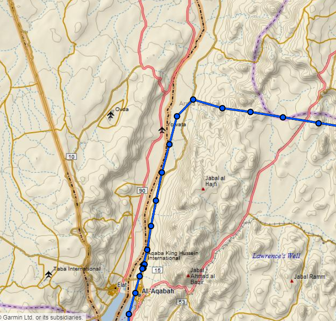 Expedition Day 31 Skirting the Isreal/Jordan border before heading 900nm over the Saudi desert. Arabian Nights, Across the Empty Quarter, Seven Pillars of Wisdom: Literature that inspired me to travel over the Arabian desert. 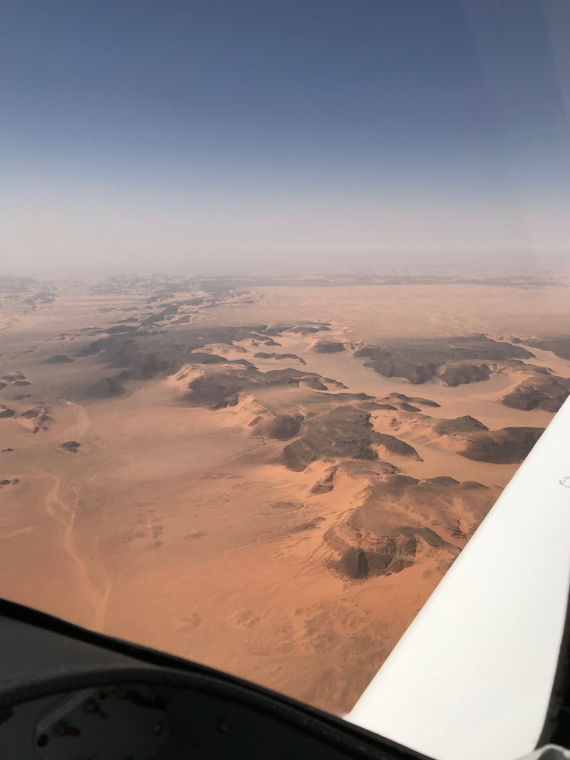 The empty wastes of the Saudi Arabian desert. "Far below me, a yellow haze hid the desert to the east. Yet it was there that my fancies ranged, planning new journeys, while I wondered at this strange compulsion which drove me back to a life that was barely possible....I knew instinctively that it was the very hardness of life in the desert which drew me back there - it was the same pull which takes men back to the polar ice, to high mountains, and to the sea. To return to the Empty Quarter would be to answer a challenge, and to remain there for long would be to test myself to the limit....It was one of the very few places where I could satisfy an urge to go where others had not been....in those empty wastes I could find the peace that comes with solitude, and, among the Bedu, comradeship in a hostile world." - Across the Empty Quarter, Wilfred Thesiger 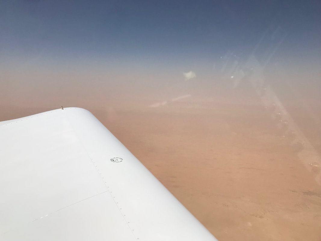 A haboob (sand storm) was still raging over the central and eastern Saudi Arabian desert 24 hours prior to my departure from Jordan. I arrived early at the empty King Hussein International airport to prepare for my flight to Bahrain. N944JK, with it's crew of one, appeared to be the only departure this morning. After clearing customs and paying airport fees, I was given a brief tour of the local GA flying club, which offers balloon and glider rides to tourists above Wadi Rum and Petra. I then blew away sand from the fuel caps before fueling the plane. During pre-flight inspection, I discovered my canopy cover had scoured a small patch of the windscreen from the abrasive, blowing sand. Aqaba control permitted me to climb to 9500 ft within 1 mile of the Israel border. I flew past the Valley of the Moon before turning east over the tangerine colored dunes and weather-beaten dark mountains of the western desert. For the last three hours of flight, conditions worsened to 1 mile visibility. I felt suspended in a copper colored haze, never seeing the ground or sky above. Only my GPS indicated forward movement. I worried about the amount of dust (and sand) being ingested in to the engine and micro-scouring of the windscreen. After many hours flying in IFR conditions, I landed at Bahrain Intl, on an small island in the Persian gulf. 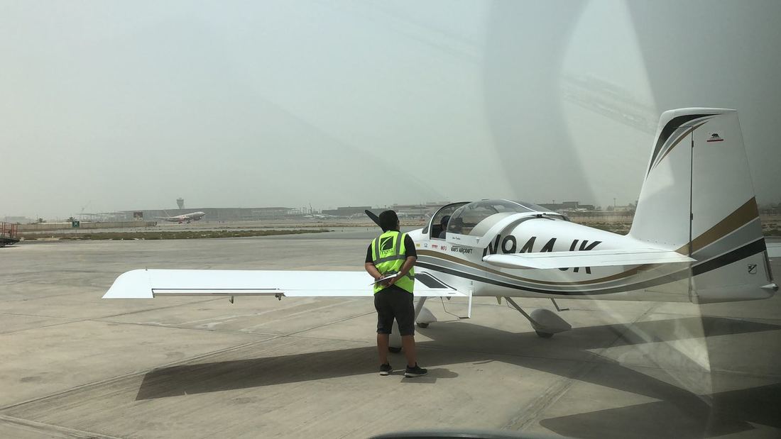 Manama, Bahrain. The outside air temperature was 118F, or 48C and rising. Waiting for my departure clearance. How much longer ops? The engine is overheating and so am I. Either we stand down or blow up. Which do you want? Dialog from the movie "The Battle of Britain" and very appropriate here. The Bahrain tower granted me permission to depart. Finally! I was soaked in perspiration and ready to fly. The engine oil temperature was uncomfortably high. Departure control directed me to climb and fly over the Persian Gulf in the direction of Iran, before turning N944JK south-east toward the United Arab Emirates. The immediate concern was to stay on course and not encroach on the heavily defended Iranian airspace. The flying conditions were atrocious; smog and poor visibility from the previous sand storms were lingering over the Gulf. At least it was slightly cooler at cruise altitude. 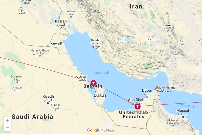 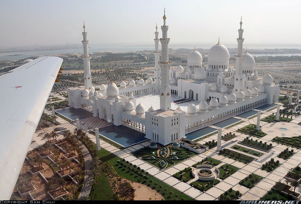 Sheikh Zayed Grand Mosque. Photo Credit: Sam Chui Eddie from G.A.S.E., recommended that I land at AL Bateen Airport Abu Dhabi regional executive instead of Dubai International. The executive airport is located centrally, and has much less air traffic than the main international airport. On final approach to the main runway, you fly past the blindingly white, marble Sheikh Zayed Grand Mosque, which is visually stunning to the point of distraction. Ground control directed me to a parking space, between late model, top of the line jet aircraft. I felt out of place with my tiny, scrappy kit plane. I was told to remain with the aircraft. I kept sipping water and huddled in my plane's shadow as temperatures approached 122 F. My handler eventually showed up after 20 minutes and we relocated the plane in to an air conditioned hanger owned by a local sheikh. I was really worried that the canopy would melt if the plane was left outside. Only two weeks prior, I was nearly frozen while flying over the Greenland ice cap in -15C temperatures. Now, I worried that my plane's plexiglass canopy would melt and I would get heat stroke. Before the trip, Eddie (G.A.S.E) warned me about one of his client's RTW failing in the middle east due to crashing avionics and a melted canopy. Flying through the middle east in peak summer temperatures can be risky to both pilot and aircraft. My iPad, running flight planning and navigation application, Foreflight, crashed several times in middle east due to the unbearable heat. My iPhone, a backup to the iPad, kept displaying IFR charts without any issues. The panel avionics with cooling fans worked flawlessly, as expected, throughout the entire trip with the OAT -15c to +49c. 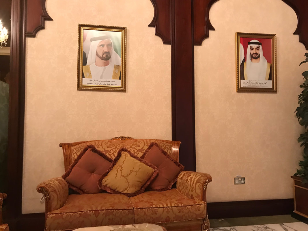 The customs waiting room at the Al Bateen executive airport in Abu Dhabi, UAE. 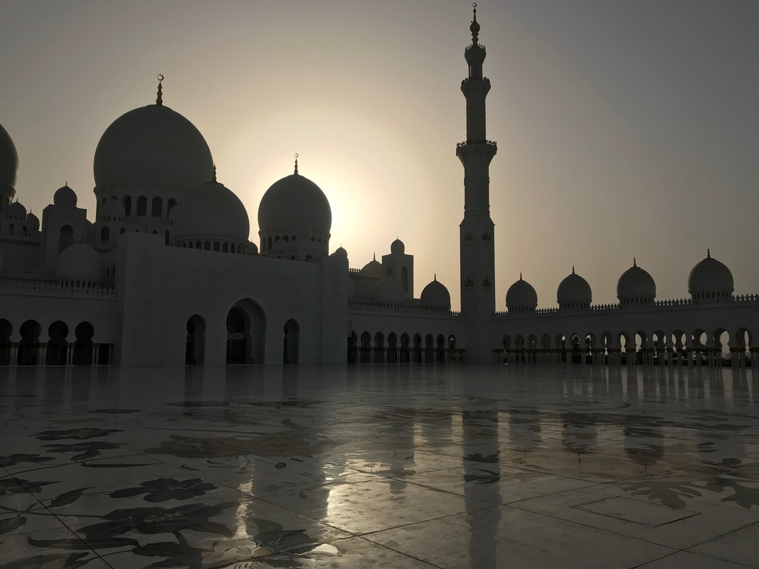 The magnificent Grand Mosque, Abu Dhabi, UAE. I flew past this architectural marvel on approach to the airport. I was loaned a Kandura, a traditional Emirati ankle-length, loose-fitting white robe, before allowed entry into the Mosque. 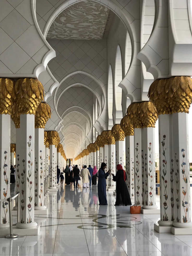 The columns are covered with gold leaf and inlaid with semi-precious stones and mother of pearl. 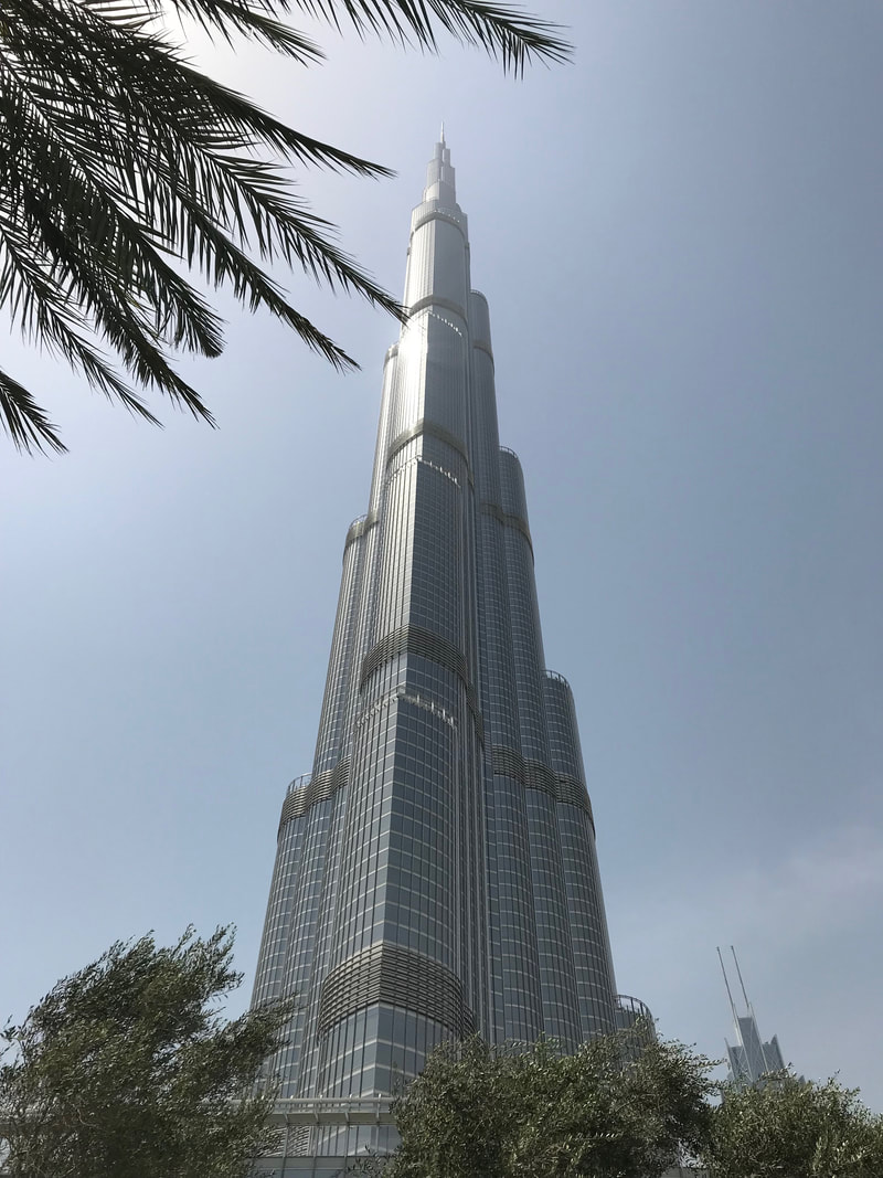 Burj Khalifa in Dubai, UAE is the world's tallest building (828m or 2717 ft). 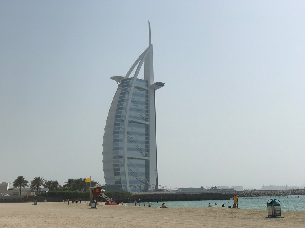 Sail shaped Burj Al Arab Jumeirah - The world's most opulent hotel with a helipad on top.
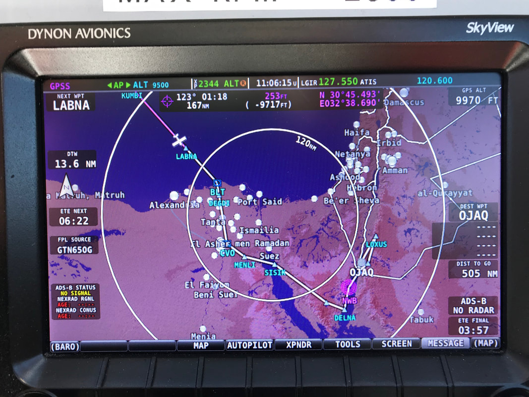 Expedition Day 28 The route across Egypt, Suez canal, Sinai peninsula, and Jordan. 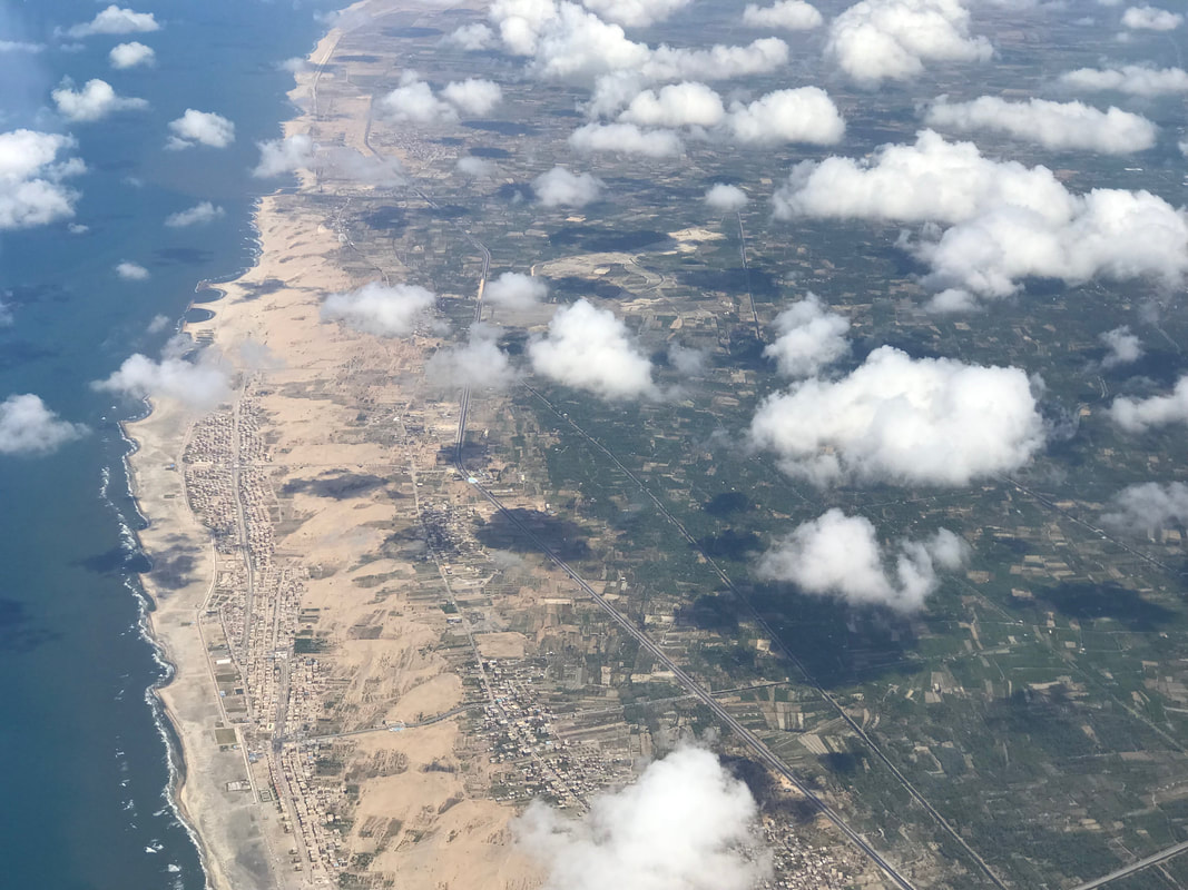 Crossing over the Egyptian coast near Alexandria. 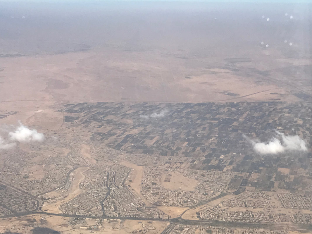 Nearing Cairo, Egypt, air traffic control vectored me to about 25 miles east of the Great pyramids. From there I crossed the Suez Canal and climbed to 13,000 ft for terrain clearance over the Sinai peninsula. The late afternoon turbulence over the mountains of the peninsula made for a very uncomfortable ride. 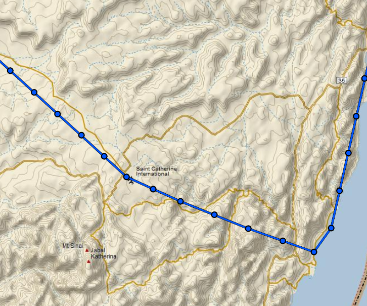 I was very excited to visit the middle east for the first time. I flew past biblical Mount Sinai, crossed over the Red Sea/Gulf of Aqaba, and landed at Aqaba International airport in Jordan. The entire international airport was opened for my sole arrival with hundreds of support staff. I felt overwhelmed with such a turnout. The next day I hired a driver, viewed Wadi Rum from a distance along the King's Highway, and explored Petra. 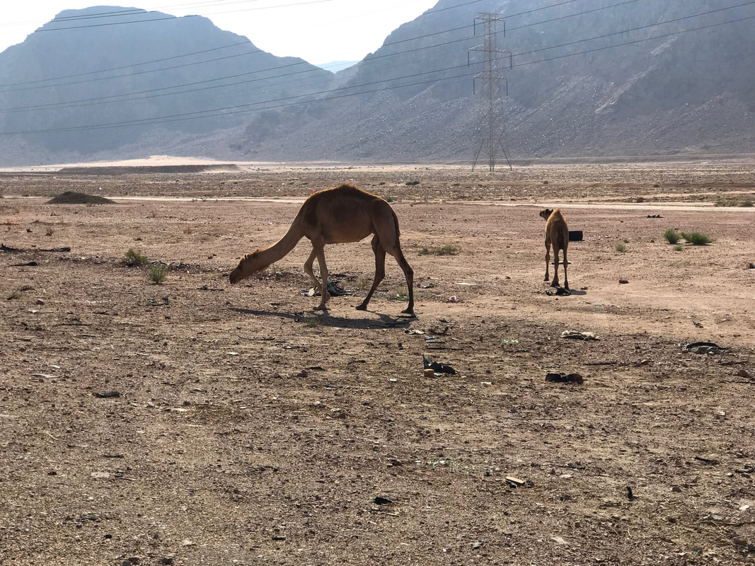 Wild camels grazing along the King's Highway. 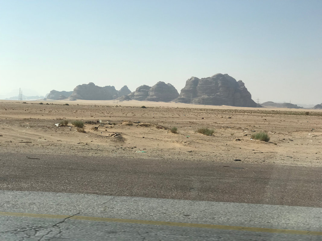 Wadi Rum shimmering in the desert heat. 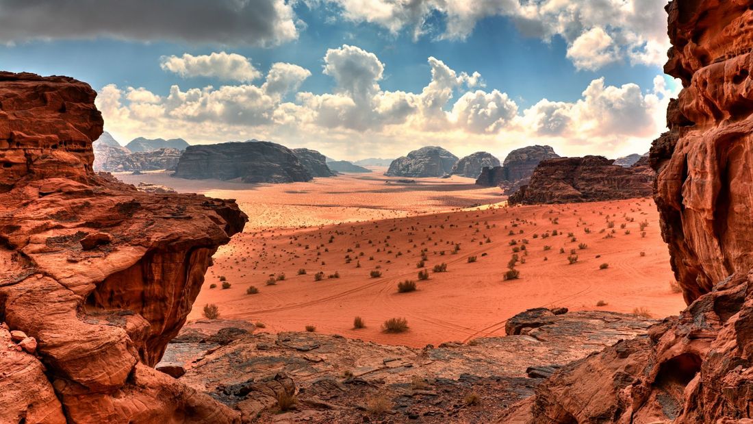 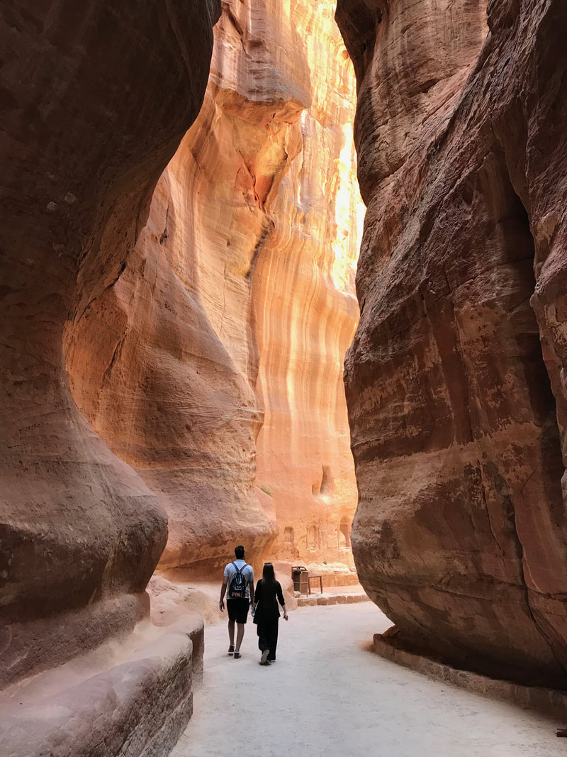 The ancient city of Petra in Jordan, one of the 7 New Wonders of the World. The water channels show above were carved by the Nabataean people around 300 B.C. to collect every drop of moisture running off the canyon walls. 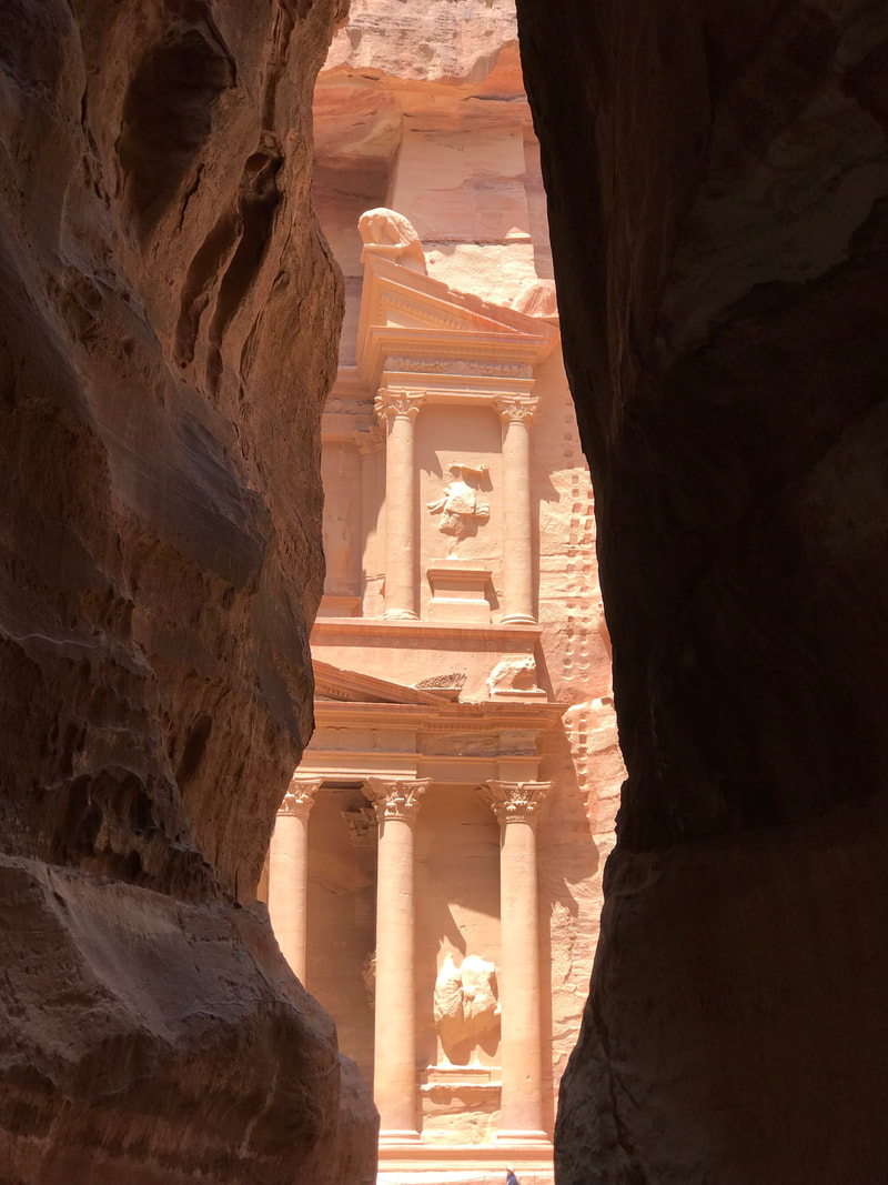 My first glimpse of the mythical "Treasury" of Petra. I hiked for hours exploring the gorge, ruins, and the upper reaches of the site. One day was not sufficient to see everything. Tomorrow, I cross the entire Saudi desert from the Red Sea to the Gulf. 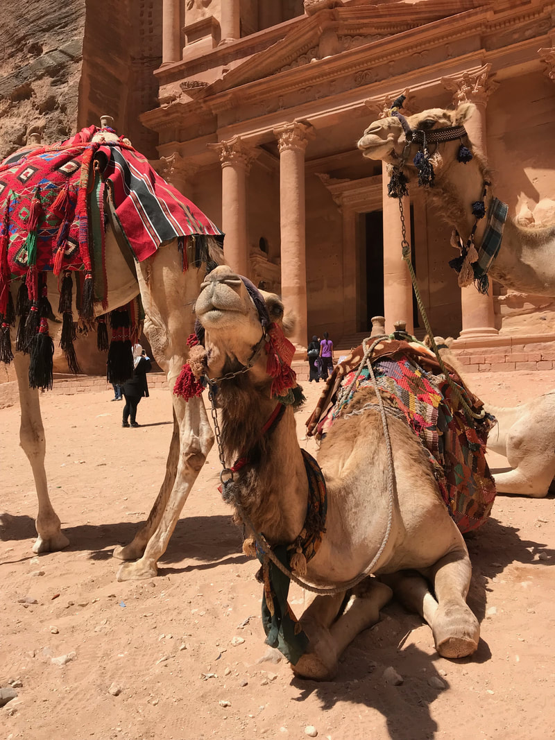 No Indiana Jones inside the Treasury, but met some friendly camels outside. 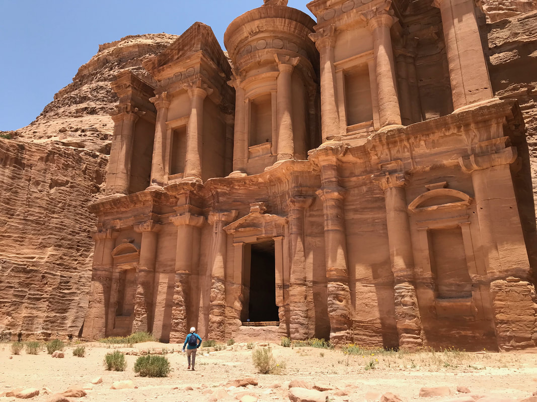 El Dier ("The Monastery"). 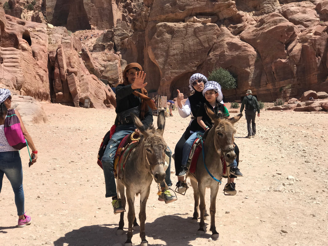 The guy was furious that I took the picture without permission, the woman not so much. 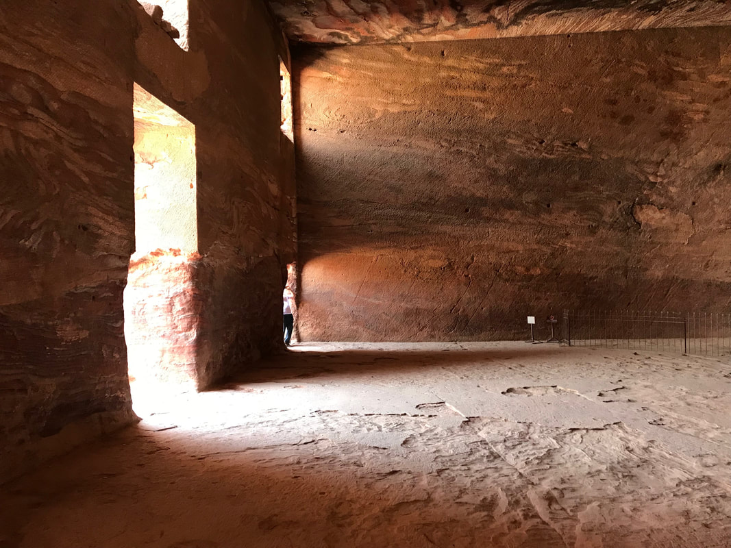 The interior of one of the Royal tombs carved out of Precambrian igneous rock and sandstone. The properties of the rock itself may have persuaded the Nabataeans to site their city here, as it was evidently suitable for rock carving and excavating.
  Expedition Day 27 The weather quickly deteriorated over the boot of Italy as I progressed further south towards Greece. I fought for improved vectors multiple times as ATC kept directing me in to cumulonimbus weather. Position reports were required every 10 minutes as there was no radar coverage off-shore. The dark waters of the Ionian sea are hidden from view as pass off the east coast of Italy. 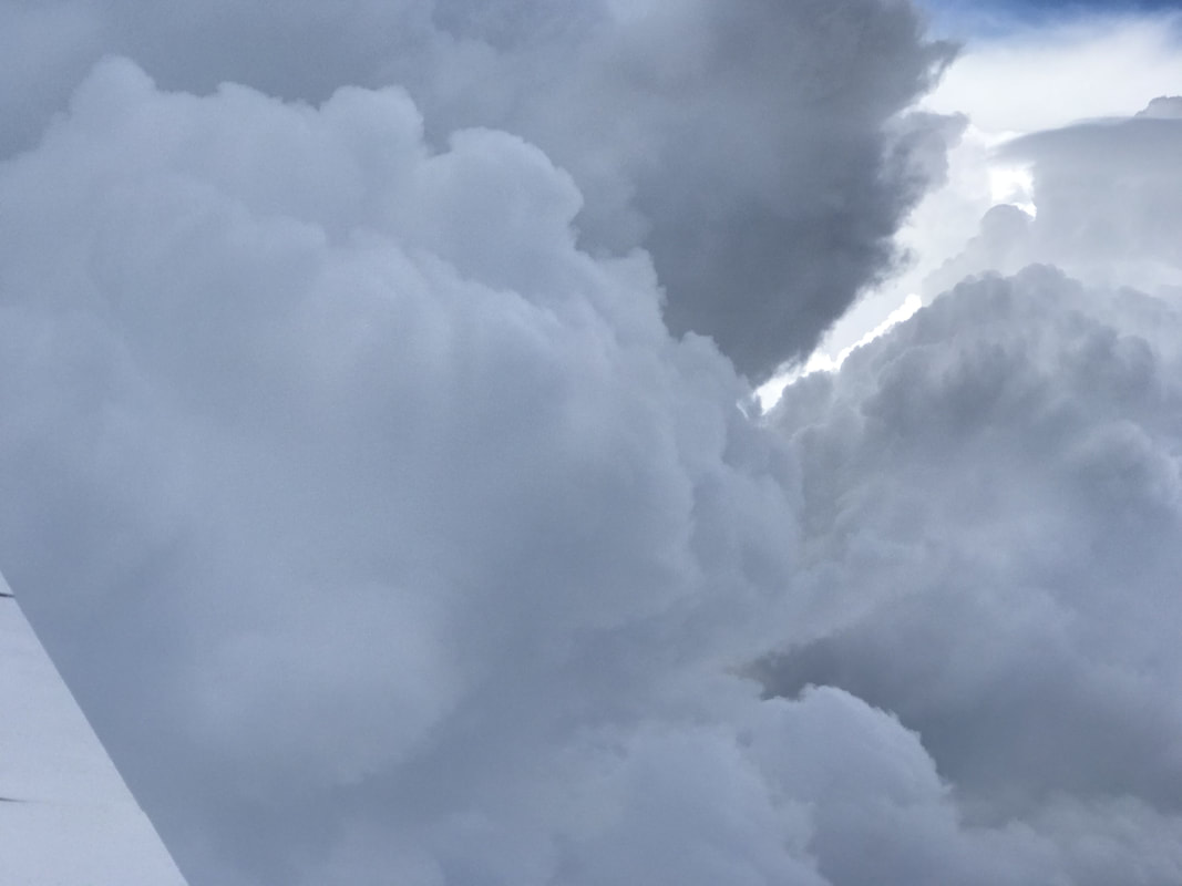 Not so much cloud dancing, but a mauling through cumulonimbus off the east coast of Italy. The RV-9A is very light and gets tossed around within the clouds. My standard operating procedure was to slow down to maneuvering speed to minimize stress on the airframe and pilot. I kept an eye on the g-meter to not exceed limits set by the RV-9A designer/engineer before the trip. 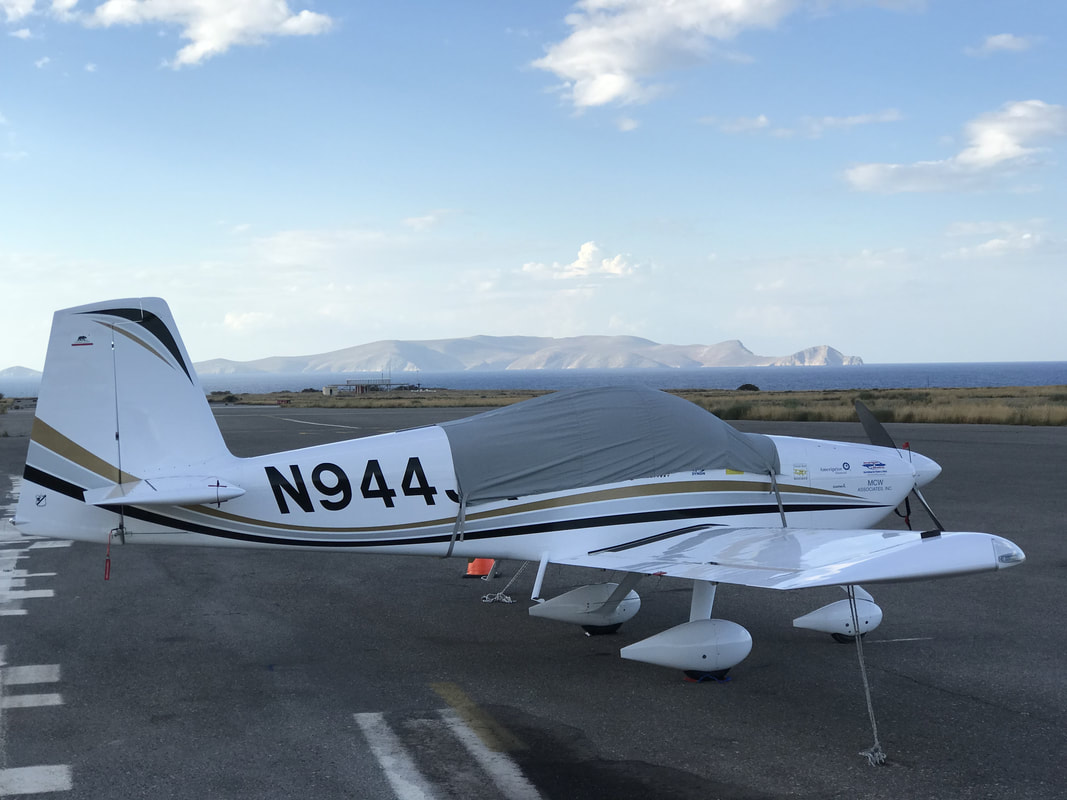 Greek ATC placed me in to a 8 turn hold over the uninhabited island of Dia (Ntia).
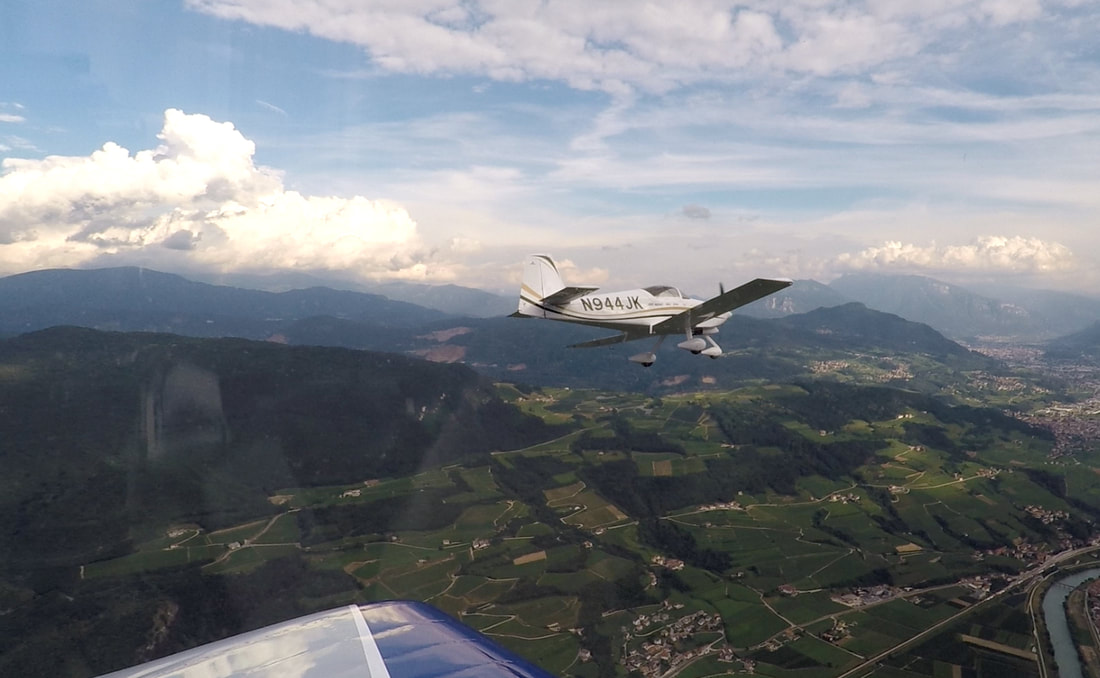
On approach to Iraklion, air traffic control placed me in to a 8 turn hold at 1500 feet off the coast of Crete. After circling for 15 minutes over the island of Dia, I declared "running low on fuel", which was promptly ignored by ATC. Eventually, they vectored me to the ILS approach. My 75 knot stabilized approach speed was too slow for the following jet traffic. Heraklion tower badgered me to make all possible speed on final and landing. The airport needs an expansion, and is well known for long hold times for both arriving and departing traffic. I have never seen ground staff hustle so quickly to keep the flow of people and aircraft moving. After clearing customs, I was whisked to my hotel and greatly enjoyed an early dinner of Antikristo and rice, along with a local craft beer. I went for a walk, then prepared for the what would be the most interesting flight of the trip: fly 400nm over the eastern Mediterranean, the great pyramids, Suez canal, Mt. Sinai, and cross the Red Sea to Jordan. All in one day. 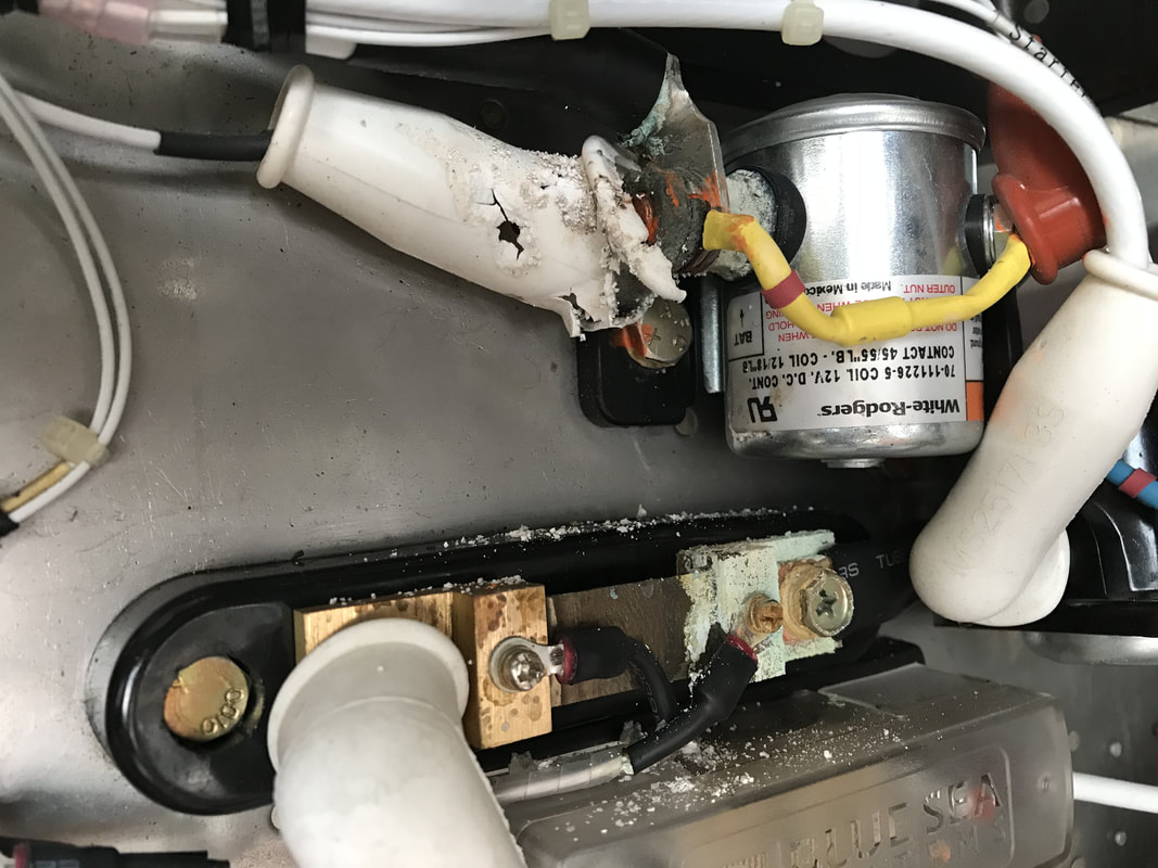 Corrosion damage from a leaking 12v main battery. Italians to my rescue. During the first oil change and maintenance inspection of the trip in Italy, Luca Parazzolli (EAA, Chapter 1581) and I discovered corrosion damage to the high current electrical bus and associated components. This was quite unexpected, as the plane was in perfect electrical and mechanical condition before the start of my trip. The corrosion damage was caused by a leak of the primary 12V powersport battery mounted to the firewall and over the electrical components. The likely cause: 1) flight over the Arctic through extremely cold temperatures causing the battery case to crack. 2) a manufacturing error in the battery. The battery was brand new and installed just before the start of the trip. Luca networked with his fellow RV builders around northern Italy and obtained a new battery, main relay, starter relay, Silicone boot, and fabricated a new #2 battery cable, all within hours. We spent 15 hours repairing the electrical system to like-new condition and tested the engine and electrical system. Luca, you are my hero. Thank you for all of your help, resourcefulness, attention to detail, and great network of friends. 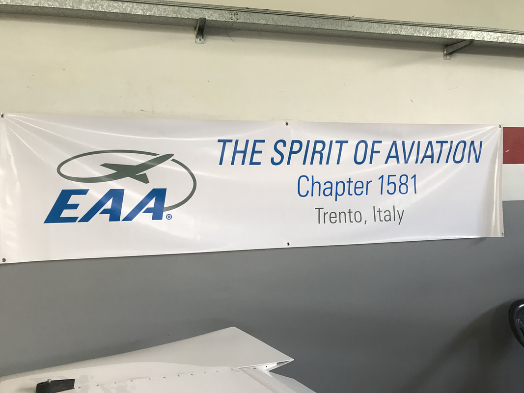 The Spirit of Aviation lives on in Trento One of the many EAA chapters around the world. Members enthusiastically help out a RTW pilot in need. 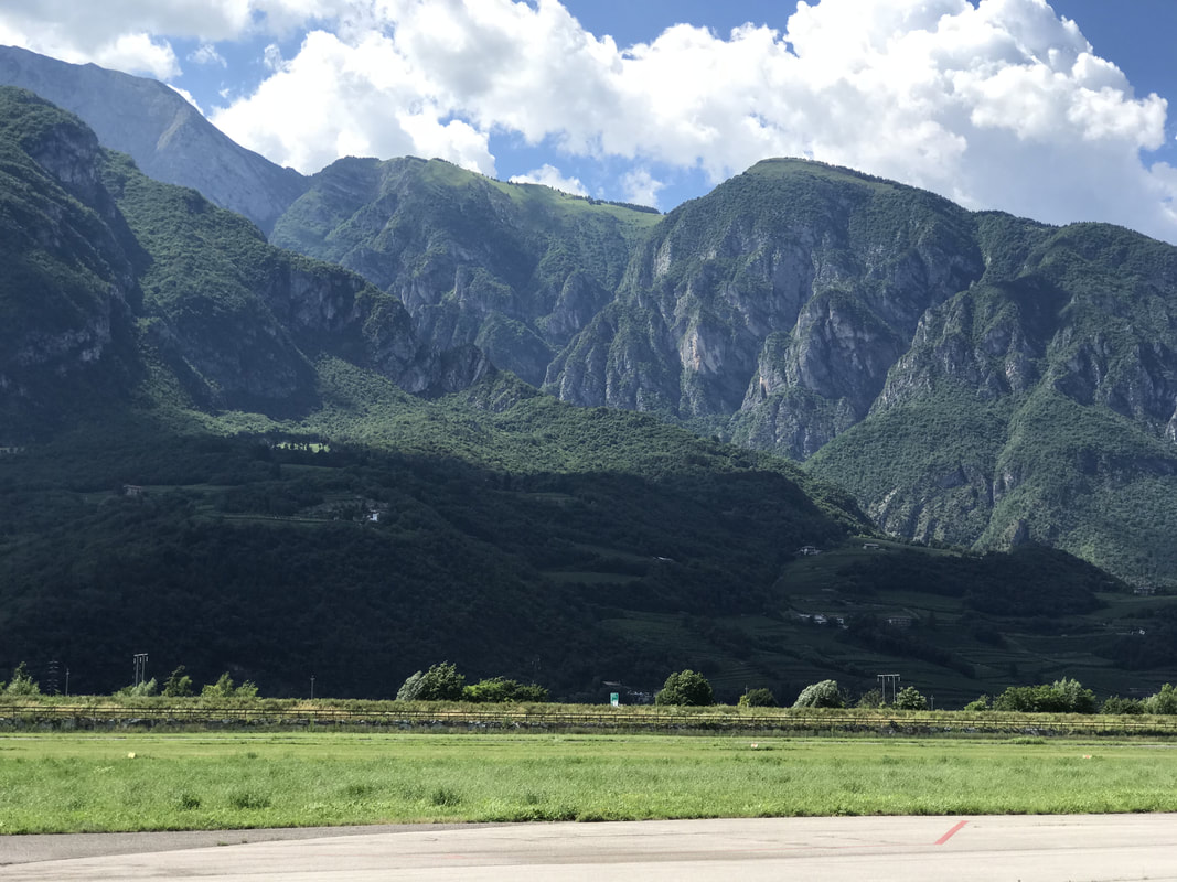 1 million Euro view from Luca Parazzolli's hanger in Trento, Italy 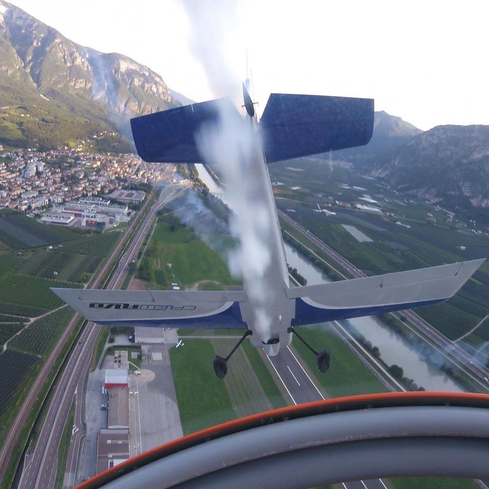 Smoke on! CREWRV8, Luca's aerobatic team practicing over Trento, Italy. 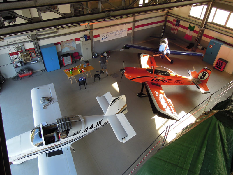 (2) RV8, (1) RV9A experimental aircraft. Luca's hanger/workshop where we performed the oil change and emergency repairs on my aircraft. Photo credit: Luca Perazzolli 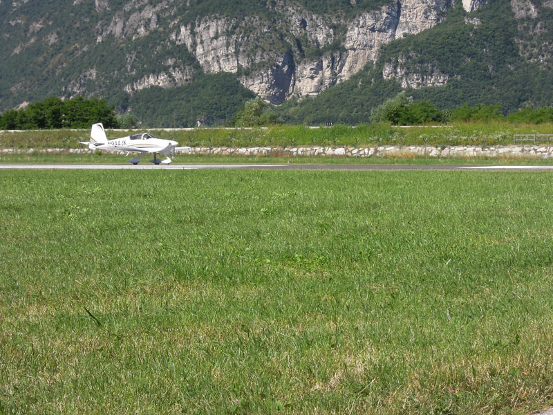 A quick run-up, then departure from Trento, Italy through a narrow mountainous valley toward the Adriatic sea.
Photo credit: Luca Perazzolli 
Expedition Day 24
This 735 nm leg would be the most complex I have ever flown. The flight would require transiting the air space of five countries with radio hand-offs to a dozen controllers. 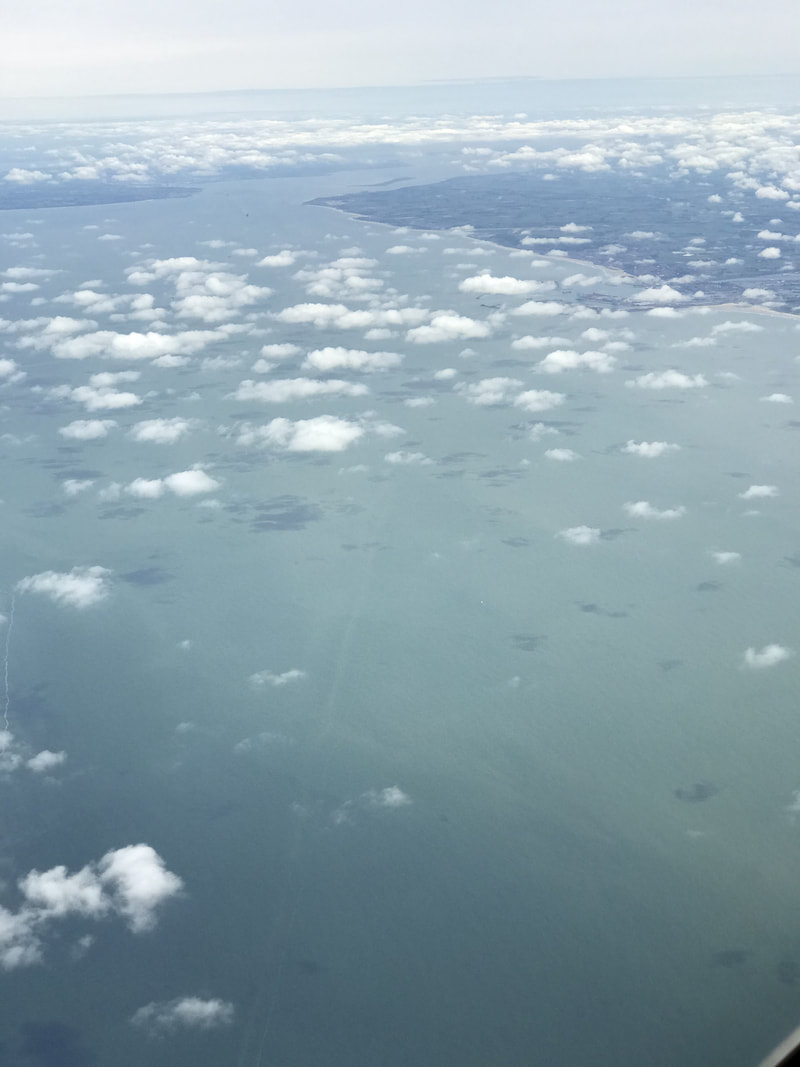
Flying over the English channel at 10,000 feet. The coast of Belgium is visible at the top of the photo.
While crossing the English channel from England to Belgium, my thoughts were on the 1944 "D-day" invasion. My flight was a milk run in comparison with the 12,000 aircraft that participated in the invasion on June 6, 1944. By that time, the Luftwaffe was a shadow it's former self. Allied aircraft still encountered fierce AA. Historical note on another, earlier flight across the English channel: 90 years ago, Louis Bleriot, a French engineer, was the first to fly an airplane across the English Channel, 21 miles from Calais in France to Dover, England. The London Daily Mail had put up a £1,000 prize for the first airplane flight across the Channel.
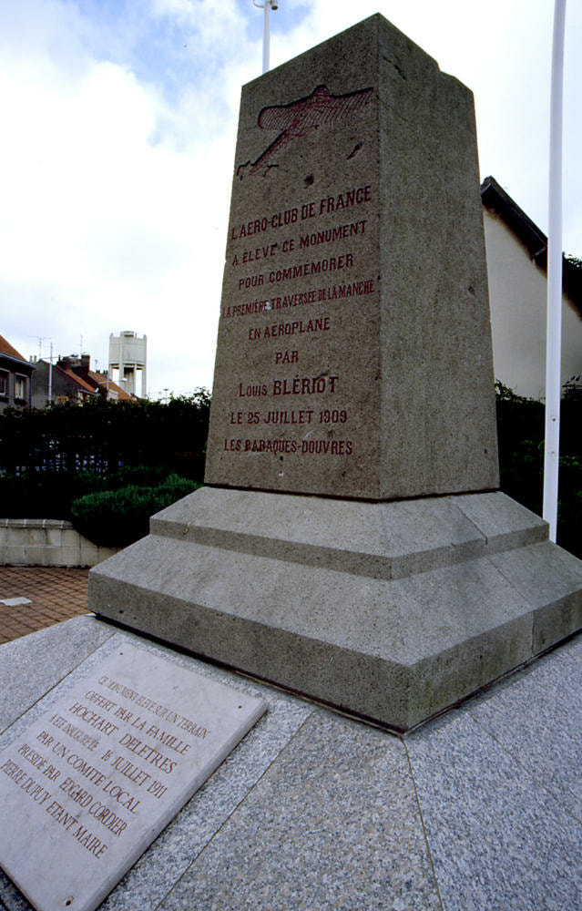
Just outside Calais in Bleriot Place, which means Bleriot Beach, there's a small stone monument in a residential neighborhood commemorating the events of July 25, 1909. Near this spot, Bleriot made a short test flight in the dark at 4:15 am.
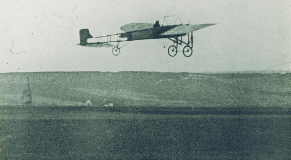
He was flying a tiny frail monoplane with a three cylinder Anzani motorcycle engine that had a tendency to explode if it overheated - or after about 30 minutes, whichever came first. The flight across the channel would take about 40 minutes. It was a calculated risk. Bleriot was not the only person trying to cross the channel in late July 1909. The Daily Mail, a London newspaper, had a put up a thousand pound prize to the first person who could do it. To be official, the flight had to happen in daylight, and at 4:41 when the sun was officially over the horizon, Bleriot took off. He had no instruments. The weather was blustery and misty. Visibility was not good. A French destroyer was positioned half way across the channel to help guide him, but legend as it - he got lost. Bleriot cut his engine and came to Earth pretty hard, breaking his propeller and landing gear, and proving again that any landing you can walk away from is a good one.The bad weather worked to his advantage, though. A rain shower cooled his engine. He had his way to the English coast, spotted someone waving a flag to signal the landing spot near Dover Castle. Bleriot cut his engine and came to Earth pretty hard, breaking his propeller and landing gear, and proving again that any landing you can walk away from is a good one. Today the open grassy field where Bleriot landed is overgrown with dense shrubs. But as you walk through the thicket, suddenly you find yourself in a wonderful clearing, and you can stand where history happened. The outline of his plane has been set down and memorialized in marble. Like many small airplanes that made history, you are surprised at how small it is. Bleriot won the prize money and became the next great aviator to become world famous in an instant, but those were the days when flying records were made and broken quickly. Another article describing his flight. CREDIT: DAN PATTERSON, WYSO.org, Smithsonian 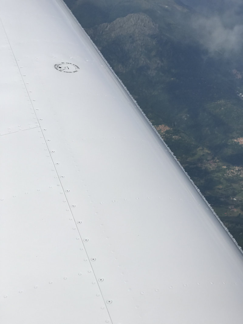
At 14,000 ft over Switzerland, the plane accumulated some light Ice fairly quickly on the wing and tail surfaces. I began my descent to warmer temperatures as soon as practical over Italian airspace.
|
Archives
September 2018
Categories |