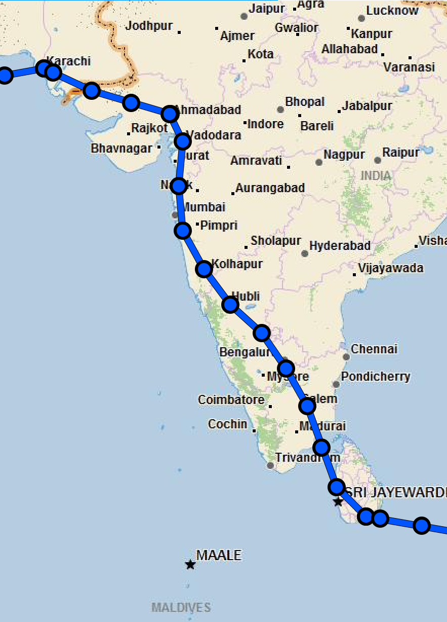
 Expedition Day 39 My route over India as recorded by Garmin Inreach. Report: Ahmedabad, India I woke up in my hotel room in Ahmedabad contemplating - the aircraft that I had built in my garage had transported me halfway around the world to exotic India. Incredible. Thank you Van's aircraft for helping me to fulfill my dream. The day before departure from India, Dr. Pravin Dave visited my hotel room and provided me with a "fit to fly" document required by customs prior to departure. This was the first time in my life that a doctor paid me a visit at a location convenient to me for a health checkup. I was very grateful for the excellent medical care I received while in India. Upon reaching the airport, my transit through customs and immigration took only 45 minutes before my handlers dropped me off at the plane for pre-flight inspection. I was quickly given a clearance and taxied to the run-up area past Airbus and Boeing giants. Again, "May" was the smallest aircraft on the entire airport. Taking off under instruments from Ahmedabad international, I climbed up through the clouds and proceeded south to a way-point directly over Mumbai, a city of nearly 19 million people. My passage over India would take approximately 9 hours flying through monsoon weather. Indian air traffic control provided no weather avoidance services nor was ADS-B (weather or traffic) available. I pressed on, following the assigned IFR route with slight deviations away from the "darker" parts of the sky. Once underway, I had no advanced warning of embedded thunderstorms along my route within the clouds. While crossing over the expansive Indian subcontinent, it was hard to imagine that the land below supported 1 billion people. Towards the mountainous southern part of India, large areas appeared to be undeveloped. As I crossed over the southern tip of India, I noted that I had plenty of fuel remaining. I increase my speed to 150 knots over the strait between India and Sri Lanka. It felt satisfying to fly fast again after sluggish performance earlier in the flight to preserve fuel and minimize stress on the heavily loaded aircraft. Colombo ATC directed me to climb to 11,000 as twilight descended over this beautiful Island. The approach in to Mattela (VCRI) required flying past a 9,000 ft mountain, followed by an instrument descent to a DME ARC and ILS intercept in the darkness. To avoid spatial disorientation, I did not dare to look out the window until the final crossing fix, with the approach lighting guiding me to the long runway. Once again, like at Aqaba, Jordan (OJAQ), they opened an entire international airport for my sole aircraft. It started to rain lightly as I was directed to my parking space. The airport staff was out in force, with 20 handlers and a ground transportation bus that could have held 75 passengers. There were even a few very beautiful women from Sri Lankan airways waiting to greet me as I entered the airport arrivals lobby at this late hour. Inside the spacious arrival area, a giant Buddha instilled peace and I relaxed immediately. Furthermore, customs took 5 minutes to process my paperwork, a remarkable and welcome difference than that of India. During the late night 30 minute taxi ride to the resort, I spotted a few wild elephants walking slowly along the side of the nearly empty road. The resort was situated on the south-eastern side of the Sri Lanka, with rough sea conditions, not suitable for swimming during my stay. There were only two guests staying at the beach resort - the benefits of low season travel. I rested one day at the nearly empty resort before tackling a shortcut across the Bay of Bengal to Subang Jaya, Malaysia. I was fortunate my flight over the bay was largely VFR, as this passage is notorious for especially severe Monsoon conditions. 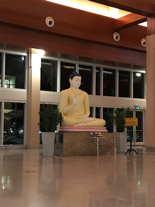 Main lobby of the Mattala International Airport. It has been called "the world's emptiest international airport" due to its low number of flights despite the large size of the airport. 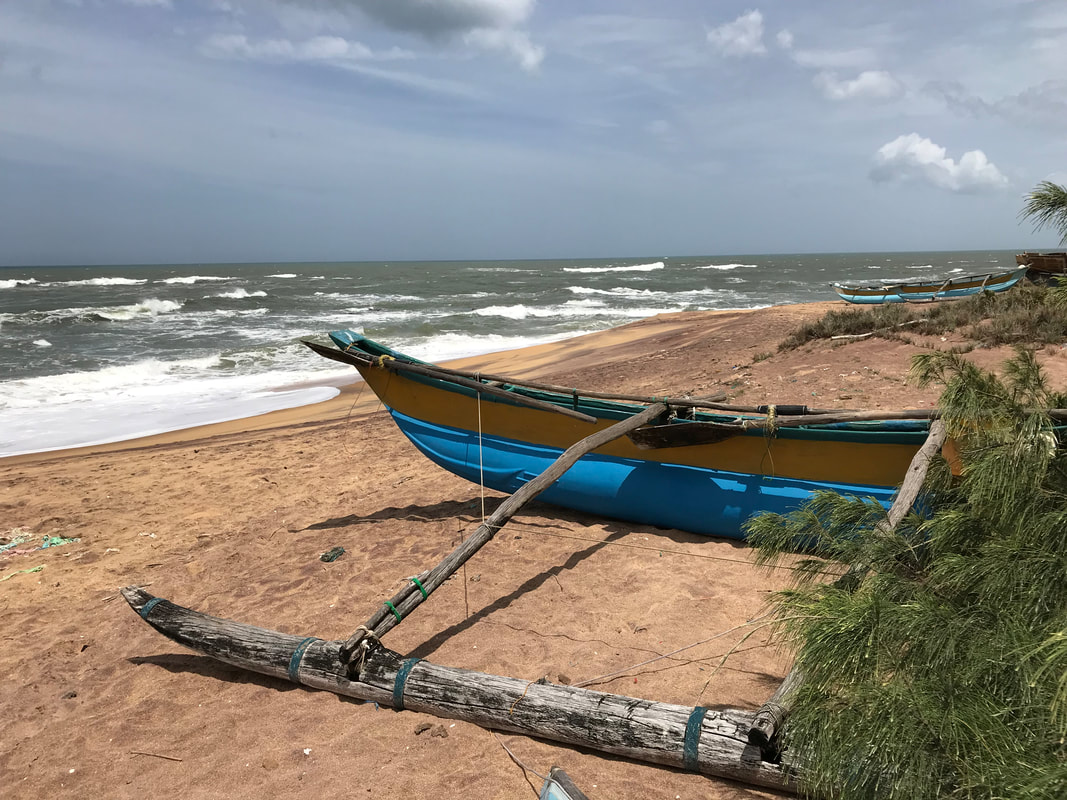 2004 Tsunami
This beach on the south-eastern coast of Sri Lanka was struck by a wall of water 10 m (30 ft) high during the 2004 Indian Ocean tsunami. The 500 mph tsunami traveled 850 nautical miles across the Bay of Bengal in 1h 45m. My hotel room was about 300 m from the beach. Comments are closed.
|

Archives
September 2018
Categories |
