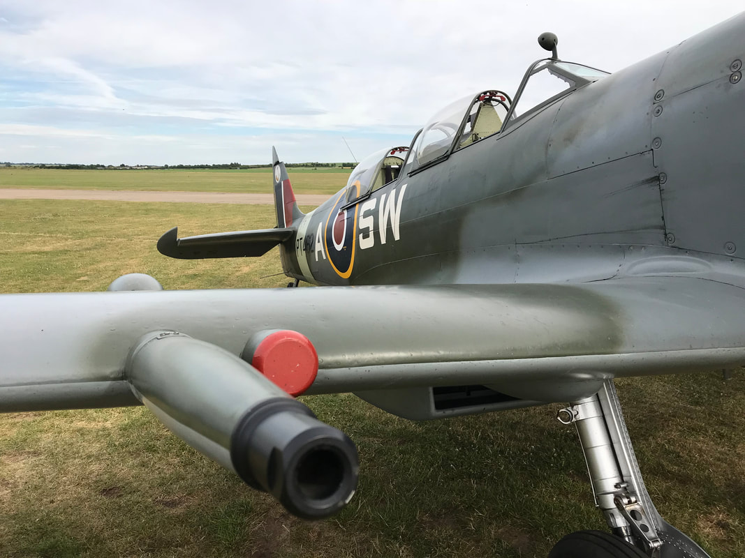
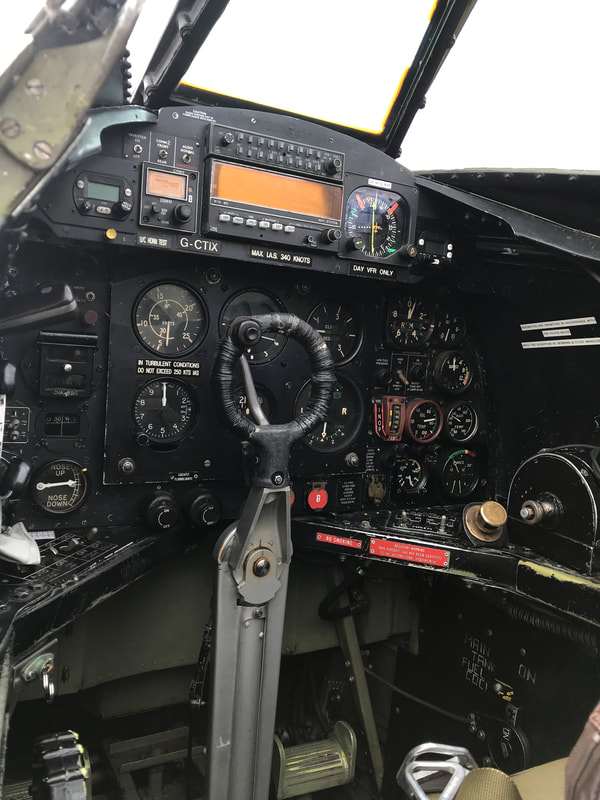
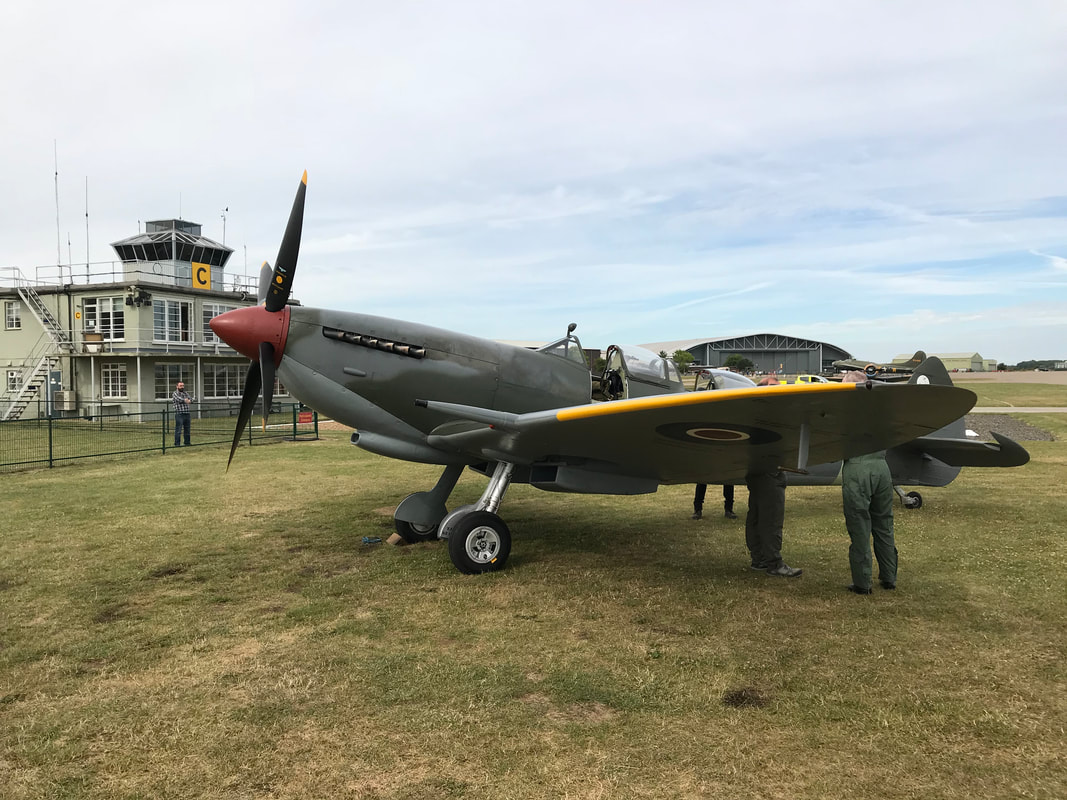
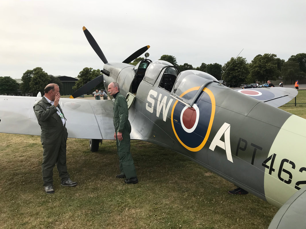
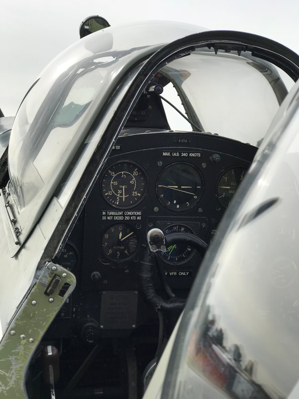
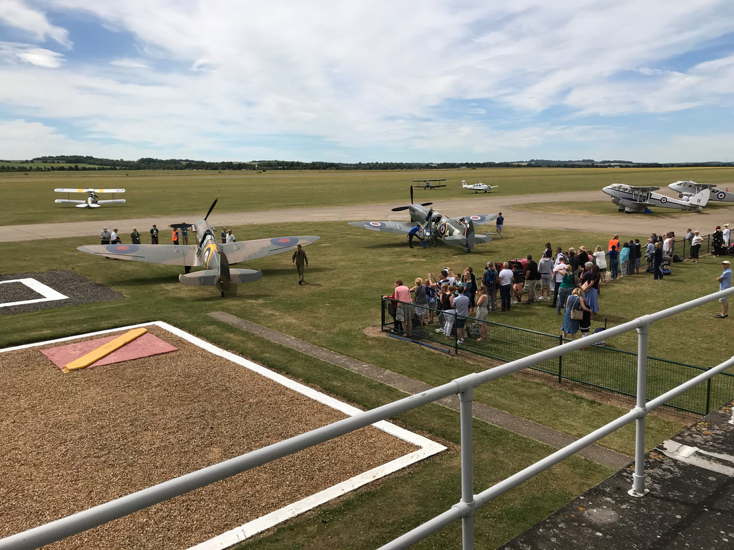
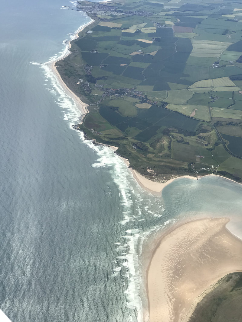
 Expedition Day 22 After a brief overnight stay in Wick, Scotland, I flew south over Aberdeen, the North Sea, North York Moors National Park, and a patchwork of green farmer's fields to Cambridge. 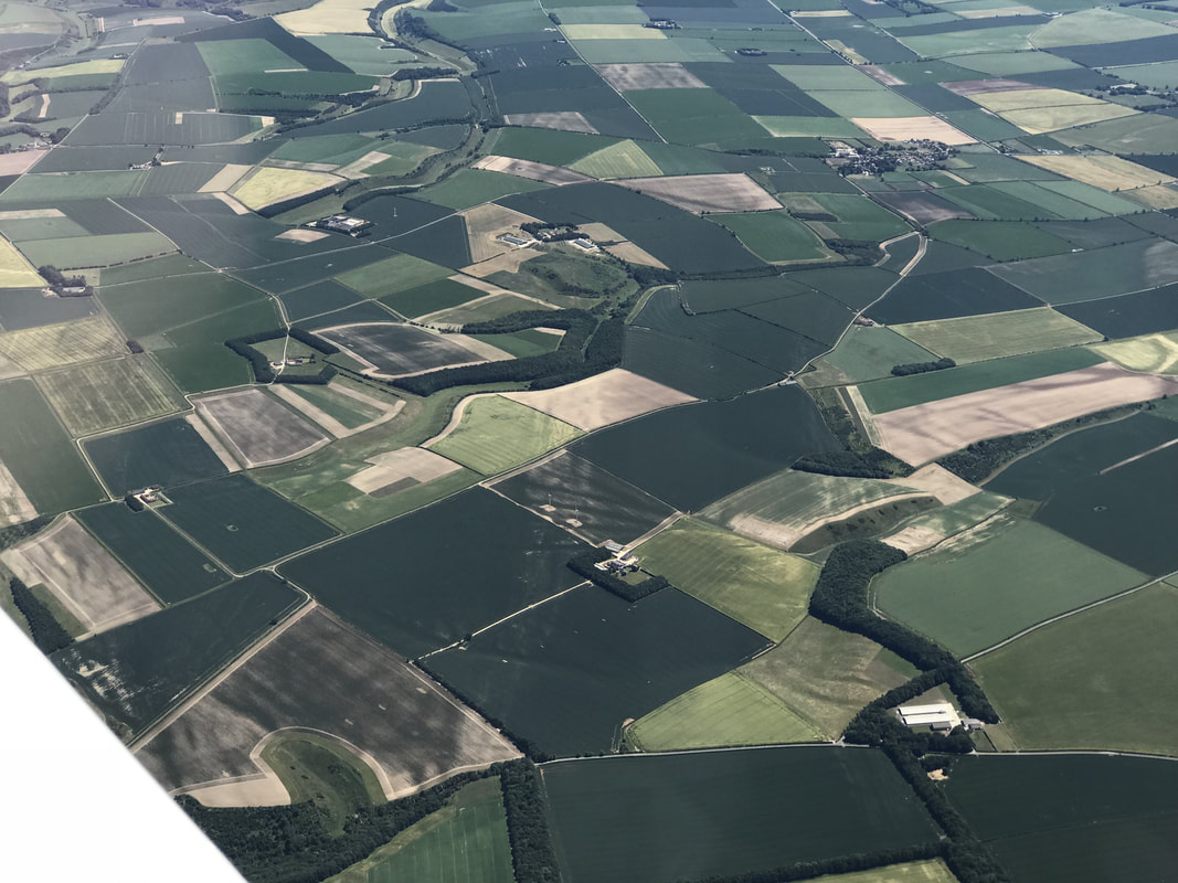 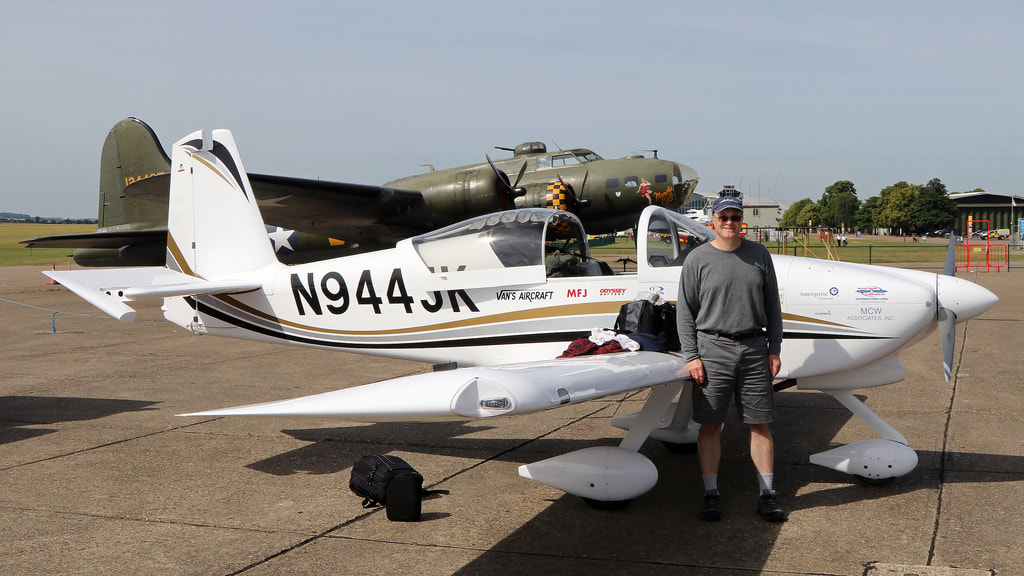 I was amazed at the vibrant plane spotting community in Duxford. David Whitworth took my photo as I unpacked my aircraft. Photo Credit: David Whitworth, Duxford Diary. 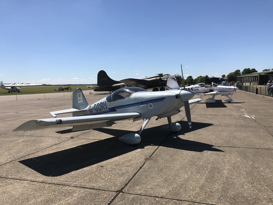 By incredible coincidence, G-GDRV was parked on the ramp next to N944JK. This aircraft was flown around the world by Manuel Queiroz in 2006. While preparing for my RTW trip, I read about this globe circling aircraft in his book "Chasing the Morning Sun" (www.chasingthemorningsun.com). 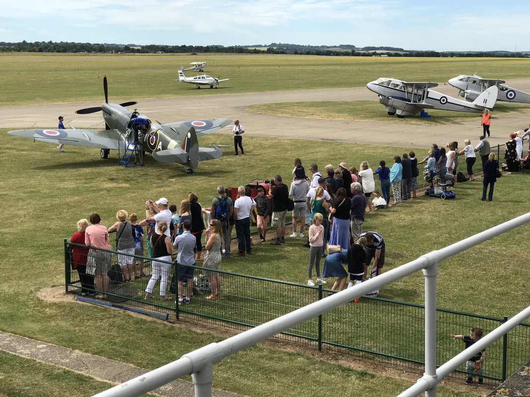 During weekends, IWM offers flights in the Spitfire and Dragon Rapide aircraft. The English are proud of their aviation history and support the IWM. A V12 powered Spitfire tearing up the sky above Duxford. 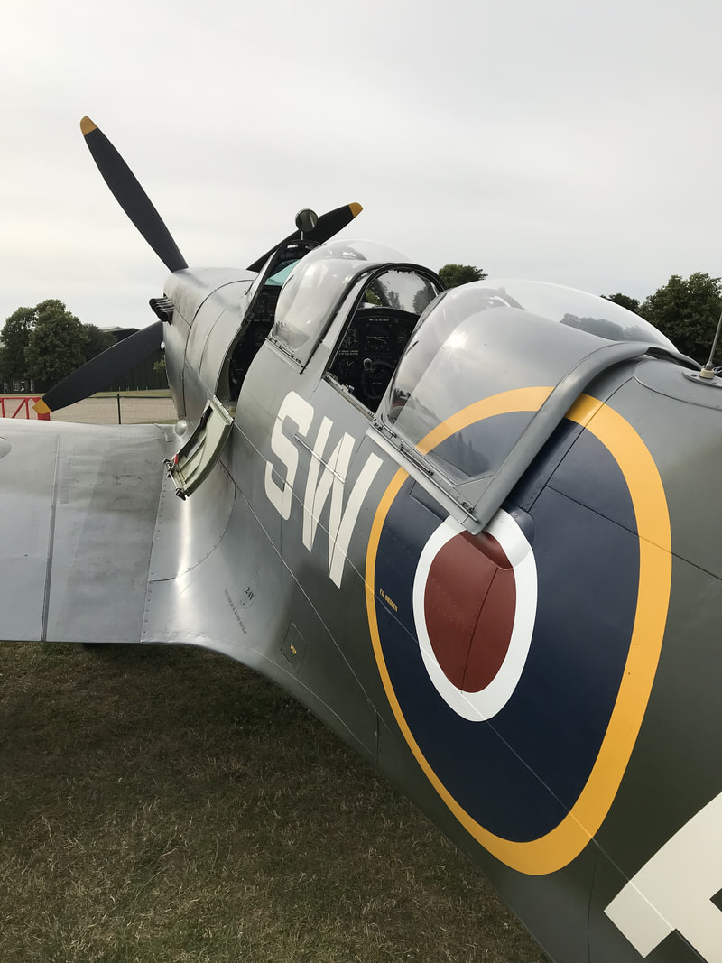 The beauty of a Spitfire. One of the many resident Spitfires at the Imperial War Museum in Duxford, England. IMF Duxford hosts an extensive collection of aircraft in multiple museums spread over the grounds of a former WWII fighter base. I wandered the museums for hours, chatted with the mechanics working on the war birds, and hung out with the spitfire crew giving rides to the public. What a fantastic day off while surrounded in aviation history. Thank you Allan, Peter, and Chris for the VIP pass, transportation, and assistance during my stay at IWM, Duxford. Allan went the extra mile to help me plan my flight across the complex European air space from England to Italy. 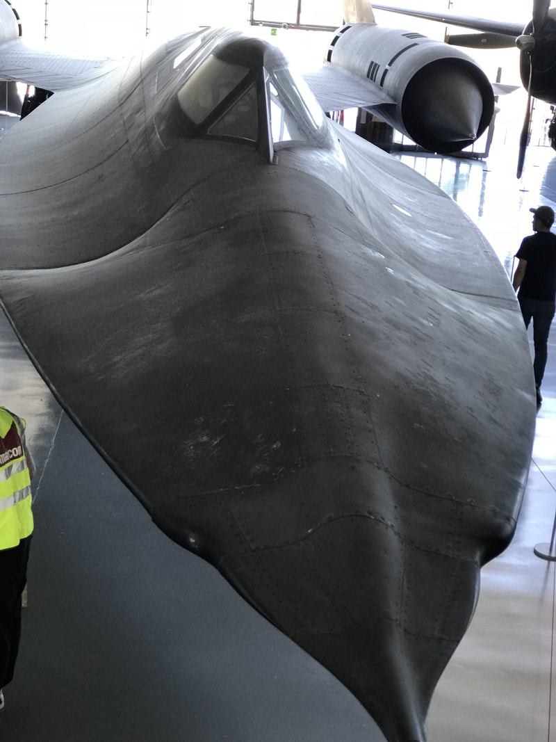 The SR-71 "Blackbird" demanding attention at the American museum at Duxford. Flying at Mach 3.2 at 80.000 ft, the nose would warp from the 800F surface temperature, requiring a periodic ironing-out process.
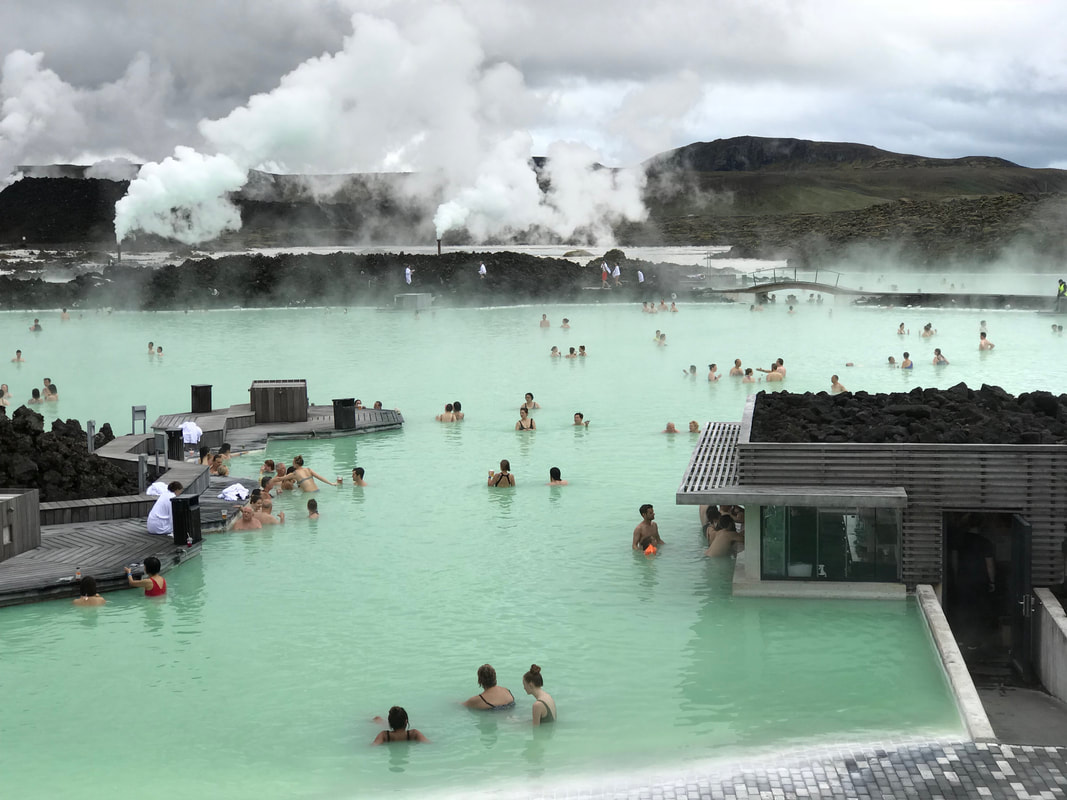 Expedition Day 21 After an extremely cold and stressful crossing of the North Atlantic from Nuuk, Greenland to Iceland, I made a beeline to Iceland's famous “Blue Lagoon". I soaked for hours in 102F (39C) mineral rich seawater, which is a byproduct from the nearby geothermal power plant. 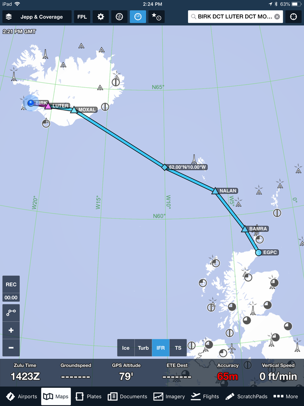 My original route of flight from Reykjavik, Iceland to Wick, Scotland. The route was modified prior to takeoff to fly at 3000 ft and below freezing levels off the coast of Iceland. I departed Reykjavik in light rain, and flew south-east for 100 miles before clearing the clouds and climbing higher for better winds. 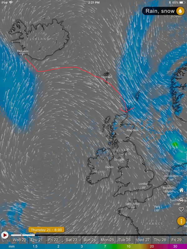 A huge storm moving quickly across the North Atlantic towards Iceland potentially would keep me grounded for the next five days. My plan was to leave Reykjavik in the early morning just before the storm hit. A large "High" pressure area parked over the west coast of Ireland provided clockwise wind rotation and 36 knot tail winds towards Scotland. 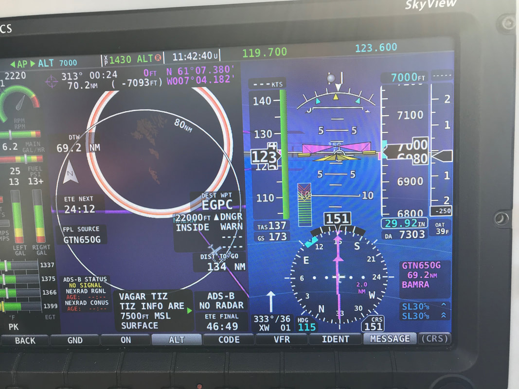 173 knots ground speed at 6.2 gph. I was thrilled with the 36 knot tail wind.
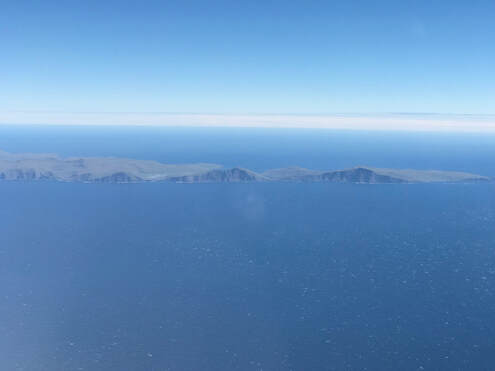
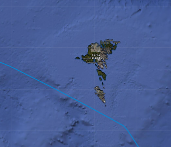
Passing the rugged Faroe Islands enroute to Scotland. EGPC - ATC reported winds at 29 knots gusting to 38 knots right down the runway. Wick is located at the northern tip of Scotland and gets blasted by unrelenting arctic winds. The landing at Wick, Scotland was like riding a bucking bronco down to the ground. After touch down and half stick back to protect the nose wheel, the plane started to climb again. I hope Wick ATC would not charge me for multiple landings! The taxi to the “Far North Aviation” hanger was practically uncontrollable in the high surface winds. 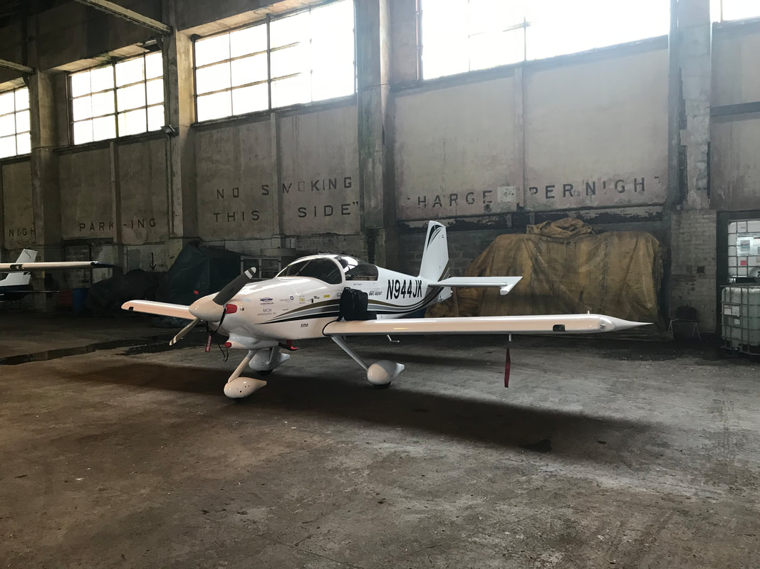 To escape the blustery winds outside, I taxied my plane in to one of the WWII-era hangers at Wick airport. The floor of the hanger was coated in a slippery layer of grease, from hundreds of oil changes done on WWII bomber and fighter aircraft.
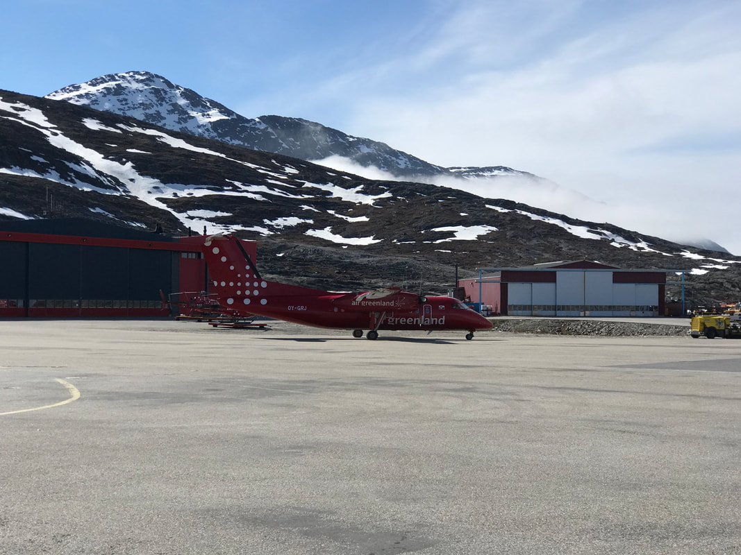
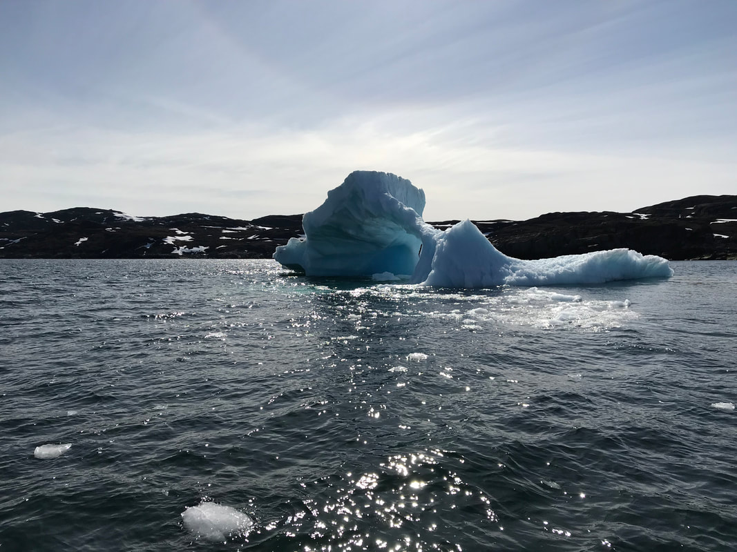
For many ferry pilots, Wick is the last stop in Europe before heading to Iceland and onward to North America. The entire airport is a time capsule from the 1940's and has a wonderful vibe. Historical note from WWII: On 21 May 1941, a photographic reconnaissance Supermarine Spitfire piloted by Flying Officer Michael F. Suckling took off from Wick, and flew to Norway, in search of the German battleship Bismarck. If Bismarck was to break out into the North Atlantic, she would present a significant risk to the ships supplying Britain. 320 miles to the east of Wick, F/O Suckling found and photographed her, hiding in Grimstadfjord.[3] This information enabled the Royal Navy to order HMS Hood and other ships, as well as aircraft, to take positions intended to track Bismarck, and prevent her from entering the North Atlantic. In ensuing battles, Hood was sunk, and, later, Bismarck. German battleships and battle cruisers never again entered the North Atlantic. Credit: Wikipedia, Wick Airport. 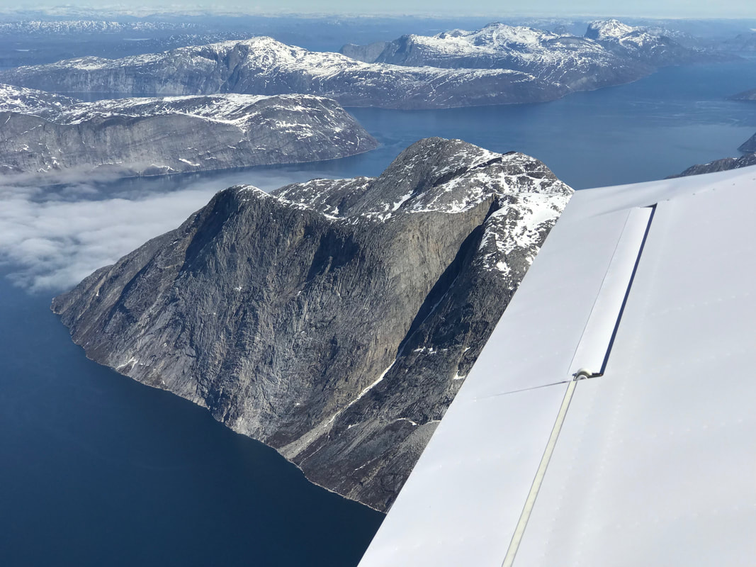 Expedition Day 18 After three relaxing days in Nuuk, it was time to depart Greenland. My flight was scheduled to climb to 13,000 ft over the ice cap and head east towards Iceland. Outside air temperatures decreased to -15c as I progressed over the east coast of Greenland. It was impossible to keep warm, even with the heater on full blast. 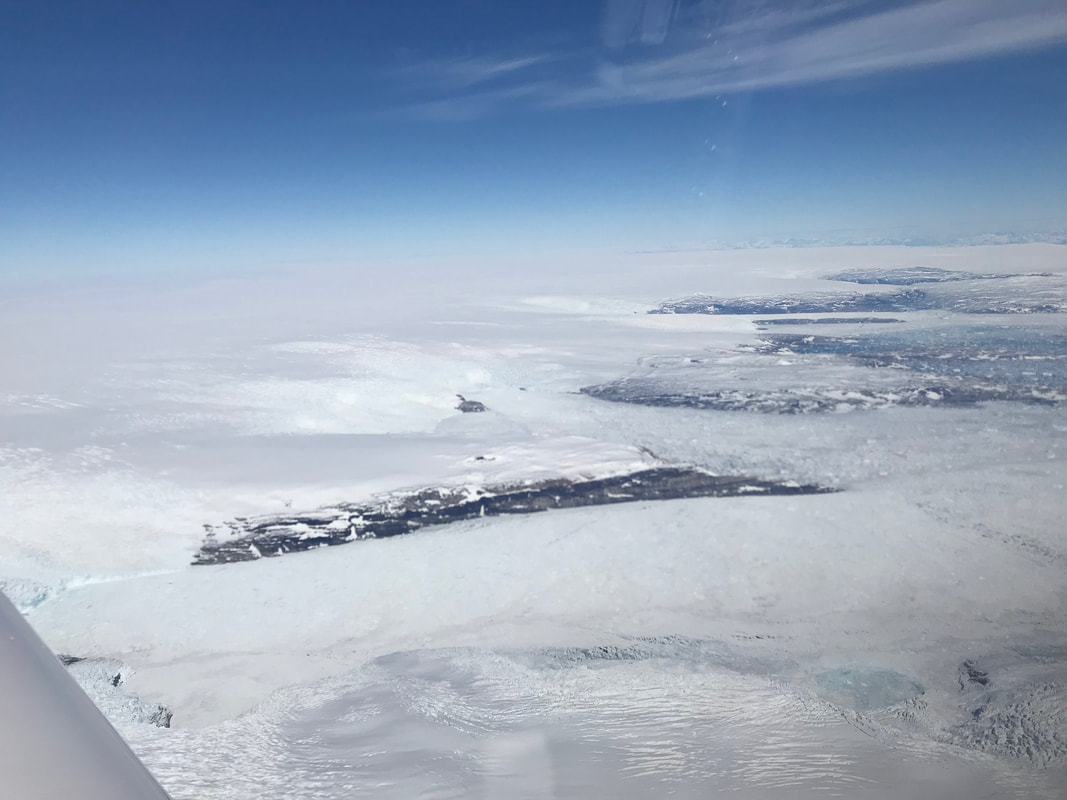 Beneath my plane lay clouds at 11,000 ft and the two mile thick layer of ice called the Greenland Ice cap. My view was largely blocked due to the cloud layer. On a clear day, previous RTW pilots have spotted dozens of polar bears wandering across the massive ice cap. 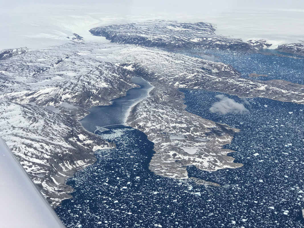 IMAX worthy Thousands of icebergs were visible while I flew over the coastal waters of eastern Greenland. 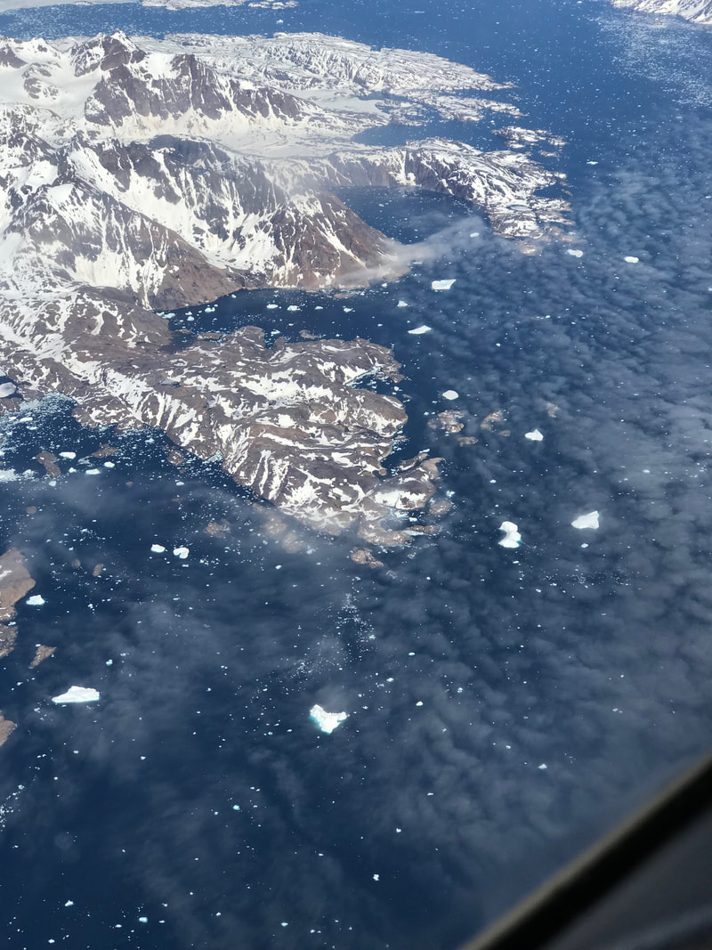 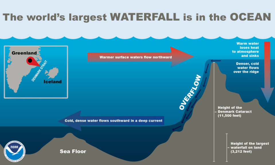 The 11,500 ft (3505 m) underwater cataract is located in the Denmark Strait. 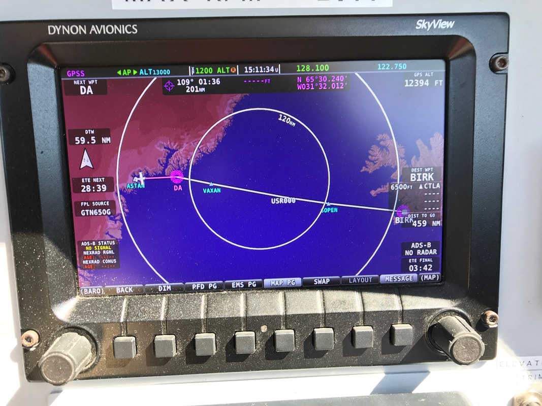 Enduring the Denmark Strait.
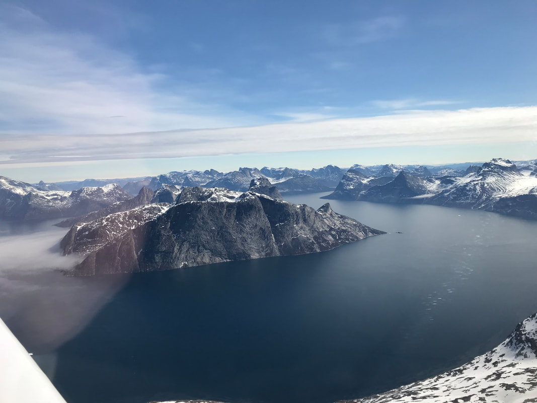
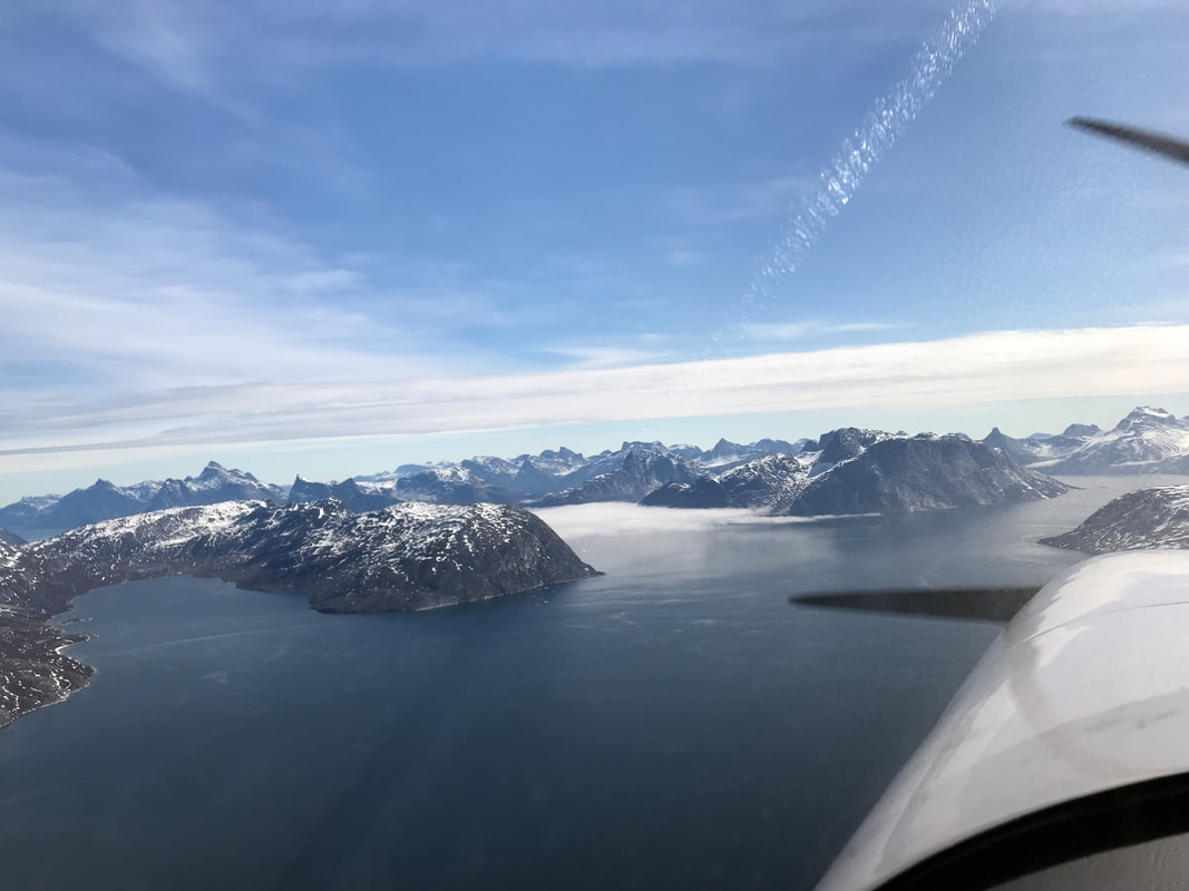
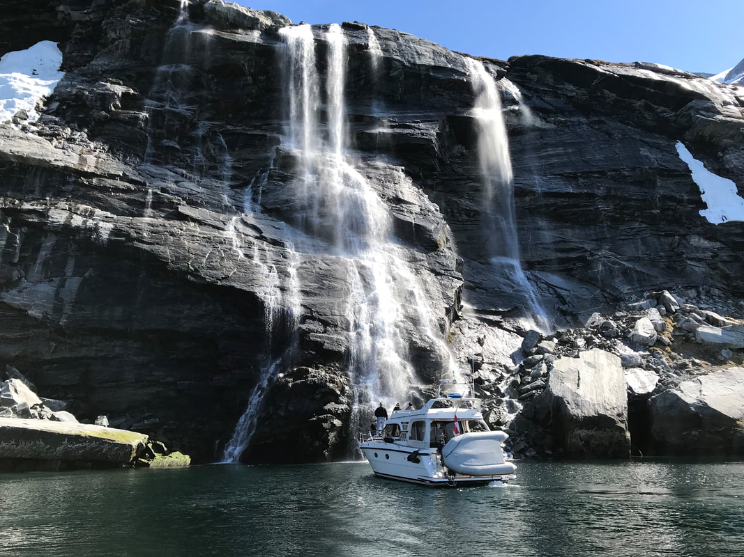
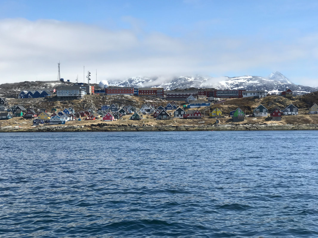
I was increasingly concerned about hypothermia. My body temperature was dropping despite the thick neoprene survival suit and down jack I was wearing. The cabin heater was on full blast and the shivering persisted for the entire flight. I requested a descent to a lower altitude with somewhat warmer temperatures and greater oxygen levels for the passage over the 450nm Denmark Strait. As I approached the north-west coast of Iceland, the cloud layers kept building to over 11,000 ft. ATC reported the ice level at 5,000 ft, so I again climbed to remain near the top of the cloud layers until close to the airport terminal area. Just off the coast, I descended quickly through the cloud layers as ice coated the leading edges of the wings. In less than 60 seconds, the windshield was iced over, obscuring all forward visibility. Ground temperatures were above freezing, so I continued my descent following vectors from ATC. Below 3,500 feet, the ice melted and quickly shed off the airframe. Airports throughout Iceland reported similar conditions, so landing at Reykjavik seemed the best option with it's precision approach and long runway. I landed at Reykjavik airport (BIRK) chilled to the bone and relieved to be on ground. 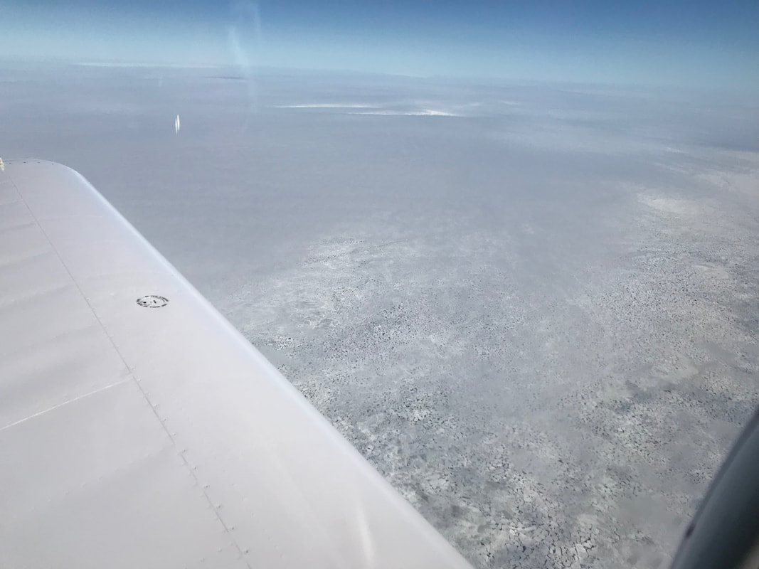 Expedition Day 16 The frozen North Atlantic from 11,000 ft over the Davis Strait in mid-summer. I selected this altitude because it was thousands of feet above the uniform cloud layer containing freezing fog and known rime icing conditions. No visible moisture was present at my flight level with temperatures about -6 C. My ISPLR single man life raft and ditch bag were close at hand in the event of an emergency. 80 percent of the time, the cold, scary Atlantic was hidden from view, with an occasional glimpse of the ice pack between gaps in the clouds. Eventually, the clouds dissipated and the ice sheet melted about half way across the Davis Strait. On the horizon, a white line of jagged mountains, then Fjords grew in size as I approached the west coast of Greenland. The coastal capital of Nuuk was invisible until I could spot the bright, primary colored houses scattered around the harbor. 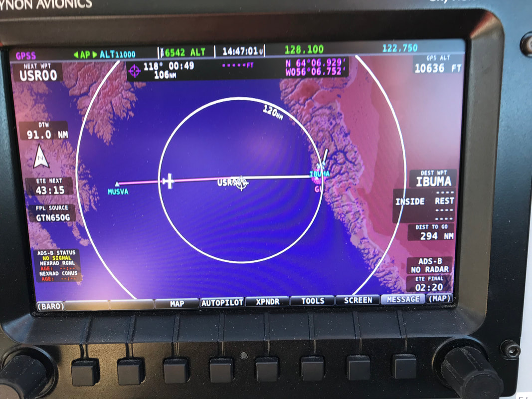 446 nm from Iqaluit to Nuuk with 25 knot headwinds. The EFIS MAP displays the route and geography on both sides of the crossing with no ADSB or radar coverage. I am getting better at blindly broadcasting position reports every 5 minutes. 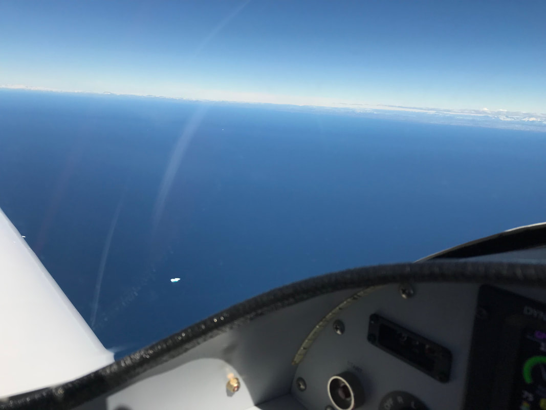 I spotted my first Iceberg 100 nm from Greenland. It was likely big enough to sink the Titanic. 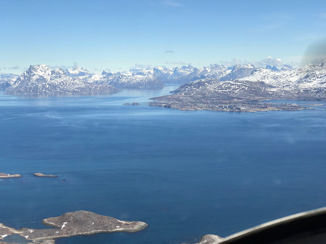 The incredibly scenic approach to Nuuk, Greenland. The airport is perched on a bluff above the city and a beautiful harbor. The houses and even the aircraft at the airport are all painted in bright colors.  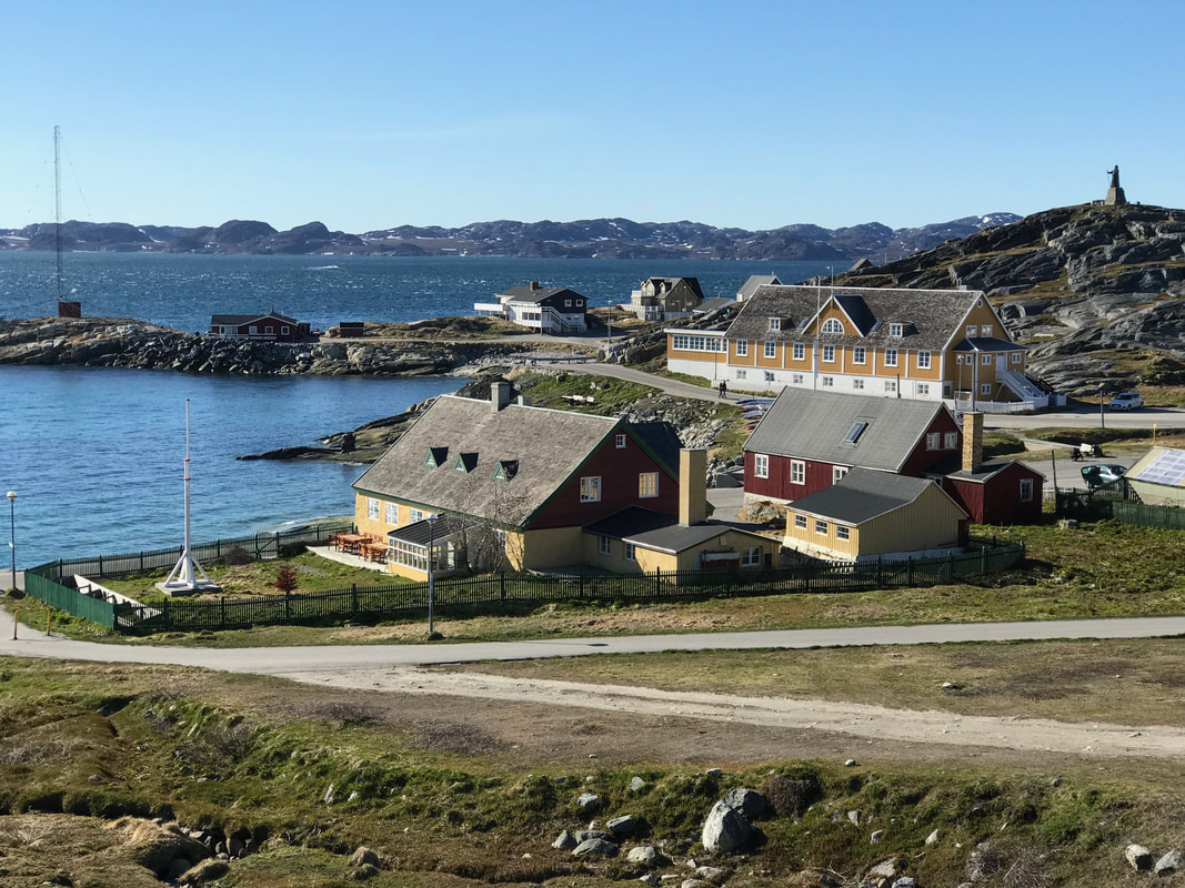 Colorful houses in contrast to the stark landscape. There are only 55,000 people in the entire country. 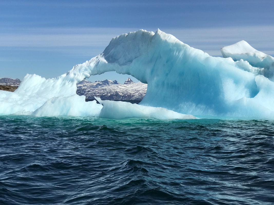 On a layover day in Nuuk, the owners of my guest house asked me to join them for their first coastal cruise of the season. Besides lunch, we packed a huge caliber rifle in the event of an unexpected polar bear encounter. The bears were apparently quite hungry and show no fear at this time of year. I had a wonderful time with my hosts as we explored the Greenland west coast, cascading waterfalls, and dodging miniature icebergs called growlers. 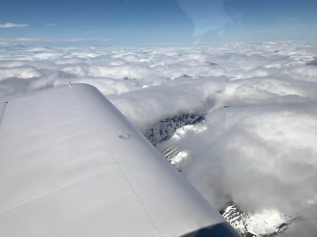 Expedition Day 12 On June 12, I filed IFR and flew along the east coast of Labrador at 11,000 ft, avoiding rain/snow clouds to the west. The terrain is still covered with snow and ice with few alternative airports along the way. It was surreal to cross over the frozen North Atlantic ocean en-route to Baffin island and Iqaluit. The cabin heater and my flight suit barely could keep me warm with outside air temperatures hovering at -5 C. The ground was obscured under the clouds most of the way, but occasionally I could see a glimpse of the land. It was a real pleasure to travel at up to 160 knots at 6.5 gph with 25 knot tail winds. 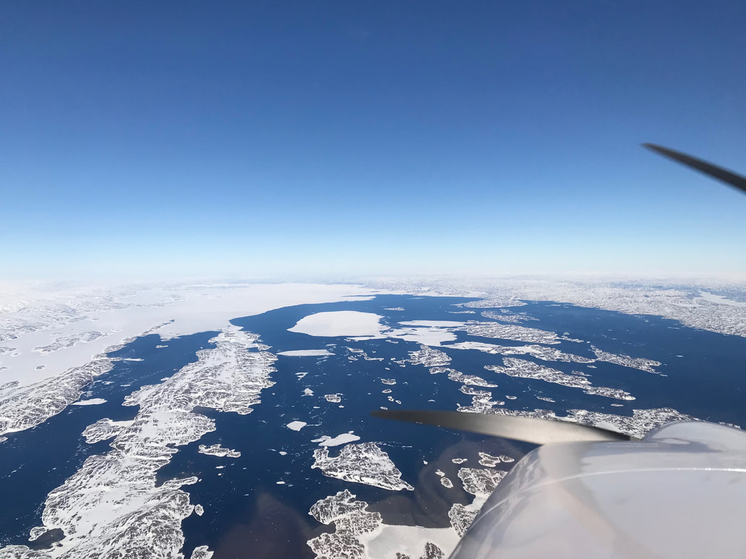 Instrument Landing System (ILS) approach in to Iqaluit, Nunavut. 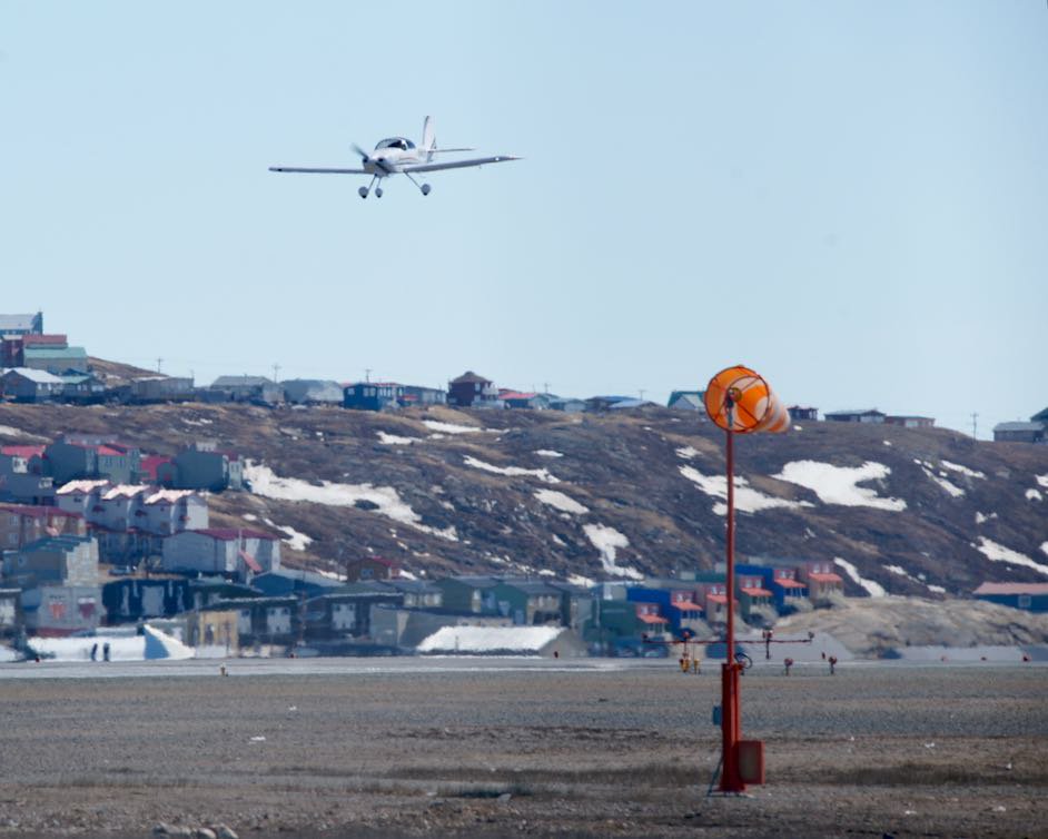 The mighty RV-9A landing in to a brisk wind. Photo Credit: Twitter (thank you airplane spotter living in Iqaluit!) 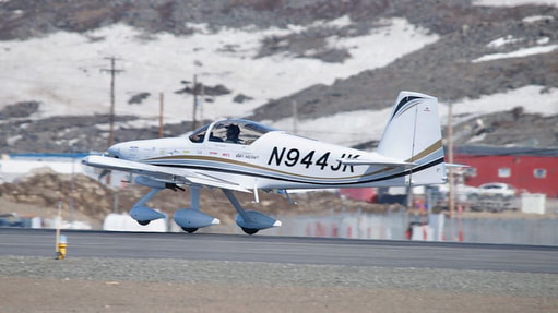  63°44'49.09"N, 68°31'2.17"W and the closest I have flown to the North pole. Photo Credit: Twitter 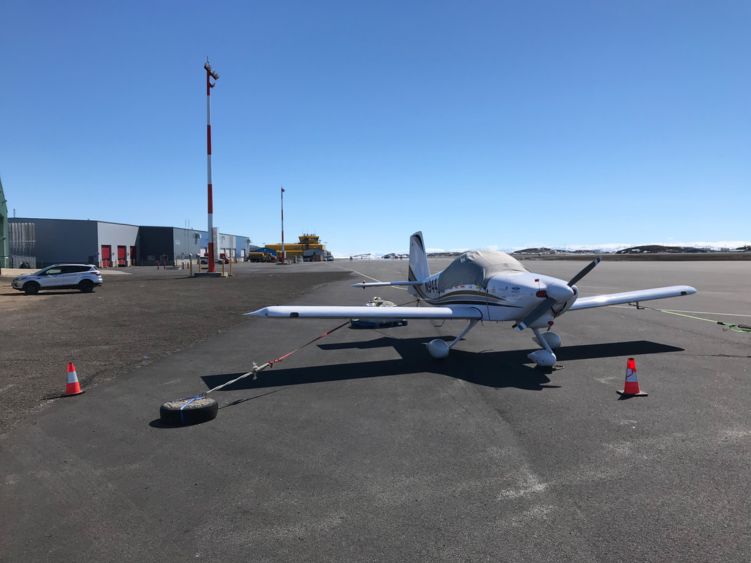 After landing, I fueled the plane with the last of the 2017 AVGAS (2 barrels remaining) . Frobisher bay was still frozen and had not received it's one shipment of fuel for the year. I lost a few gallons fueling the plane in 30 knot winds. 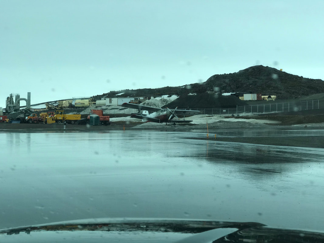 A broken down Antonov AN-2 is pushed to the side of the runway. Behind the battered aircraft, a chain-link fence keeps out wandering and curious polar bears. The weather this far north is extremely unpredictable and one can experience all seasons within a short period of time. The temperature hovered around 1C while I waited 3 days for a weather opening to Greenland. 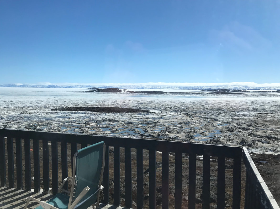 The frozen Frobisher Bay is close to break-up and the entire town is waiting for the supply ships to arrive.
 Expedition Day 11 The permit to enter Greenland was finally approved, so I decided to continue to Bangor, Maine. I was fortunate to meet up with David, a RV-12 owner and member of VAF in the Bangor area. He seems to know many of the RV owners on the east coast and very involved with the community. The next day, I flew from Bangor, Maine over the St. Lawrence river and rugged terrain to Goose Bay, Newfoundland and Labrador, fighting head winds all the way. I was glad to have the aft ferry tank filled to capacity before departure. The range of the aircraft without the 66g Turtle Pac is 1250nm. There are not many alternative airports in this remote area. 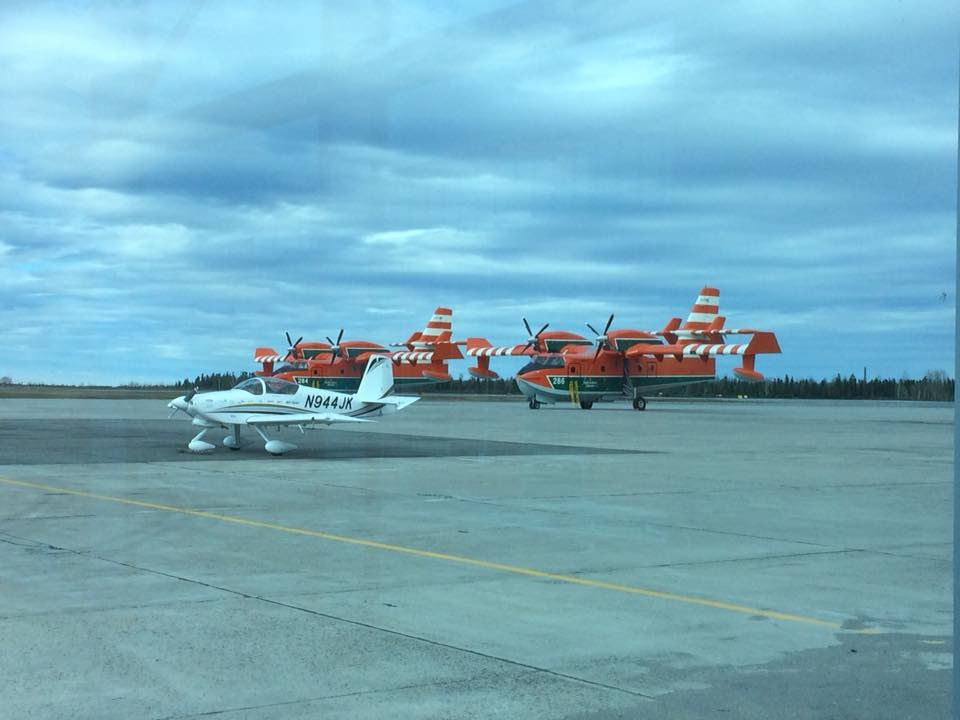 Water bombers ready for the fire fighting season. It snowed a few nights ago. Will summer ever arrive this year?
Goose Bay is an unexpectedly large airport with lots of turbo prop and jet traffic. A passenger from one of the inbound flights spotted "May" in the terminal area , Googled my tail number, and handed me a donation towards the "Alzheimer's Association of America". Thank you Rob Perry! Please make a donation towards the Alzheimer's Association. Expedition Day 6 I fly from New York to Vermont in IFR conditions for the entire flight. Clouds, rain, and icing are reported slightly above my flying altitude. The carefully monitored outside air temperature is slightly above freezing, and I experience no issues flying over the mountains to Vermont. This was great practice for upcoming legs of the trip. I am staying with my sister's family in Montpelier, VT waiting for a Greenland permit. Since I am running slightly behind schedule, I will likely head directly up to Goose Bay and not land at Bangor. There are still reports of snow falling in Iqaluit! 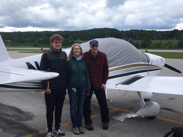 My sister's family greet me at Edward F Knapp State airport in Vermont. Her son (on the left) first spots my plane emerge from the clouds. The green hills of Vermont are in stark contrast with dry California.
 Expedition Day 1 The NAA "Certificate of Departure" form is signed by the tower and all configuration checks are complete.  I climb heading in to the morning sun and up to 11,000 ft over the Sacramento valley. The plane is heavily loaded with 90 gallons of fuel, safety equipment for polar/desert/marine environments, spare parts, and flies like a sluggish transport. My nimble RV feels like a completely different plane.
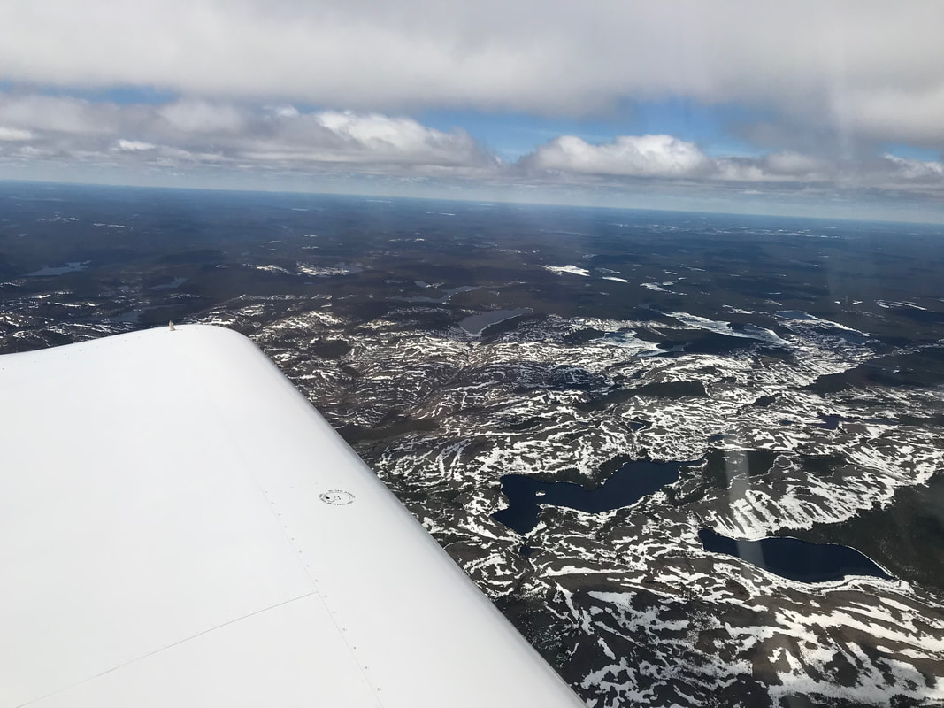
The familiar landmarks of Sacramento, Blue Canyon, and scenic Lake Tahoe quickly pass by under my wing and I have a grin plastered on my face. After 5 years of planning, the RTW trip is finally happening. The routine tasks of navigation, engine monitoring, and communications help me to relax and stay focused. Every 100 miles or so, I am handed off to a new controller as I progressed over the sparsely populated western states. Occasionally, I spot a lone ranch or an open pit mine in the middle of nowhere. After about 3 hours, "May" crosses the Sierra Nevada, the Great Basin desert (avoiding numerous no-fly, restricted areas), and the Rocky mountains. The terrain rises quickly near Bingham City, Utah, requiring a climb to 15,000 ft over the Rocky mountains. This would be the highest altitude recorded for the entire around the world flight. Over Nebraska, I am forced to divert 100 miles south of my original great circle route to avoid a super cell dominating South Dakota. This impressive formation will eventually spawn 2 tornadoes and golf ball sized hail. Further south, the volatile atmosphere spools up 2 more tornadoes that afternoon. I hear fear in the voices of commercial pilots trying to wrangle better vectors around the storm. If the big boys are nervous, it gets your attention. After flying 1552 nm non-stop from California, I arrive at Oshkosh, WI at 8:52 pm local time. I am exhausted, and ask for progressive taxi instructions to the base the famous Oshkosh tower. The controller on duty waits for me to land after hours, and provides a quick tour of the tower along with signing an official FAI "certificate of landing" form. Hopefully, the NAA/FAI will accept my paperwork for this record attempt. I spend the next day recovering from my flight, visiting the EAA museum with my brother, and planning for the next leg of the trip. Looking ahead a few days, I may be delayed flying to Montpelier/Barre due to thunderstorms over New York and Pennsylvania. How about some simple VFR weather! After waiting days for a favorable weather window, I finally begin my trip around the world On Friday June 1st. "May" will fly heading east from KCCR to KOSH non-stop in about 11 hours. The route will follow the most direct path possible and avoid restricted/military operations airspace. Highlights include crossing the Sierra Nevada and Rocky mountains, the Great Basin desert, and vast open spaces of the west. Spectacular!
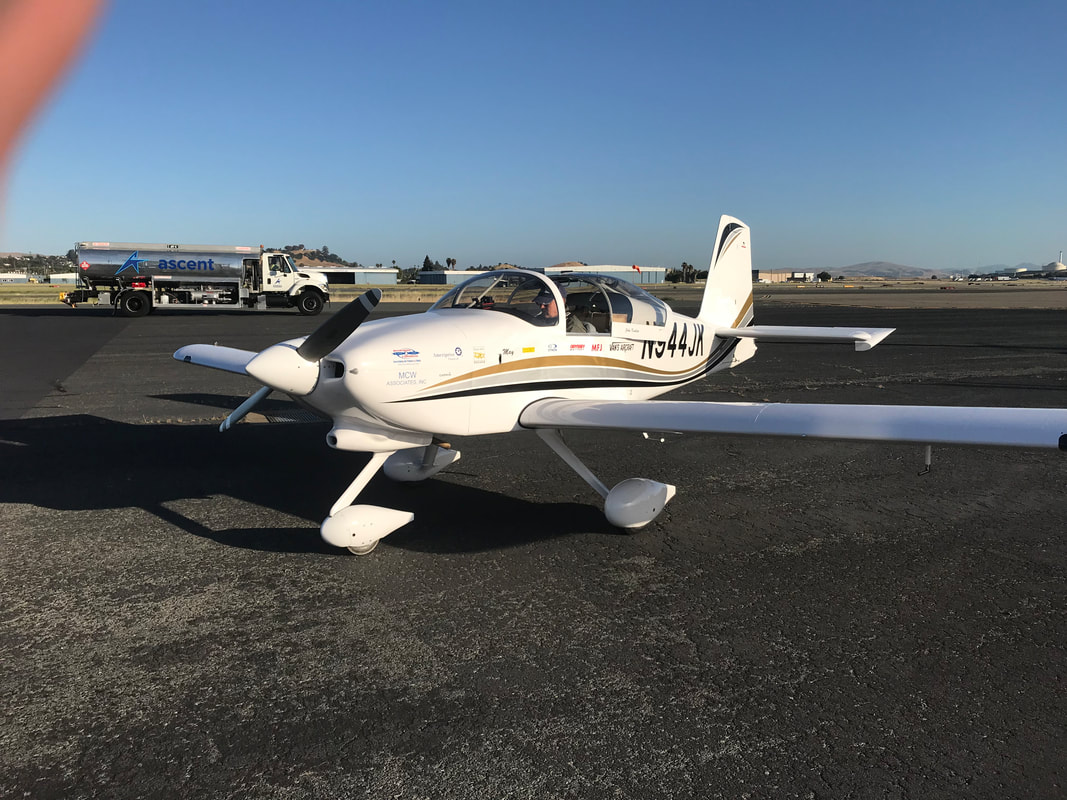
This past week, I have been testing the extended range fuel tanks with several long flights within the state of California. I am waiting for a weather window to open to start the first leg of my around the world flight.
|
Archives
September 2018
Categories |