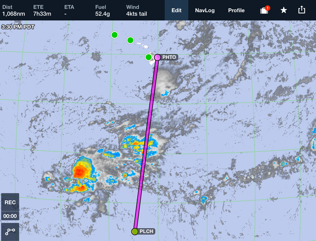
 Kiribati to Hawaii through the thunderstorm infested ITCZ. Expedition Day 57 The Intertropical Convergence Zone, or ITCZ, is a belt of low pressure which circles the Earth generally near the equator where the trade winds of the Northern and Southern Hemispheres come together. The area receives the highest amount of heat energy from the sun, which causes moisture to condense quickly in to clouds. The rising air in the ITCZ cause frequent thunderstorms and heavy rainfall. Circular typhoons often form along with the highest recorded winds on the planet. For months I had been dreading the flight through the ITCZ. Like mariners facing an unpredictable passage around Cape Horn, pilots face the ITCZ with trepidation as the weather is nearly always stormy. Unlike a jet, which can fly above the weather, "May" would fly from 8,000 to 12,000 ft down in the clouds and unforgiving turbulence. Squall lines and embedded thunderstorms are common and should be expected. To maximize my chance of success, I decided to fly through the ITCZ only during the daylight hours, so that I could see and avoid the worst of the weather. Reviewing the satellite weather charts from Christmas Island the night before the flight, suggested that flying just to the west of the 1100 nautical mile direct line path to Hawaii would avoid most of the weather. On the morning of departure, I double checked the weather and filed an IFR flight plan at the "radio shack" at Christmas Island. The controllers had a relaxed, positive attitude, and ensured me that the flight plan would go through. That said, we needed to take up a collection of phone credits to call in the flight plan. I knew that the aircraft was prepared for the flight with plenty of fuel, but just how bad would be the passage be through the ITCZ? 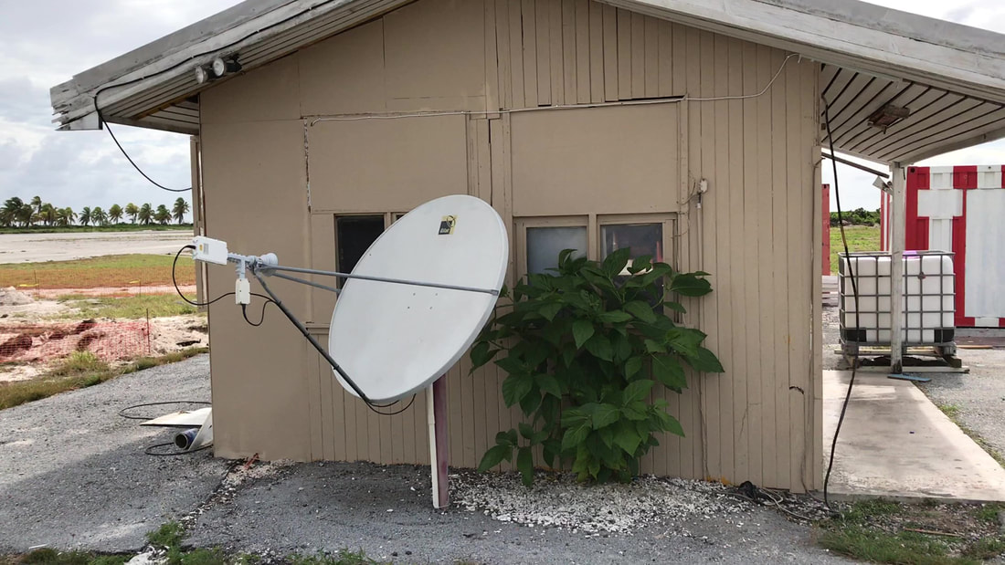 This modest building at Christmas Island houses automated weather and air traffic control services. 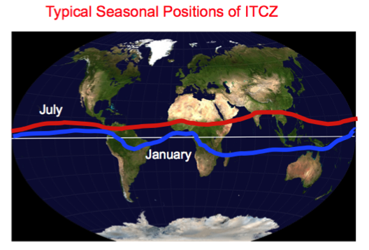 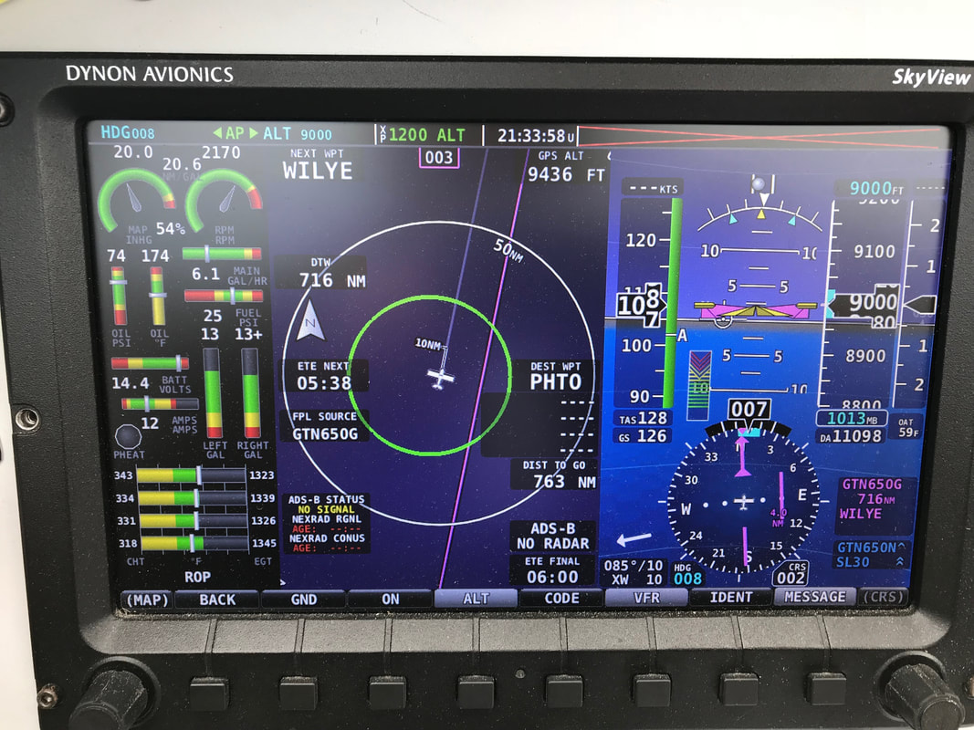 Without radar or a storm scope, I relied on the old-school method of flying through the lighter parts of the clouds. This technique was effective, but required vigilance. I had no idea what weather lay further along my path and was prepared to back-track or go-around the largest cloud build-ups. 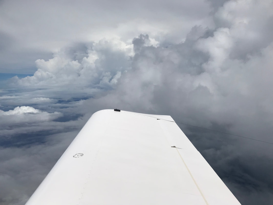 The experimental high frequency (HF) wire antenna could reach ARINC stations 5000+ miles away. I purchased a used Icom 706Mk2 mobile ham radio on Craigslist and modified it to transmit on aircraft frequencies. 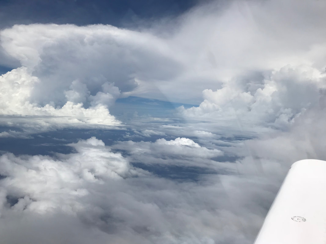 Slalom course around towering CB's in the ITCZ. Half way between Christmas Island and Hawaii. For 7 1/2 hours I flew on, covering a little over 2 nautical miles per minute. I felt very exposed flying over this isolated section of the Pacific; keenly aware a water rescue would take a long time if the engine quit. 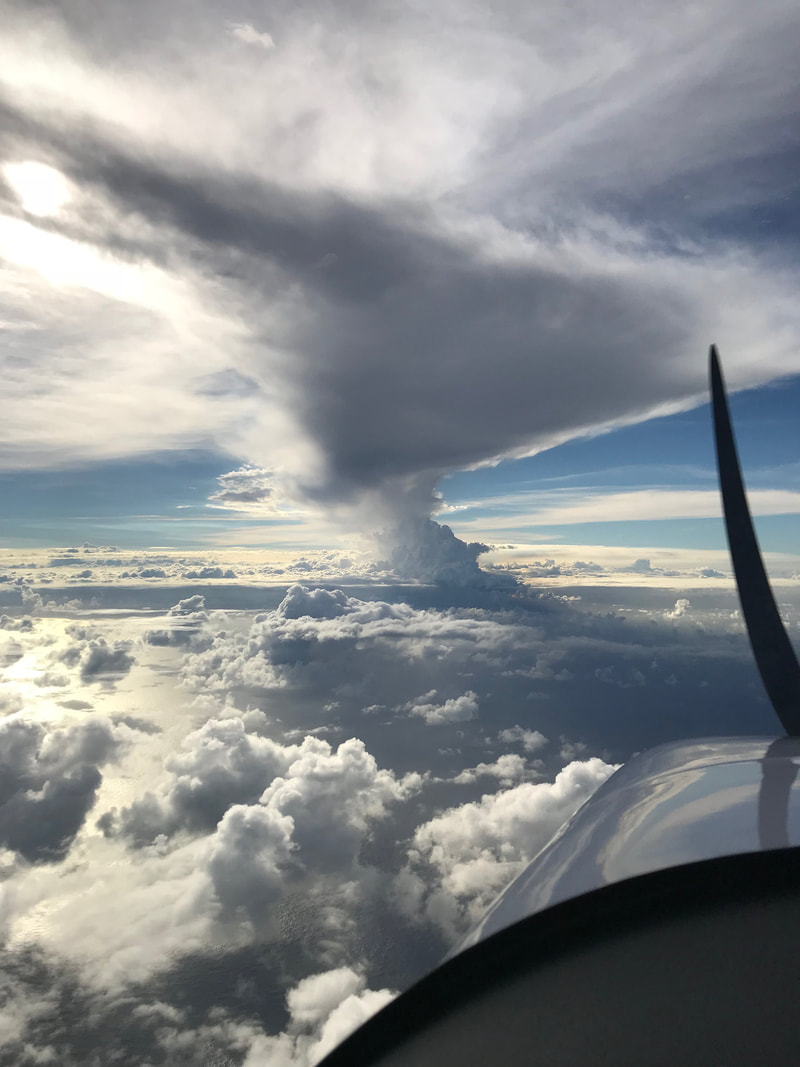 Volcanic navigation. The tallest mountain on earth (Mauna Kea - at 32,696 feet) is hidden from view. 200 miles off the coast of the Big Island of Hawaii, in-cockpit traffic and weather data suddenly appeared on the EFIS (glass panel). These enhanced services were not available to me outside the US, so they were a welcome surprise when I approached Hawaii. For most of the RTW flight, with the exception of terminal areas around airports, I practically had the airspace from 0-18,000 ft AGL to myself. The sky now felt very busy with all the jet traffic and helicopter tourist flights around the Big Island. From my vantage point 100 miles out, the entire Big Island was obscured from view. The steam generated from magma pouring in to the ocean, rose 25,000 feet in to the atmosphere. The highest peak in the entire Pacific Ocean, and the tallest mountain on Earth as measured from base to summit, was hidden in the cloud over the Big island. I passed through the ITCZ unscathed but landed at Hilo 72 hours prior to the arrival of Cat 4 hurricane Hector. There was not much time to recover and come up with a new game plan. 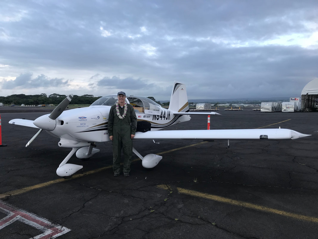 Moments after my arrival at Hilo, Big Island, Hawaii, the welcoming staff of Air Services Hawaii hung a lei around my neck and handed me an ice-cold Kona Longboard beer. Mahalo.
Comments are closed.
|
Archives
September 2018
Categories |
